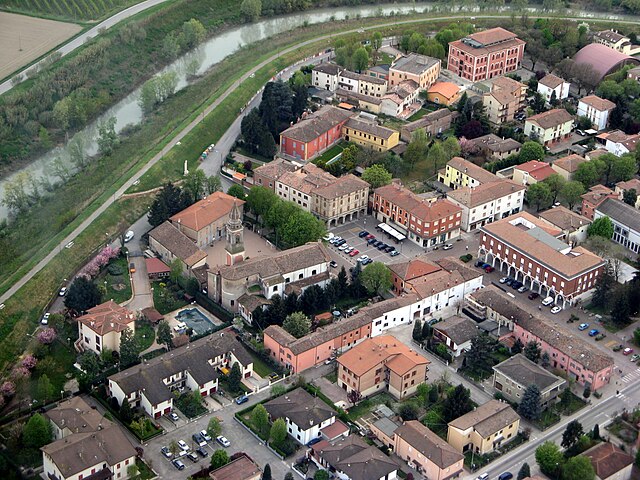
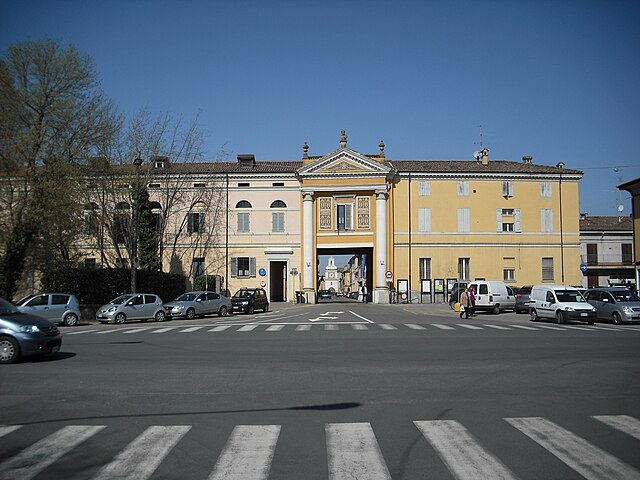
Finale Emilia (Finale Emilia)
- Italian comune
Finale Emilia, located in the Emilia-Romagna region of Italy, is not primarily known as a hiking destination compared to the surrounding areas that are more mountainous. However, it offers some pleasant opportunities for walking and enjoying the natural scenery.
Hiking in Finale Emilia:
-
Surrounding Nature:
- The region around Finale Emilia has a mix of agricultural landscapes and flat terrains, offering easy hikes. The countryside is dotted with farms and picturesque views, making for delightful walking experiences.
-
Routes:
- While specific hiking trails directly in Finale Emilia might be limited, the nearby Po River and its banks offer scenic walking paths. You can explore routes along the river that lead to lovely views and potential bird-watching spots.
-
Nearby Parks:
- Consider visiting parks such as the Parco del Delta del Po, which is a bit further afield but offers a variety of trails and natural beauty. This area is more renowned for its hiking opportunities and biodiversity.
-
Historical Routes:
- The region has paths that connect historical sites, allowing for a mix of hiking and cultural exploration. This includes sites of architectural and historical significance, such as castles and ancient villages.
-
Cycling and Walking:
- In the Emilia-Romagna region, cycling paths are quite popular. Many hikers enjoy combining biking with walking for a comprehensive experience of the region's rural landscapes.
Tips for Hiking in Finale Emilia:
- Weather: Check weather conditions beforehand, as the region can experience variations in climate.
- Footwear: Wear comfortable hiking boots or shoes suitable for flat, uneven terrain.
- Hydration: Keep hydrated, especially during warmer months, as some routes may not have access to drinking water.
- Local Maps: Consider obtaining local hiking maps or guides to explore the best routes available in and around Finale Emilia.
Overall, while Finale Emilia may not be a classic hiking hotspot, it offers a chance to enjoy leisurely walks and experience the beautiful Emilian countryside. For more challenging hikes, consider exploring the Apennine mountains or national parks located a bit further away.
- Country:

- Postal Code: 41034
- Local Dialing Code: 0535
- Licence Plate Code: MO
- Coordinates: 44° 49' 55" N, 11° 17' 45" E


- GPS tracks (wikiloc): [Link]
- AboveSeaLevel: 15 м m
- Area: 105.13 sq km
- Population: 15581
- Web site: http://www.comunefinale.net/
- Wikipedia en: wiki(en)
- Wikipedia: wiki(it)
- Wikidata storage: Wikidata: Q100050
- Wikipedia Commons Category: [Link]
- Freebase ID: [/m/0gkg7n]
- GeoNames ID: Alt: [6539708]
- VIAF ID: Alt: [157189433]
- OSM relation ID: [43645]
- archINFORM location ID: [6675]
- MusicBrainz area ID: [0af1f59b-fb7e-42cb-ba02-ad9cc7de4833]
- WOEID: [715480]
- TGN ID: [7004960]
- UN/LOCODE: [ITFIE]
- Gran Enciclopèdia Catalana ID: [0264999]
- ISTAT ID: 036012
- Italian cadastre code: D599
Shares border with regions:


Camposanto
- Italian comune
Camposanto, often referred to as Camposanto Monumentale, is not primarily known as a hiking destination but rather as a cemetery located in Pisa, Italy, renowned for its sculpture and art. However, if you are looking for hiking opportunities in the broader Tuscan region, here are some suggestions:...
- Country:

- Postal Code: 41031
- Local Dialing Code: 0535
- Licence Plate Code: MO
- Coordinates: 44° 47' 0" N, 11° 8' 0" E


- GPS tracks (wikiloc): [Link]
- AboveSeaLevel: 21 м m
- Area: 22.71 sq km
- Population: 3049
- Web site: [Link]


Mirandola
- Italian comune
Mirandola is a charming town located in the Emilia-Romagna region of Italy, known for its rich history, architecture, and proximity to the natural landscapes of the Po Valley. While Mirandola itself may not be a major hiking destination, there are opportunities for outdoor activities and exploration in the surrounding areas....
- Country:

- Postal Code: 41037
- Local Dialing Code: 0535
- Licence Plate Code: MO
- Coordinates: 44° 53' 14" N, 11° 3' 58" E


- GPS tracks (wikiloc): [Link]
- AboveSeaLevel: 18 м m
- Area: 137.09 sq km
- Population: 23650
- Web site: [Link]


San Felice sul Panaro
- Italian comune
 Hiking in San Felice sul Panaro
San Felice sul Panaro is a charming town located in the Emilia-Romagna region of Italy, and while it might not be as widely recognized for hiking as some larger national parks, it offers various outdoor activities and access to beautiful natural landscapes....
- Country:

- Postal Code: 41038
- Local Dialing Code: 0535
- Licence Plate Code: MO
- Coordinates: 44° 50' 3" N, 11° 8' 37" E


- GPS tracks (wikiloc): [Link]
- AboveSeaLevel: 19 м m
- Area: 51.66 sq km
- Population: 10802
- Web site: [Link]


Crevalcore
- Italian comune
Crevalcore is a charming town located in the Emilia-Romagna region of Italy, known more for its agricultural landscape than for traditional hiking trails. However, there are opportunities for easy hiking and walking in the surrounding countryside....
- Country:

- Postal Code: 40014
- Local Dialing Code: 051
- Licence Plate Code: BO
- Coordinates: 44° 43' 0" N, 11° 9' 0" E


- GPS tracks (wikiloc): [Link]
- AboveSeaLevel: 20 м m
- Area: 102.75 sq km
- Population: 13501
- Web site: [Link]


Bondeno
- Italian comune
Bondeno, a town located in the Emilia-Romagna region of Italy, offers a unique outdoor experience for hikers with its diverse landscapes, historical sites, and natural beauty. While it may not be as widely known for hiking as other Italian regions, it has its own charm....
- Country:

- Postal Code: 44012
- Local Dialing Code: 0532
- Licence Plate Code: FE
- Coordinates: 44° 53' 22" N, 11° 24' 56" E


- GPS tracks (wikiloc): [Link]
- AboveSeaLevel: 13 м m
- Area: 174.76 sq km
- Population: 14217
- Web site: [Link]


Cento
- Italian comune
Cento is a town located in the Emilia-Romagna region of northern Italy, known more for its historical significance and cultural sites than for extensive hiking trails. However, if you're looking to explore the natural beauty of the surrounding areas, there are a few options you might consider....
- Country:

- Postal Code: 44042
- Local Dialing Code: 051
- Licence Plate Code: FE
- Coordinates: 44° 44' 0" N, 11° 17' 0" E


- GPS tracks (wikiloc): [Link]
- AboveSeaLevel: 15 м m
- Area: 64.74 sq km
- Population: 35547
- Web site: [Link]
