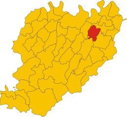
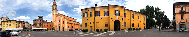
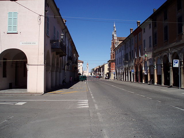
Fiorenzuola d'Arda (Fiorenzuola d'Arda)
.svg)
- Italian comune
 Hiking in Fiorenzuola d'Arda
Fiorenzuola d'Arda is a charming town located in the Emilia-Romagna region of Italy, offering a mix of historical attractions and access to beautiful natural landscapes. While it may not be as well-known as some other hiking destinations, it’s a great starting point for exploring the surrounding areas, including the nearby hills and countryside that are ideal for hiking.
Hiking Options Near Fiorenzuola d'Arda:
-
Val d’Arda: The valley surrounding Fiorenzuola provides several trails that vary in difficulty. You'll encounter beautiful landscapes, vineyards, and the Arda River. These trails often connect small villages, allowing hikers to explore the local culture and gastronomy.
-
Parco Regionale dei Boschi di Carrega: Located a short drive from Fiorenzuola, this regional park features a network of well-maintained trails. It’s characterized by lush forests, diverse wildlife, and serene landscapes. There are various routes for all skill levels, perfect for a day hike.
-
Appennine Mountains: While a bit further from Fiorenzuola, the Appennine range offers more challenging hikes. You can access trails that provide stunning panoramic views, particularly around the towns of Bardi and Bedonia.
-
Local Trails: The area around Fiorenzuola d'Arda has many local trails that can be explored, typically well-marked. These might lead you through vineyards, olive groves, and historical sites, giving you a taste of the local culture and landscape.
Tips for Hiking in the Area:
- Check Weather Conditions: Weather can change quickly, so it's important to check the forecast and prepare accordingly.
- Stay Hydrated and Snack: Carry enough water and some snacks, especially if you're planning a longer hike.
- Map or GPS: While many trails are marked, having a detailed map or a GPS device can help you navigate more effectively.
- Footwear: Good hiking boots are essential, especially on uneven terrain.
- Respect Nature and Wildlife: Follow Leave No Trace principles to protect the environment.
Additional Activities:
In addition to hiking, Fiorenzuola d'Arda is known for its historic center and nearby attractions, including local churches and archaeological sites. Sampling local cuisine, especially dishes unique to the Emilia-Romagna region, can complement your hiking experience.
Overall, Fiorenzuola d'Arda provides a wonderful blend of hiking opportunities and cultural experiences, making it an ideal stop for those looking to explore the natural beauty of Emilia-Romagna. Make sure to plan your hike according to your fitness level and interests!
- Country:

- Postal Code: 29017
- Local Dialing Code: 0523
- Licence Plate Code: PC
- Coordinates: 44° 56' 0" N, 9° 54' 0" E


- GPS tracks (wikiloc): [Link]
- AboveSeaLevel: 82 м m
- Area: 59.77 sq km
- Population: 15276
- Web site: http://www.comune.fiorenzuola.pc.it
- Wikipedia en: wiki(en)
- Wikipedia: wiki(it)
- Wikidata storage: Wikidata: Q102767
- Wikipedia Commons Category: [Link]
- Freebase ID: [/m/08fgwy]
- GeoNames ID: Alt: [6541022]
- VIAF ID: Alt: [258018727]
- OSM relation ID: [43792]
- UN/LOCODE: [ITFNZ]
- Gran Enciclopèdia Catalana ID: [0027063]
- Digital Atlas of the Roman Empire ID: [17216]
- ISTAT ID: 033021
- Italian cadastre code: D611
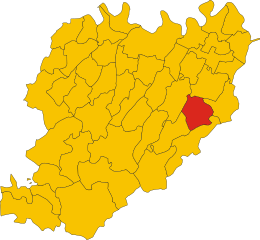
Shares border with regions:
Alseno
- Italian comune
Hiking in Alseno
Alseno, a charming town in the Emilia-Romagna region of Italy, is surrounded by beautiful landscapes that offer a variety of hiking opportunities. While Alseno itself is more rural and is known for its traditional Italian countryside charm, nearby areas provide access to scenic trails....
- Country:
- Postal Code: 29010
- Local Dialing Code: 0523
- Licence Plate Code: PC
- Coordinates: 44° 54' 0" N, 9° 58' 0" E
- GPS tracks (wikiloc): [Link]
- AboveSeaLevel: 79 м m
- Area: 55.27 sq km
- Population: 4695
- Web site: [Link]
Besenzone
- Italian comune
Hiking in Besenzone
Besenzone is a small town in the province of Piacenza, located in the Emilia-Romagna region of Italy. The surrounding area is characterized by beautiful landscapes, rolling hills, and a mix of agricultural land and natural beauty, making it an appealing destination for hiking enthusiasts....
- Country:
- Postal Code: 29010
- Local Dialing Code: 0523
- Licence Plate Code: PC
- Coordinates: 44° 59' 0" N, 9° 57' 0" E
- GPS tracks (wikiloc): [Link]
- AboveSeaLevel: 48 м m
- Area: 23.95 sq km
- Population: 953
- Web site: [Link]

Cadeo
- Italian comune
Hiking in Cadeo
Cadeo is a small town in the province of Piacenza in the Emilia-Romagna region of Italy. While it may not be as well-known for hiking as some of the larger national parks or mountainous regions in Italy, it can still serve as a good base for exploring the surrounding countryside and nearby natural areas....
- Country:
- Postal Code: 29010
- Local Dialing Code: 0523
- Licence Plate Code: PC
- Coordinates: 44° 58' 0" N, 9° 50' 0" E
- GPS tracks (wikiloc): [Link]
- AboveSeaLevel: 65 м m
- Area: 38.48 sq km
- Population: 6083
- Web site: [Link]

Carpaneto Piacentino
- Italian comune
Hiking in Carpaneto Piacentino
Carpaneto Piacentino is a charming town located in the Piacenza province of Emilia-Romagna, Italy. It is surrounded by beautiful landscapes, rolling hills, and vineyards, making it a delightful destination for hiking enthusiasts. Here are some highlights to consider if you're planning a hiking trip in and around Carpaneto Piacentino:...
- Country:
- Postal Code: 29013
- Local Dialing Code: 0523
- Licence Plate Code: PC
- Coordinates: 44° 55' 0" N, 9° 47' 0" E
- GPS tracks (wikiloc): [Link]
- AboveSeaLevel: 400 м m
- Area: 63.08 sq km
- Population: 7733
- Web site: [Link]
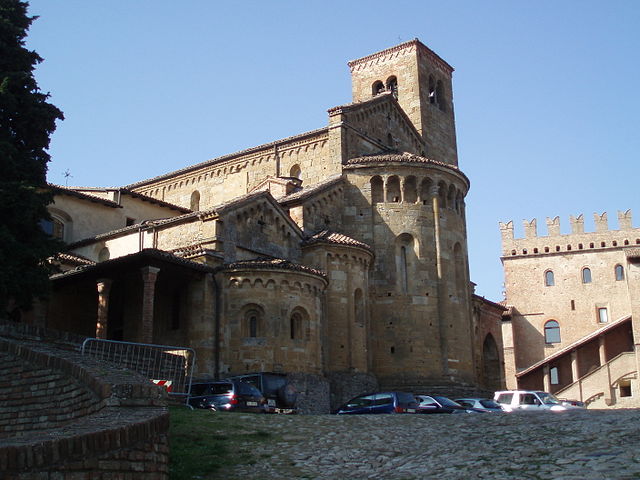
Castell'Arquato
- Italian comune
Hiking in Castell'Arquato
Castell'Arquato is a picturesque medieval village located in the Emilia-Romagna region of Italy, surrounded by rolling hills and stunning landscapes, making it a fantastic destination for hiking enthusiasts. The area around Castell'Arquato offers a variety of hiking trails that cater to different skill levels, from easy walks suitable for families to more challenging routes for experienced hikers....
- Country:
- Postal Code: 29014
- Local Dialing Code: 0523
- Licence Plate Code: PC
- Coordinates: 44° 51' 0" N, 9° 52' 0" E
- GPS tracks (wikiloc): [Link]
- AboveSeaLevel: 224 м m
- Area: 52.75 sq km
- Population: 4621
- Web site: [Link]

Cortemaggiore
- Italian comune
Hiking in Cortemaggiore
Cortemaggiore, a charming town in Italy's Emilia-Romagna region, offers a unique blend of history and natural beauty, though it may not be as widely recognized as some other hiking destinations. Here are some insights about hiking in and around Cortemaggiore:...
- Country:
- Postal Code: 29016
- Local Dialing Code: 0523
- Licence Plate Code: PC
- Coordinates: 45° 0' 0" N, 9° 56' 0" E
- GPS tracks (wikiloc): [Link]
- AboveSeaLevel: 50 м m
- Area: 36.47 sq km
- Population: 4679
- Web site: [Link]