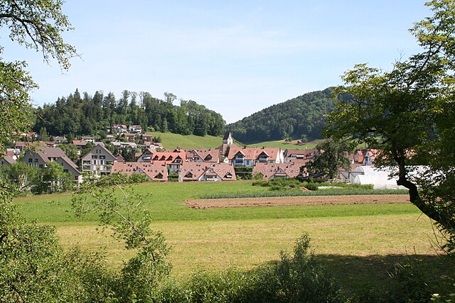
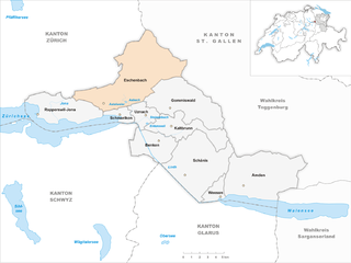
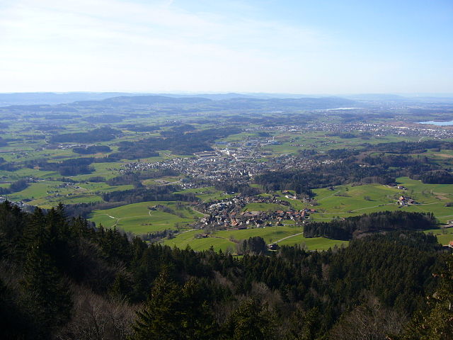
Fischenthal (Fischenthal)
- municipality in Switzerland
Fischenthal, located in the Zürcher Oberland in Switzerland, offers a delightful hiking experience with its picturesque landscapes, charming villages, and scenic trails. Here are some highlights of hiking in the Fischenthal area:
Trails and Scenery
-
Varied Terrain: The hiking trails around Fischenthal vary from easy walks to more challenging treks. You can find paths that take you through lush forests, along rivers, and past stunning viewpoints.
-
Natural Beauty: The region is characterized by rolling hills, meadows, and a mix of deciduous and coniferous forests. Be sure to take in the views of the surrounding countryside and the impressive contours of the Swiss landscape.
-
Wildlife: Keep an eye out for local wildlife, including deer, a variety of birds, and possibly some interesting plant species. It’s a tranquil area that’s great for nature lovers.
Popular Hiking Routes
-
Fischenthal to Bäretswil: This is a moderately easy hike that often takes you through picturesque meadows and small forests, offering beautiful views of the region along the way.
-
Schnäggweg: This well-marked trail is great for families and leads you through diverse landscapes while providing educational insights about the local flora and fauna.
Accessibility
- Public Transport: Fischenthal can be easily reached by train or bus from Zurich, making it an accessible destination for a day hike. The public transportation system in Switzerland is reliable and can efficiently get you to the start of various trails.
Tips for Hikers
- Weather: Always check the weather conditions before you head out, as mountain weather can change rapidly.
- Equipment: Wear sturdy hiking shoes, and consider bringing trekking poles if you’re planning on hiking longer distances or if the terrain is uneven.
- Season: The best times to hike in Fischenthal are during the spring and fall when the weather is mild, and the scenery is particularly beautiful.
Overall, Fischenthal offers a peaceful and beautiful hiking destination for both casual walkers and more dedicated hikers. Plan your hike according to your skill level and enjoy the serenity of the Swiss outdoors!
- Country:

- Postal Code: 8496
- Local Dialing Code: 055
- Licence Plate Code: ZH
- Coordinates: 47° 20' 12" N, 8° 56' 29" E


- GPS tracks (wikiloc): [Link]
- AboveSeaLevel: 769 м m
- Area: 30.25 sq km
- Population: 2504
- Web site: http://www.fischenthal.ch
- Wikipedia en: wiki(en)
- Wikipedia: wiki(de)
- Wikidata storage: Wikidata: Q65854
- Wikipedia Commons Category: [Link]
- Freebase ID: [/m/0gv0h_]
- GeoNames ID: Alt: [7285830]
- VIAF ID: Alt: [143052060]
- OSM relation ID: [1682122]
- Library of Congress authority ID: Alt: [n79028863]
- HDS ID: [86]
- Swiss municipality code: [0114]
Shares border with regions:


Fischingen
- municipality in the canton of Thurgau, Switzerland
Fischingen is a picturesque village located in the canton of Thurgau in Switzerland, surrounded by beautiful landscapes that are perfect for hiking enthusiasts. The area is characterized by rolling hills, lush forests, and serene lakes, making it a fantastic destination for both casual walkers and serious hikers....
- Country:

- Postal Code: 8376
- Local Dialing Code: 071
- Licence Plate Code: TG
- Coordinates: 47° 24' 59" N, 8° 58' 0" E


- GPS tracks (wikiloc): [Link]
- AboveSeaLevel: 625 м m
- Area: 30.7 sq km
- Population: 2695
- Web site: [Link]


Bäretswil
- municipality in Switzerland
Bäretswil is a charming municipality located in the Zürcher Oberland region of Switzerland, known for its scenic beauty and diverse hiking opportunities. Here are some key highlights for hiking in Bäretswil:...
- Country:

- Local Dialing Code: 044
- Licence Plate Code: ZH
- Coordinates: 47° 20' 13" N, 8° 51' 27" E


- GPS tracks (wikiloc): [Link]
- AboveSeaLevel: 702 м m
- Area: 22.19 sq km
- Population: 5026
- Web site: [Link]


Sternenberg
- former municipality of Switzerland
Sternenberg is an attractive destination for hiking enthusiasts, located in the beautiful region of Switzerland. Here are some key points to consider if you're exploring the area:...
- Country:

- Postal Code: 8499
- Local Dialing Code: 052
- Licence Plate Code: ZH
- Coordinates: 47° 23' 0" N, 8° 55' 0" E


- GPS tracks (wikiloc): [Link]
- AboveSeaLevel: 869 м m
- Area: 8.75 sq km
- Web site: [Link]


Eschenbach
- municipality in the canton of St. Gallen, Switzerland
Eschenbach, located in the canton of St. Gallen in Switzerland, is a charming village surrounded by beautiful landscapes, making it a fantastic destination for hiking enthusiasts. Here are some aspects to consider if you're planning a hike in this region:...
- Country:

- Postal Code: 8733
- Local Dialing Code: 055
- Licence Plate Code: SG
- Coordinates: 47° 16' 15" N, 8° 58' 12" E


- GPS tracks (wikiloc): [Link]
- AboveSeaLevel: 763 м m
- Area: 54.82 sq km
- Population: 9477
- Web site: [Link]


Bauma
- municipality in Switzerland
Bauma, located in the Zurich canton of Switzerland, is a charming town nestled in a picturesque landscape. The region offers a variety of hiking opportunities that cater to different skill levels and preferences....
- Country:

- Postal Code: 8494
- Local Dialing Code: 052
- Licence Plate Code: ZH
- Coordinates: 47° 22' 24" N, 8° 53' 2" E


- GPS tracks (wikiloc): [Link]
- AboveSeaLevel: 755 м m
- Area: 29.53 sq km
- Population: 4925
- Web site: [Link]


Wald
- municipality in the canton of Zürich, Switzerland
Wald is a beautiful area located in the Canton of Zürich, Switzerland, known for its scenic landscapes and picturesque hiking trails. Here are some highlights of hiking in Wald:...
- Country:

- Postal Code: 8636
- Local Dialing Code: 055
- Licence Plate Code: ZH
- Coordinates: 47° 16' 31" N, 8° 54' 52" E


- GPS tracks (wikiloc): [Link]
- AboveSeaLevel: 619 м m
- Area: 25.25 sq km
- Population: 9758
- Web site: [Link]


Hinwil
- municipality in Switzerland
Hinwil, located in the Zurich Oberland region of Switzerland, is a fantastic destination for hiking enthusiasts. The area is characterized by its beautiful landscapes, including rolling hills, dense forests, and scenic views of the surrounding mountains. Here are some highlights and tips for hiking in Hinwil:...
- Country:

- Postal Code: 8340
- Local Dialing Code: 044
- Licence Plate Code: ZH
- Coordinates: 47° 18' 12" N, 8° 50' 40" E


- GPS tracks (wikiloc): [Link]
- AboveSeaLevel: 573 м m
- Area: 22.3 sq km
- Population: 11179
- Web site: [Link]

