Fischingen (Fischingen)

- municipality in the canton of Thurgau, Switzerland
 Hiking in Fischingen
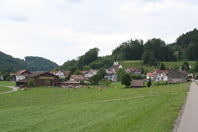
Fischingen is a picturesque village located in the canton of Thurgau in Switzerland, surrounded by beautiful landscapes that are perfect for hiking enthusiasts. The area is characterized by rolling hills, lush forests, and serene lakes, making it a fantastic destination for both casual walkers and serious hikers.
Hiking Trails
-
Local Trails: There are several marked hiking trails that start in Fischingen, offering varying levels of difficulty. These trails often take you through scenic countryside, vineyards, and along the shores of nearby lakes.
-
Toggenburg Trail: It’s possible to access parts of the Toggenburg Trail, which is a longer trail that connects various villages in the area, providing a more challenging option for experienced hikers.
-
Forest Walks: The surrounding forests offer shaded paths that are great for family hikes or leisurely walks. These trails are particularly beautiful in the spring and autumn seasons when the foliage is vibrant.
-
Cultural Routes: Some trails may incorporate local historical sites, allowing hikers to enjoy not just nature but also cultural experiences by visiting churches, old farms, and other landmarks.
Practical Information
-
Season: Hiking is ideal during the spring, summer, and early autumn months, but always check trail conditions as weather can vary. Snow may impact higher elevation trails in winter.
-
Equipment: Good walking shoes are essential. Depending on the season, hiking poles and weather-appropriate clothing might also be necessary.
-
Nature Reserves: Be mindful of local wildlife and natural habitats. Stick to marked paths to minimize your impact on the environment.
Local Facilities
Fischingen has various accommodations, from hotels to guesthouses, making it convenient for hikers looking to explore the area over several days. Additionally, local dining options provide a taste of Swiss cuisine, which can refuel you after a long day on the trails.
Exploring the hiking opportunities around Fischingen can be a lovely experience, providing both physical activity and a chance to appreciate the serene beauty of rural Switzerland. Always remember to carry a map, stay hydrated, and enjoy the journey!
- Country:

- Postal Code: 8376
- Local Dialing Code: 071
- Licence Plate Code: TG
- Coordinates: 47° 24' 59" N, 8° 58' 0" E


- GPS tracks (wikiloc): [Link]
- AboveSeaLevel: 625 м m
- Area: 30.7 sq km
- Population: 2695
- Web site: http://www.fischingen.ch
- Wikipedia en: wiki(en)
- Wikipedia: wiki(de)
- Wikidata storage: Wikidata: Q65525
- Wikipedia Commons Category: [Link]
- Freebase ID: [/m/0g358p]
- GeoNames ID: Alt: [7285831]
- VIAF ID: Alt: [151423623]
- OSM relation ID: [1684521]
- archINFORM location ID: [8510]
- HDS ID: [1951]
- Swiss municipality code: [4726]
Shares border with regions:


Kirchberg
- municipality in the canton of St. Gallen, Switzerland
Hiking in Kirchberg
Kirchberg, located in the Canton of St. Gallen, Switzerland, is a beautiful area known for its scenic landscapes and outdoor recreational opportunities. While the region is less known than some of the more touristic spots in Switzerland, it offers several delightful hiking trails that cater to different skill levels....
- Country:
- Postal Code: 9533
- Local Dialing Code: 071
- Licence Plate Code: SG
- Coordinates: 47° 24' 30" N, 9° 1' 34" E
- GPS tracks (wikiloc): [Link]
- AboveSeaLevel: 723 м m
- Area: 42.59 sq km
- Population: 9016
- Web site: [Link]


Eschlikon
- municipality in Switzerland
Hiking in Eschlikon
Eschlikon, located in the Zurich Region of Switzerland, offers a charming backdrop for hiking enthusiasts. The area is characterized by rolling hills, picturesque landscapes, and Swiss countryside charm, making it a great destination for both casual walkers and more experienced hikers....
- Country:
- Postal Code: 8360
- Local Dialing Code: 071
- Licence Plate Code: TG
- Coordinates: 47° 27' 30" N, 8° 57' 46" E
- GPS tracks (wikiloc): [Link]
- AboveSeaLevel: 565 м m
- Area: 6.2 sq km
- Population: 4308
- Web site: [Link]


Mosnang
- municipality in Switzerland
Hiking in Mosnang
Mosnang is a municipality located in the canton of St. Gallen in Switzerland, known for its beautiful landscapes and outdoor recreational opportunities, including hiking. Here are some key points for those interested in hiking in the Mosnang area:...
- Country:
- Postal Code: 9607
- Local Dialing Code: 071
- Licence Plate Code: SG
- Coordinates: 47° 21' 0" N, 9° 1' 59" E
- GPS tracks (wikiloc): [Link]
- AboveSeaLevel: 735 м m
- Area: 50.46 sq km
- Population: 2884
- Web site: [Link]


Sirnach
- municipality in Switzerland
Hiking in Sirnach
Sirnach is a beautiful area located in the canton of Thurgau in Switzerland, known for its picturesque landscapes and outdoor activities, including hiking. Here are some highlights and tips for hiking in and around Sirnach:...
- Country:
- Postal Code: 8370
- Local Dialing Code: 071
- Licence Plate Code: TG
- Coordinates: 47° 27' 16" N, 9° 0' 8" E
- GPS tracks (wikiloc): [Link]
- AboveSeaLevel: 655 м m
- Area: 12.4 sq km
- Population: 7737
- Web site: [Link]

Bichelsee-Balterswil
- municipality in Switzerland
Hiking in Bichelsee-Balterswil
Bichelsee-Balterswil is a picturesque area in the canton of Thurgau in Switzerland, known for its natural beauty and a variety of hiking trails. The region is characterized by rolling hills, serene lakes, and lush forests, making it an ideal destination for outdoor enthusiasts....
- Country:
- Postal Code: 8362
- Local Dialing Code: 071
- Licence Plate Code: TG
- Coordinates: 47° 26' 59" N, 8° 54' 59" E
- GPS tracks (wikiloc): [Link]
- AboveSeaLevel: 601 м m
- Area: 12.1 sq km
- Population: 2839
- Web site: [Link]

Fischenthal
- municipality in Switzerland
Hiking in Fischenthal
Fischenthal, located in the Zürcher Oberland in Switzerland, offers a delightful hiking experience with its picturesque landscapes, charming villages, and scenic trails. Here are some highlights of hiking in the Fischenthal area:...
- Country:
- Postal Code: 8496
- Local Dialing Code: 055
- Licence Plate Code: ZH
- Coordinates: 47° 20' 12" N, 8° 56' 29" E
- GPS tracks (wikiloc): [Link]
- AboveSeaLevel: 769 м m
- Area: 30.25 sq km
- Population: 2504
- Web site: [Link]


Turbenthal
- municipality in Switzerland
Hiking in Turbenthal
Turbenthal, a picturesque town located in the Canton of Zurich, Switzerland, offers various hiking opportunities that cater to different skill levels. Surrounded by lush landscapes, rolling hills, and scenic views of the Zurich Oberland, it is an ideal destination for both leisurely walks and more challenging hikes....
- Country:
- Postal Code: 8488
- Local Dialing Code: 052
- Licence Plate Code: ZH
- Coordinates: 47° 25' 56" N, 8° 52' 47" E
- GPS tracks (wikiloc): [Link]
- AboveSeaLevel: 600 м m
- Area: 25.07 sq km
- Population: 4748
- Web site: [Link]


Sternenberg
- former municipality of Switzerland
Hiking in Sternenberg
Sternenberg is an attractive destination for hiking enthusiasts, located in the beautiful region of Switzerland. Here are some key points to consider if you're exploring the area:...
- Country:
- Postal Code: 8499
- Local Dialing Code: 052
- Licence Plate Code: ZH
- Coordinates: 47° 23' 0" N, 8° 55' 0" E
- GPS tracks (wikiloc): [Link]
- AboveSeaLevel: 869 м m
- Area: 8.75 sq km
- Web site: [Link]


Wila
- municipality in Switzerland
Hiking in Wila
Wila is a charming village located in the Zurich Oberland region of Switzerland, making it a great starting point for various hiking adventures. The area is characterized by picturesque landscapes, lush forests, rolling hills, and breathtaking views of the surrounding Alps....
- Country:
- Postal Code: 8492
- Local Dialing Code: 052
- Licence Plate Code: ZH
- Coordinates: 47° 24' 33" N, 8° 51' 39" E
- GPS tracks (wikiloc): [Link]
- AboveSeaLevel: 579 м m
- Area: 9.21 sq km
- Population: 1975
- Web site: [Link]