Fleurac (Fleurac)

- commune in Dordogne, France
- Country:

- Postal Code: 24580
- Coordinates: 45° 0' 28" N, 1° 0' 7" E


- GPS tracks (wikiloc): [Link]
- Area: 22.18 sq km
- Population: 247
- Wikipedia en: wiki(en)
- Wikipedia: wiki(fr)
- Wikidata storage: Wikidata: Q1078847
- Wikipedia Commons Category: [Link]
- Freebase ID: [/m/03mhks4]
- Freebase ID: [/m/03mhks4]
- GeoNames ID: Alt: [6429385]
- GeoNames ID: Alt: [6429385]
- SIREN number: [212401830]
- SIREN number: [212401830]
- BnF ID: [15251831z]
- BnF ID: [15251831z]
- VIAF ID: Alt: [240112403]
- VIAF ID: Alt: [240112403]
- INSEE municipality code: 24183
- INSEE municipality code: 24183
Shares border with regions:

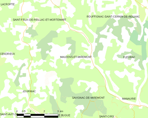
Mauzens-et-Miremont
- commune in Dordogne, France
- Country:
- Postal Code: 24260
- Coordinates: 44° 59' 35" N, 0° 55' 7" E
- GPS tracks (wikiloc): [Link]
- Area: 20.57 sq km
- Population: 299

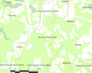
Peyzac-le-Moustier
- commune in Dordogne, France
- Country:
- Postal Code: 24620
- Coordinates: 44° 59' 26" N, 1° 4' 44" E
- GPS tracks (wikiloc): [Link]
- Area: 10.1 sq km
- Population: 179
- Web site: [Link]


Savignac-de-Miremont
- commune in Dordogne, France
- Country:
- Postal Code: 24260
- Coordinates: 44° 58' 20" N, 0° 56' 41" E
- GPS tracks (wikiloc): [Link]
- Area: 7.62 sq km
- Population: 172


Plazac
- commune in Dordogne, France
- Country:
- Postal Code: 24580
- Coordinates: 45° 2' 6" N, 1° 2' 22" E
- GPS tracks (wikiloc): [Link]
- Area: 33.77 sq km
- Population: 695
- Web site: [Link]


Manaurie
- commune in Dordogne, France
- Country:
- Postal Code: 24620
- Coordinates: 44° 57' 37" N, 0° 59' 29" E
- GPS tracks (wikiloc): [Link]
- Area: 9.97 sq km
- Population: 146