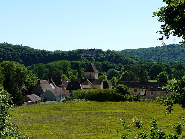
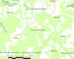
Peyzac-le-Moustier (Peyzac-le-Moustier)
- commune in Dordogne, France
- Country:

- Postal Code: 24620
- Coordinates: 44° 59' 26" N, 1° 4' 44" E


- GPS tracks (wikiloc): [Link]
- Area: 10.1 sq km
- Population: 179
- Web site: http://www.peyzac-le-moustier-perigord.fr/
- Wikipedia en: wiki(en)
- Wikipedia: wiki(fr)
- Wikidata storage: Wikidata: Q196511
- Wikipedia Commons Category: [Link]
- Freebase ID: [/m/03mg7gj]
- Freebase ID: [/m/03mg7gj]
- GeoNames ID: Alt: [2987447]
- GeoNames ID: Alt: [2987447]
- SIREN number: [212403265]
- SIREN number: [212403265]
- BnF ID: [15251972t]
- BnF ID: [15251972t]
- PACTOLS thesaurus ID: [pcrtZag5kTEtxM]
- PACTOLS thesaurus ID: [pcrtZag5kTEtxM]
- INSEE municipality code: 24326
- INSEE municipality code: 24326
Shares border with regions:


Fleurac
- commune in Dordogne, France
- Country:

- Postal Code: 24580
- Coordinates: 45° 0' 28" N, 1° 0' 7" E


- GPS tracks (wikiloc): [Link]
- Area: 22.18 sq km
- Population: 247


Tamniès
- commune in Dordogne, France
- Country:

- Postal Code: 24620
- Coordinates: 44° 57' 57" N, 1° 8' 58" E


- GPS tracks (wikiloc): [Link]
- Area: 19.09 sq km
- Population: 382
- Web site: [Link]


Tursac
- commune in Dordogne, France
- Country:

- Postal Code: 24620
- Coordinates: 44° 58' 8" N, 1° 2' 40" E


- GPS tracks (wikiloc): [Link]
- Area: 17.71 sq km
- Population: 356
- Web site: [Link]


Les Eyzies-de-Tayac-Sireuil
- commune in Dordogne, France
- Country:

- Postal Code: 24620
- Coordinates: 44° 56' 8" N, 1° 1' 1" E


- GPS tracks (wikiloc): [Link]
- AboveSeaLevel: 74 м m
- Area: 37.44 sq km
- Population: 815
- Web site: [Link]


Saint-Léon-sur-Vézère
- commune in Dordogne, France
- Country:

- Postal Code: 24290
- Coordinates: 45° 0' 38" N, 1° 5' 19" E


- GPS tracks (wikiloc): [Link]
- Area: 13.76 sq km
- Population: 428
- Web site: [Link]


Sergeac
- commune in Dordogne, France
- Country:

- Postal Code: 24290
- Coordinates: 45° 0' 9" N, 1° 6' 23" E


- GPS tracks (wikiloc): [Link]
- Area: 10.71 sq km
- Population: 215
- Web site: [Link]


Marquay
- commune in Dordogne, France
- Country:

- Postal Code: 24620
- Coordinates: 44° 56' 37" N, 1° 8' 2" E


- GPS tracks (wikiloc): [Link]
- Area: 24.27 sq km
- Population: 573
