Fleurieux-sur-l'Arbresle (Fleurieux-sur-l'Arbresle)

- commune in Rhône, France
- Country:

- Postal Code: 69210
- Coordinates: 45° 50' 11" N, 4° 39' 9" E


- GPS tracks (wikiloc): [Link]
- Area: 9.51 sq km
- Population: 2334
- Web site: http://www.fleurieuxsurlarbresle.fr
- Wikipedia en: wiki(en)
- Wikipedia: wiki(fr)
- Wikidata storage: Wikidata: Q1388779
- Wikipedia Commons Category: [Link]
- Freebase ID: [/m/03qgg19]
- Freebase ID: [/m/03qgg19]
- GeoNames ID: Alt: [6450763]
- GeoNames ID: Alt: [6450763]
- SIREN number: [216900860]
- SIREN number: [216900860]
- BnF ID: [15272174z]
- BnF ID: [15272174z]
- WOEID: [22756476]
- WOEID: [22756476]
- INSEE municipality code: 69086
- INSEE municipality code: 69086
Shares border with regions:
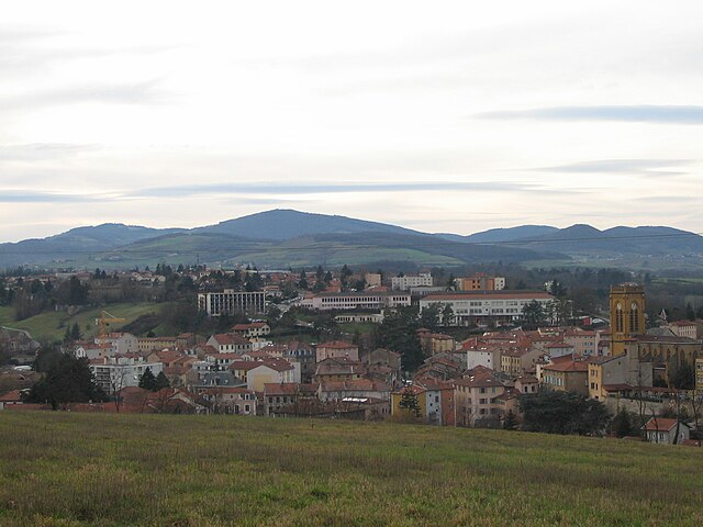

L'Arbresle
- commune in Rhône, France
- Country:
- Postal Code: 69210
- Coordinates: 45° 50' 8" N, 4° 37' 1" E
- GPS tracks (wikiloc): [Link]
- Area: 3.36 sq km
- Population: 6360
- Web site: [Link]


Lozanne
- commune in Rhône, France
- Country:
- Postal Code: 69380
- Coordinates: 45° 51' 26" N, 4° 40' 51" E
- GPS tracks (wikiloc): [Link]
- Area: 5.5 sq km
- Population: 2630
- Web site: [Link]


Châtillon
- commune in Rhône, France
- Country:
- Postal Code: 69380
- Coordinates: 45° 52' 38" N, 4° 38' 45" E
- GPS tracks (wikiloc): [Link]
- Area: 10.71 sq km
- Population: 2178
- Web site: [Link]


Éveux
- commune in Rhône, France
- Country:
- Postal Code: 69210
- Coordinates: 45° 49' 35" N, 4° 37' 23" E
- GPS tracks (wikiloc): [Link]
- Area: 3.32 sq km
- Population: 1197
- Web site: [Link]


Lentilly
- commune in Rhône, France
- Country:
- Postal Code: 69210
- Coordinates: 45° 49' 7" N, 4° 39' 47" E
- GPS tracks (wikiloc): [Link]
- Area: 18.39 sq km
- Population: 5390