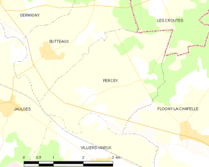
Flogny-la-Chapelle (Flogny-la-Chapelle)
- commune in Yonne, France
- Country:

- Postal Code: 89360
- Coordinates: 47° 57' 9" N, 3° 52' 20" E


- GPS tracks (wikiloc): [Link]
- AboveSeaLevel: 150 м m
- Area: 23.75 sq km
- Population: 1035
- Web site: http://flogny-la-chapelle.fr/
- Wikipedia en: wiki(en)
- Wikipedia: wiki(fr)
- Wikidata storage: Wikidata: Q127999
- Wikipedia Commons Category: [Link]
- Freebase ID: [/m/03npdj4]
- Freebase ID: [/m/03npdj4]
- GeoNames ID: Alt: [6617918]
- GeoNames ID: Alt: [6617918]
- SIREN number: [218901692]
- SIREN number: [218901692]
- BnF ID: [15279618j]
- BnF ID: [15279618j]
- VIAF ID: Alt: [235199827]
- VIAF ID: Alt: [235199827]
- PACTOLS thesaurus ID: [pcrt6Zc7Lhu73Q]
- PACTOLS thesaurus ID: [pcrt6Zc7Lhu73Q]
- INSEE municipality code: 89169
- INSEE municipality code: 89169
Shares border with regions:


Marolles-sous-Lignières
- commune in Aube, France
- Country:

- Postal Code: 10130
- Coordinates: 47° 56' 57" N, 3° 55' 6" E


- GPS tracks (wikiloc): [Link]
- Area: 15.12 sq km
- Population: 330


Les Croûtes
- commune in Aube, France
- Country:

- Postal Code: 10130
- Coordinates: 47° 59' 50" N, 3° 51' 51" E


- GPS tracks (wikiloc): [Link]
- Area: 7.11 sq km
- Population: 104


Chessy-les-Prés
- commune in Aube, France
- Country:

- Postal Code: 10130
- Coordinates: 48° 1' 28" N, 3° 54' 52" E


- GPS tracks (wikiloc): [Link]
- Area: 25.69 sq km
- Population: 511
Villiers-Vineux
- commune in Yonne, France
- Country:

- Postal Code: 89360
- Coordinates: 47° 56' 36" N, 3° 50' 3" E


- GPS tracks (wikiloc): [Link]
- Area: 11.18 sq km
- Population: 308


Percey
- commune in Yonne, France
- Country:

- Postal Code: 89360
- Coordinates: 47° 57' 49" N, 3° 49' 31" E


- GPS tracks (wikiloc): [Link]
- Area: 9.56 sq km
- Population: 242
- Web site: [Link]


Bernouil
- commune in Yonne, France
- Country:

- Postal Code: 89360
- Coordinates: 47° 53' 59" N, 3° 53' 42" E


- GPS tracks (wikiloc): [Link]
- Area: 4.55 sq km
- Population: 107
Dyé
- commune in Yonne, France
- Country:

- Postal Code: 89360
- Coordinates: 47° 53' 57" N, 3° 52' 11" E


- GPS tracks (wikiloc): [Link]
- Area: 17 sq km
- Population: 205
Carisey
- commune in Yonne, France
- Country:

- Postal Code: 89360
- Coordinates: 47° 55' 24" N, 3° 50' 49" E


- GPS tracks (wikiloc): [Link]
- Area: 11.29 sq km
- Population: 365
