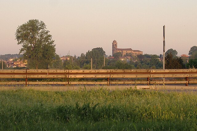
Fombio (Fombio)
.svg)
- Italian comune
 Hiking in Fombio
Fombio, a small town in the Lombardy region of Italy, offers several opportunities for hikers, especially those looking to explore the beautiful Italian countryside. While it may not be a well-known hiking destination, its proximity to larger natural areas makes it a great base for exploring.
Hiking Opportunities:
-
Local Trails: Fombio itself has a few local trails that can be explored on foot. Walking around the town and nearby agricultural fields can provide a peaceful experience, showcasing the charm of rural Italy.
-
Parks and Nature Reserves: A short drive from Fombio can lead you to parks such as the Parco Regionale Adda Nord. Here, you'll find well-marked trails along the Adda River, lush forests, and opportunities for birdwatching and wildlife spotting.
-
The Martesana Canal: The Martesana Canal runs near Fombio and offers a nice route for walking or biking along its banks. This trail is relatively flat, making it suitable for hikers of all skill levels.
-
Nearby Hills and Mountains: If you’re willing to travel a bit further, the Orobic Alps and the Bergamo area provide more challenging trails with stunning views, a range of difficulty levels, and opportunities for longer hikes.
Tips for Hiking in Fombio:
-
Seasonal Considerations: Spring and fall are ideal for hiking due to milder temperatures. Summers can be hot, while winters may bring snow to higher elevations.
-
Gear Up: Wear suitable hiking footwear and carry a map or use a GPS device to navigate local trails.
-
Stay Hydrated and Energized: Bring enough water and snacks, especially when tackling longer hikes or touring more remote areas.
-
Respect Nature: Always follow local guidelines for preserving nature, and consider leaving no trace behind.
-
Connect with Locals: Don’t hesitate to ask local hikers or tourist information for recommended trails and experiences.
Conclusion:
While Fombio may not be a major hiking hub, it provides access to the natural beauty of Lombardy, making it a potential starting point for various outdoor adventures. If you’re in the area, take the opportunity to explore both the tranquility of the countryside and the more rugged terrains just a short drive away!
- Country:

- Postal Code: 26861
- Local Dialing Code: 0377
- Licence Plate Code: LO
- Coordinates: 45° 8' 29" N, 9° 41' 20" E


- GPS tracks (wikiloc): [Link]
- AboveSeaLevel: 56 м m
- Area: 7.4 sq km
- Population: 2325
- Web site: http://www.comune.fombio.lo.it/home.htm
- Wikipedia en: wiki(en)
- Wikipedia: wiki(it)
- Wikidata storage: Wikidata: Q42938
- Wikipedia Commons Category: [Link]
- Freebase ID: [/m/0gr5ld]
- GeoNames ID: Alt: [6539416]
- VIAF ID: Alt: [158434724]
- OSM relation ID: [44231]
- UN/LOCODE: [ITFBI]
- ISTAT ID: 098026
- Italian cadastre code: D660
Shares border with regions:


Codogno
- Italian comune
Hiking in Codogno
Codogno is a town located in the Lombardy region of Italy, primarily known for its agricultural landscape and historical charm. While Codogno itself may not be a major hiking destination, there are several scenic areas and trails nearby that can provide a pleasant hiking experience....
- Country:
- Postal Code: 26845
- Local Dialing Code: 0377
- Licence Plate Code: LO
- Coordinates: 45° 9' 46" N, 9° 42' 12" E
- GPS tracks (wikiloc): [Link]
- AboveSeaLevel: 58 м m
- Area: 20.87 sq km
- Population: 15901
- Web site: [Link]


San Fiorano
- Italian comune
Hiking in San Fiorano
San Fiorano is a small town in the Lombardy region of Italy, located near the city of Lodi. While it may not be widely recognized as a major hiking destination, the surrounding area offers opportunities for outdoor activities, including hiking, especially if you're interested in exploring the broader landscape of Lombardy....
- Country:
- Postal Code: 26848
- Local Dialing Code: 0377
- Licence Plate Code: LO
- Coordinates: 45° 8' 14" N, 9° 43' 24" E
- GPS tracks (wikiloc): [Link]
- AboveSeaLevel: 56 м m
- Area: 8.97 sq km
- Population: 1841
- Web site: [Link]
Guardamiglio
- Italian comune
Hiking in Guardamiglio
Guardamiglio is a small town located in the province of Lodi in the Lombardy region of northern Italy. While it may not be as well-known for hiking as some of the larger national parks or mountainous regions in Italy, there are definitely opportunities for outdoor activities in and around the area....
- Country:
- Postal Code: 26862
- Local Dialing Code: 0377
- Licence Plate Code: LO
- Coordinates: 45° 6' 31" N, 9° 40' 57" E
- GPS tracks (wikiloc): [Link]
- AboveSeaLevel: 49 м m
- Area: 10.44 sq km
- Population: 2664
- Web site: [Link]


San Rocco al Porto
- Italian comune
Hiking in San Rocco al Porto
San Rocco al Porto is a charming village located in the province of Lodi, Lombardy, Italy. While it may not be as widely recognized for hiking as some of the more mountainous regions of Italy, there are still opportunities for outdoor enthusiasts to explore the natural beauty surrounding the area....
- Country:
- Postal Code: 26865
- Local Dialing Code: 0377
- Licence Plate Code: LO
- Coordinates: 45° 4' 58" N, 9° 41' 54" E
- GPS tracks (wikiloc): [Link]
- AboveSeaLevel: 47 м m
- Area: 30.57 sq km
- Population: 3513
- Web site: [Link]


Somaglia
- Italian comune
Hiking in Somaglia
Somaglia is a small town located in the Lombardy region of Italy. While it may not be widely recognized as a hiking destination, the surrounding areas offer some beautiful landscapes and opportunities for outdoor activities....
- Country:
- Postal Code: 26867
- Local Dialing Code: 0377
- Licence Plate Code: LO
- Coordinates: 45° 9' 1" N, 9° 38' 4" E
- GPS tracks (wikiloc): [Link]
- AboveSeaLevel: 57 м m
- Area: 20.82 sq km
- Population: 3797
- Web site: [Link]

Santo Stefano Lodigiano
- Italian comune
Hiking in Santo Stefano Lodigiano
Santo Stefano Lodigiano, located in the Lombardy region of Italy, offers a peaceful outdoor experience set against a backdrop of natural beauty, picturesque countryside, and rural landscapes. While it may not be among the most famous hiking destinations, it provides a number of trails ideal for hiking enthusiasts looking for a quieter experience....
- Country:
- Postal Code: 26849
- Local Dialing Code: 0377
- Licence Plate Code: LO
- Coordinates: 45° 7' 10" N, 9° 44' 11" E
- GPS tracks (wikiloc): [Link]
- AboveSeaLevel: 48 м m
- Area: 10.53 sq km
- Population: 1910
- Web site: [Link]