Fontaine-de-Vaucluse (Fontaine-de-Vaucluse)
- commune in Vaucluse, France
 Hiking in Fontaine-de-Vaucluse
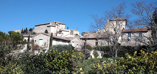
Fontaine-de-Vaucluse is a picturesque village located in the Vaucluse department of the Provence region in southeastern France. It's famous for its stunning natural springs and is surrounded by beautiful landscapes, making it an excellent destination for hiking enthusiasts.
Key Highlights of Hiking in Fontaine-de-Vaucluse:
-
Scenic Trails: The area offers numerous trails that cater to various skill levels. You can often expect to encounter beautiful views of the Sorgue River, limestone cliffs, and lush greenery.
-
The Source of the Sorgue River: One of the main attractions is the spectacular source of the Sorgue River, which is a short hike from the village. The vibrant turquoise waters spring forth from the mountains, creating a stunning natural site.
-
Mont Ventoux Views: Some hiking paths offer views of Mont Ventoux, one of the most iconic peaks in Provence. This can add an impressive backdrop to your hike.
-
Cultural and Historical Sites: Along the trails, you may encounter historical landmarks, such as the remnants of ancient mill structures and charming old houses that reflect the region's history.
-
Conservation Areas: Many trails pass through protected areas, offering a chance to observe local wildlife and the unique flora of the region.
-
Difficulty Levels: Whether you're an experienced hiker or a novice, you can find trails that suit your fitness and experience level. You can look for easier routes along the river or more challenging hikes in the surrounding hills.
Tips for Hiking in Fontaine-de-Vaucluse:
- Stay Hydrated: Always bring water, especially during the warmer months, as the temperatures can get quite high in Provence.
- Footwear: Wear sturdy hiking shoes for better grip and comfort, particularly if you're tackling rocky or uneven terrain.
- Weather Check: Before setting out, check the weather forecast as conditions can change rapidly in the mountains.
- Local Maps: Consider obtaining a local hiking map or guidebook to help you navigate the trails effectively.
- Respect Nature: Stay on marked trails and follow local guidelines to preserve the natural environment.
Conclusion
Hiking in Fontaine-de-Vaucluse is an enriching experience that combines natural beauty with cultural heritage. Whether you’re looking for a leisurely stroll or a more intense hike, this region offers a diverse array of options for outdoor adventurers. Enjoy your hiking adventure!
- Country:

- Postal Code: 84800
- Coordinates: 43° 55' 20" N, 5° 7' 37" E


- GPS tracks (wikiloc): [Link]
- Area: 7.14 sq km
- Population: 643
- Web site: http://oti-delasorgue.fr/
- Wikipedia en: wiki(en)
- Wikipedia: wiki(fr)
- Wikidata storage: Wikidata: Q463304
- Wikipedia Commons Category: [Link]
- Freebase ID: [/m/02vmpjs]
- GeoNames ID: Alt: [3018066]
- SIREN number: [218401396]
- BnF ID: [152781198]
- VIAF ID: Alt: [134404294]
- OSM relation ID: [107924]
- GND ID: Alt: [4192850-7]
- Library of Congress authority ID: Alt: [n91048326]
- PACTOLS thesaurus ID: [pcrtl53ZEezBPl]
- WOEID: [22756120]
- Digital Atlas of the Roman Empire ID: [22571]
- INSEE municipality code: 84139
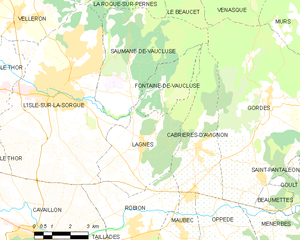
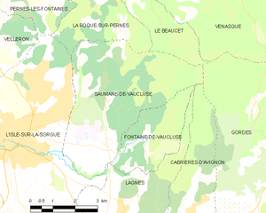
Shares border with regions:


Lagnes
- commune in Vaucluse, France
Lagnes, located in the Vaucluse region of France, is a great destination for hiking enthusiasts. Nestled near the Luberon Mountains and close to the picturesque village of Gordes, Lagnes offers a variety of trails that showcase the natural beauty of the surrounding landscape....
- Country:

- Postal Code: 84800
- Coordinates: 43° 53' 36" N, 5° 6' 53" E


- GPS tracks (wikiloc): [Link]
- Area: 16.93 sq km
- Population: 1622
- Web site: [Link]


Saumane-de-Vaucluse
- commune in Vaucluse, France
Saumane-de-Vaucluse is a charming village located in the Vaucluse region of Provence, France. It's nestled in a picturesque landscape characterized by rolling hills, lavender fields, and impressive limestone cliffs, making it a fantastic spot for hiking enthusiasts....
- Country:

- Postal Code: 84800
- Coordinates: 43° 56' 11" N, 5° 6' 22" E


- GPS tracks (wikiloc): [Link]
- AboveSeaLevel: 140 м m
- Area: 20.81 sq km
- Population: 936
