Lagnes (Lagnes)

- commune in Vaucluse, France
 Hiking in Lagnes
Lagnes, located in the Vaucluse region of France, is a great destination for hiking enthusiasts. Nestled near the Luberon Mountains and close to the picturesque village of Gordes, Lagnes offers a variety of trails that showcase the natural beauty of the surrounding landscape.
Hiking Trails
-
Luberon National Park Trails: The park offers a range of trails that cater to different skill levels. You can find paths that lead through vineyards, olive groves, and rocky paths with stunning views of the landscape.
-
Gordes to Roussillon: This hike takes you between two beautiful villages. The trail provides breathtaking views of the ochre cliffs and rolling vineyards. It’s moderately challenging and is approximately 10 km long.
-
Cascades de Sorgue: A trail that follows the Sorgue River, leading to beautiful natural springs and ponds. It’s perfect for a leisurely hike and also suitable for families.
-
Sentier des Ocres: Near Roussillon, this trail is famous for its unique ochre landscape. The colors of the cliffs and ground provide a stunning backdrop for photography and exploration.
Tips for Hiking in Lagnes
-
Best Time to Go: The best time for hiking in this region is during spring (April to June) and fall (September to October) when the weather is mild.
-
Hydration and Supplies: Carry enough water and snacks, as some trails may not have facilities for refueling.
-
Footwear: Wear sturdy hiking boots and appropriate clothing. The terrain can be rocky and uneven.
-
Local Maps: It might be helpful to have a local hiking map or a GPS device, as some trails can be less clearly marked.
-
Respect Nature: Stay on marked trails to preserve the natural environment and follow local guidelines regarding wildlife.
Whether you're a seasoned hiker or just looking for a pleasant walk, Lagnes and its surroundings offer a serene and picturesque hiking experience!
- Country:

- Postal Code: 84800
- Coordinates: 43° 53' 36" N, 5° 6' 53" E


- GPS tracks (wikiloc): [Link]
- Area: 16.93 sq km
- Population: 1622
- Web site: http://www.lagnes.fr
- Wikipedia en: wiki(en)
- Wikipedia: wiki(fr)
- Wikidata storage: Wikidata: Q625954
- Wikipedia Commons Category: [Link]
- Freebase ID: [/m/02vmpgq]
- GeoNames ID: Alt: [3009078]
- SIREN number: [218400620]
- BnF ID: [15278042h]
- INSEE municipality code: 84062
Shares border with regions:


Cabrières-d'Avignon
- commune in Vaucluse, France
Hiking in Cabrières-d'Avignon
Cabrières-d'Avignon is a charming village in the Provence region of France, surrounded by stunning landscapes and offering a variety of hiking opportunities. Here’s what you should know about hiking in this area:...
- Country:
- Postal Code: 84220
- Coordinates: 43° 53' 31" N, 5° 8' 58" E
- GPS tracks (wikiloc): [Link]
- Area: 14.68 sq km
- Population: 1760


Fontaine-de-Vaucluse
- commune in Vaucluse, France
Hiking in Fontaine-de-Vaucluse
Fontaine-de-Vaucluse is a picturesque village located in the Vaucluse department of the Provence region in southeastern France. It's famous for its stunning natural springs and is surrounded by beautiful landscapes, making it an excellent destination for hiking enthusiasts....
- Country:
- Postal Code: 84800
- Coordinates: 43° 55' 20" N, 5° 7' 37" E
- GPS tracks (wikiloc): [Link]
- Area: 7.14 sq km
- Population: 643
- Web site: [Link]


Robion
- commune in Vaucluse, France
Hiking in Robion
Robion, located in the Vaucluse department in southeastern France, is surrounded by the scenic landscapes of the Luberon Regional Natural Park, making it an excellent starting point for hiking enthusiasts. Here are a few key points about hiking in and around Robion:...
- Country:
- Postal Code: 84440
- Coordinates: 43° 50' 42" N, 5° 6' 46" E
- GPS tracks (wikiloc): [Link]
- Area: 17.7 sq km
- Population: 4393
- Web site: [Link]
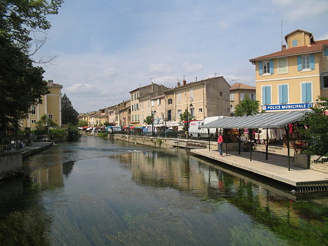
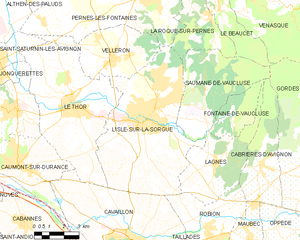
L'Isle-sur-la-Sorgue
- commune in Vaucluse, France
Hiking in L'Isle-sur-la-Sorgue
L'Isle-sur-la-Sorgue is a picturesque town located in the Provence-Alpes-Côte d'Azur region of France, renowned for its beautiful canals, charming antique shops, and vibrant markets. While it is mostly known for its cultural and historical significance, it also offers various opportunities for hiking and enjoying the natural landscape....
- Country:
- Postal Code: 84800
- Coordinates: 43° 55' 10" N, 5° 3' 5" E
- GPS tracks (wikiloc): [Link]
- AboveSeaLevel: 246 м m
- Area: 44.57 sq km
- Population: 19483
- Web site: [Link]

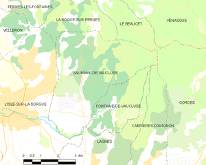
Saumane-de-Vaucluse
- commune in Vaucluse, France
Hiking in Saumane-de-Vaucluse
Saumane-de-Vaucluse is a charming village located in the Vaucluse region of Provence, France. It's nestled in a picturesque landscape characterized by rolling hills, lavender fields, and impressive limestone cliffs, making it a fantastic spot for hiking enthusiasts....
- Country:
- Postal Code: 84800
- Coordinates: 43° 56' 11" N, 5° 6' 22" E
- GPS tracks (wikiloc): [Link]
- AboveSeaLevel: 140 м m
- Area: 20.81 sq km
- Population: 936