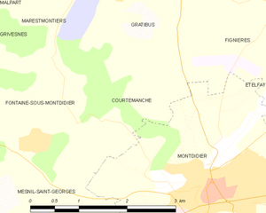
Fontaine-sous-Montdidier (Fontaine-sous-Montdidier)

- commune in Somme, France
- Country:

- Postal Code: 80500
- Coordinates: 49° 39' 25" N, 2° 31' 7" E


- GPS tracks (wikiloc): [Link]
- Area: 9.03 sq km
- Population: 112
- Wikipedia en: wiki(en)
- Wikipedia: wiki(fr)
- Wikidata storage: Wikidata: Q146087
- Wikipedia Commons Category: [Link]
- Freebase ID: [/m/03nrm1t]
- GeoNames ID: Alt: [6444444]
- SIREN number: [218003127]
- BnF ID: [15276806c]
- INSEE municipality code: 80326
Shares border with regions:


Cantigny
- commune in Somme, France
- Country:
- Postal Code: 80500
- Coordinates: 49° 39' 48" N, 2° 29' 32" E
- GPS tracks (wikiloc): [Link]
- Area: 4.03 sq km
- Population: 114


Broyes
- commune in Oise, France
- Country:
- Postal Code: 60120
- Coordinates: 49° 37' 42" N, 2° 27' 25" E
- GPS tracks (wikiloc): [Link]
- Area: 4.8 sq km
- Population: 181


Gratibus
- commune in Somme, France
- Country:
- Postal Code: 80500
- Coordinates: 49° 41' 14" N, 2° 32' 23" E
- GPS tracks (wikiloc): [Link]
- Area: 5.33 sq km
- Population: 184


Grivesnes
- commune in Somme, France
- Country:
- Postal Code: 80250
- Coordinates: 49° 41' 15" N, 2° 28' 15" E
- GPS tracks (wikiloc): [Link]
- Area: 18.75 sq km
- Population: 392


Mesnil-Saint-Georges
- commune in Somme, France
- Country:
- Postal Code: 80500
- Coordinates: 49° 38' 21" N, 2° 31' 27" E
- GPS tracks (wikiloc): [Link]
- Area: 6.04 sq km
- Population: 181


Marestmontiers
- commune in Somme, France
- Country:
- Postal Code: 80500
- Coordinates: 49° 41' 12" N, 2° 31' 48" E
- GPS tracks (wikiloc): [Link]
- AboveSeaLevel: 50 м m
- Area: 2.48 sq km
- Population: 114

Courtemanche
- commune in Somme, France
- Country:
- Postal Code: 80500
- Coordinates: 49° 39' 42" N, 2° 32' 22" E
- GPS tracks (wikiloc): [Link]
- Area: 4.15 sq km
- Population: 100


Villers-Tournelle
- commune in Somme, France
- Country:
- Postal Code: 80500
- Coordinates: 49° 39' 12" N, 2° 27' 49" E
- GPS tracks (wikiloc): [Link]
- Area: 5.93 sq km
- Population: 158


Le Cardonnois
- commune in Somme, France
- Country:
- Postal Code: 80500
- Coordinates: 49° 37' 39" N, 2° 28' 48" E
- GPS tracks (wikiloc): [Link]
- Area: 2.37 sq km
- Population: 85