Broyes (Broyes)

- commune in Oise, France
- Country:

- Postal Code: 60120
- Coordinates: 49° 37' 42" N, 2° 27' 25" E


- GPS tracks (wikiloc): [Link]
- Area: 4.8 sq km
- Population: 181
- Wikipedia en: wiki(en)
- Wikipedia: wiki(fr)
- Wikidata storage: Wikidata: Q1098752
- Wikipedia Commons Category: [Link]
- Freebase ID: [/m/03qh2zn]
- GeoNames ID: Alt: [6612674]
- SIREN number: [216001115]
- BnF ID: [15267350h]
- INSEE municipality code: 60111
Shares border with regions:

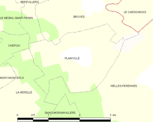
Plainville
- commune in Oise, France
- Country:
- Postal Code: 60120
- Coordinates: 49° 36' 49" N, 2° 27' 10" E
- GPS tracks (wikiloc): [Link]
- Area: 4.25 sq km
- Population: 160


Sérévillers
- commune in Oise, France
- Country:
- Postal Code: 60120
- Coordinates: 49° 38' 20" N, 2° 25' 49" E
- GPS tracks (wikiloc): [Link]
- Area: 3.26 sq km
- Population: 132


Welles-Pérennes
- commune in Oise, France
- Country:
- Postal Code: 60420
- Coordinates: 49° 36' 29" N, 2° 29' 0" E
- GPS tracks (wikiloc): [Link]
- Area: 13.41 sq km
- Population: 260


Fontaine-sous-Montdidier
- commune in Somme, France
- Country:
- Postal Code: 80500
- Coordinates: 49° 39' 25" N, 2° 31' 7" E
- GPS tracks (wikiloc): [Link]
- Area: 9.03 sq km
- Population: 112


Villers-Tournelle
- commune in Somme, France
- Country:
- Postal Code: 80500
- Coordinates: 49° 39' 12" N, 2° 27' 49" E
- GPS tracks (wikiloc): [Link]
- Area: 5.93 sq km
- Population: 158


Le Cardonnois
- commune in Somme, France
- Country:
- Postal Code: 80500
- Coordinates: 49° 37' 39" N, 2° 28' 48" E
- GPS tracks (wikiloc): [Link]
- Area: 2.37 sq km
- Population: 85