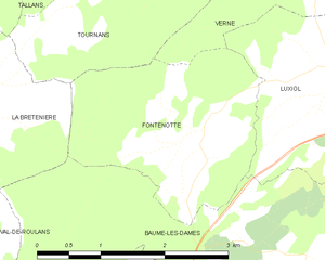
Fontenotte (Fontenotte)
- commune in Doubs, France
Hiking in Fontenotte, a picturesque area often associated with its natural beauty, can offer a delightful experience for outdoor enthusiasts. While specific trail details may vary, here are some general aspects you can expect:
Landscape and Scenery
Fontenotte is typically characterized by its rolling hills, lush forests, and serene landscapes, making it perfect for those looking to connect with nature. Depending on the time of year, you might also encounter vibrant wildflowers in spring or stunning fall foliage.
Hiking Trails
There may be a variety of hiking trails, ranging from easy walks suitable for families to more challenging paths for experienced hikers. Be sure to check local maps or guides for trail lengths, difficulty levels, and highlights along the way.
Flora and Fauna
The area can boast diverse wildlife, so hikers may spot various birds, deer, or smaller mammals. Always remain mindful of your surroundings and respect local wildlife.
Weather Considerations
The weather can change, so it's important to check the forecast before heading out. Dressing in layers and preparing for rain or sudden temperature changes is advisable.
Safety Tips
- Stay on marked trails to protect the natural environment and ensure your safety.
- Carry enough water and snacks to keep your energy up during the hike.
- Wear appropriate footwear to avoid injury and ensure comfort.
- Tell someone your hiking plan before you leave so they know when to expect you back.
Local Regulations
Check for any local regulations or permits that may be required for hiking in Fontenotte. Some areas may have restrictions to preserve the landscape and ecosystem.
Conclusion
Exploring Fontenotte on foot can be a wonderful way to experience the outdoors, enjoy the scenery, and immerse yourself in the tranquility of nature. Just remember to plan ahead and hike responsibly!
- Country:

- Postal Code: 25110
- Coordinates: 47° 22' 35" N, 6° 19' 21" E


- GPS tracks (wikiloc): [Link]
- Area: 5.65 sq km
- Population: 59
- Wikipedia en: wiki(en)
- Wikipedia: wiki(fr)
- Wikidata storage: Wikidata: Q836434
- Wikipedia Commons Category: [Link]
- Freebase ID: [/m/03mh8d8]
- Freebase ID: [/m/03mh8d8]
- GeoNames ID: Alt: [6429788]
- GeoNames ID: Alt: [6429788]
- SIREN number: [212502496]
- SIREN number: [212502496]
- BnF ID: [15252475q]
- BnF ID: [15252475q]
- INSEE municipality code: 25249
- INSEE municipality code: 25249
Shares border with regions:


Verne
- commune in Doubs, France
Verne, located in the Doubs department of the Bourgogne-Franche-Comté region in eastern France, offers a variety of hiking opportunities for outdoor enthusiasts. The area is characterized by its beautiful natural landscapes, with rolling hills, lush forests, and picturesque valleys....
- Country:

- Postal Code: 25110
- Coordinates: 47° 23' 53" N, 6° 21' 14" E


- GPS tracks (wikiloc): [Link]
- Area: 7.82 sq km
- Population: 130
- Web site: [Link]


Tournans
- commune in Doubs, France
Tournans is a beautiful area that offers a variety of hiking opportunities, showcasing its natural beauty and diverse landscapes. The region typically features scenic trails that can accommodate different skill levels, from beginner-friendly paths to more challenging routes for seasoned hikers....
- Country:

- Postal Code: 25680
- Coordinates: 47° 24' 49" N, 6° 19' 39" E


- GPS tracks (wikiloc): [Link]
- Area: 9.14 sq km
- Population: 132

