Forgès (Forgès)

- commune in Corrèze, France
- Country:

- Postal Code: 19380
- Coordinates: 45° 9' 20" N, 1° 52' 12" E


- GPS tracks (wikiloc): [Link]
- Area: 10.43 sq km
- Population: 322
- Wikipedia en: wiki(en)
- Wikipedia: wiki(fr)
- Wikidata storage: Wikidata: Q625454
- Wikipedia Commons Category: [Link]
- Freebase ID: [/m/03mfz9_]
- GeoNames ID: Alt: [6454986]
- SIREN number: [211908405]
- BnF ID: [15249720r]
- INSEE municipality code: 19084
Shares border with regions:


Lagarde-Enval
- commune in Corrèze, France
- Country:
- Postal Code: 19150
- Coordinates: 45° 11' 13" N, 1° 48' 27" E
- GPS tracks (wikiloc): [Link]
- Area: 21.55 sq km
- Population: 814
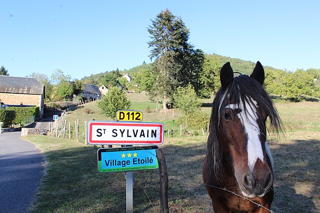

Saint-Sylvain
- commune in Corrèze, France
- Country:
- Postal Code: 19380
- Coordinates: 45° 10' 31" N, 1° 52' 32" E
- GPS tracks (wikiloc): [Link]
- Area: 7.49 sq km
- Population: 140


Albussac
- commune in Corrèze, France
- Country:
- Postal Code: 19380
- Coordinates: 45° 8' 17" N, 1° 50' 8" E
- GPS tracks (wikiloc): [Link]
- Area: 36.26 sq km
- Population: 713
- Web site: [Link]


Saint-Chamant
- commune in Corrèze, France
- Country:
- Postal Code: 19380
- Coordinates: 45° 7' 34" N, 1° 53' 44" E
- GPS tracks (wikiloc): [Link]
- Area: 14.05 sq km
- Population: 496

Saint-Bonnet-Elvert
- commune in Corrèze, France
- Country:
- Postal Code: 19380
- Coordinates: 45° 9' 43" N, 1° 54' 13" E
- GPS tracks (wikiloc): [Link]
- Area: 18.37 sq km
- Population: 207


Marc-la-Tour
- commune in Corrèze, France
- Country:
- Postal Code: 19150
- Coordinates: 45° 12' 18" N, 1° 50' 41" E
- GPS tracks (wikiloc): [Link]
- Area: 6.59 sq km
- Population: 160