Fouquereuil (Fouquereuil)

- commune in Pas-de-Calais, France
- Country:

- Postal Code: 62232
- Coordinates: 50° 31' 8" N, 2° 36' 4" E


- GPS tracks (wikiloc): [Link]
- Area: 2.01 sq km
- Population: 1522
- Web site: http://www.fouquereuil.fr
- Wikipedia en: wiki(en)
- Wikipedia: wiki(fr)
- Wikidata storage: Wikidata: Q852269
- Wikipedia Commons Category: [Link]
- Freebase ID: [/m/02vmp63]
- GeoNames ID: Alt: [6439542]
- SIREN number: [216203497]
- BnF ID: [15268791f]
- INSEE municipality code: 62349
Shares border with regions:

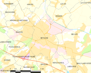
Béthune
- commune in Pas-de-Calais, France
- Country:
- Postal Code: 62400
- Coordinates: 50° 31' 47" N, 2° 38' 24" E
- GPS tracks (wikiloc): [Link]
- Area: 9.46 sq km
- Population: 24995
- Web site: [Link]
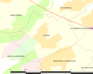
Gosnay
- commune in Pas-de-Calais, France
- Country:
- Postal Code: 62199
- Coordinates: 50° 30' 27" N, 2° 35' 12" E
- GPS tracks (wikiloc): [Link]
- Area: 2.21 sq km
- Population: 942


Annezin
- commune in Pas-de-Calais, France
- Country:
- Postal Code: 62232
- Coordinates: 50° 32' 1" N, 2° 37' 6" E
- GPS tracks (wikiloc): [Link]
- Area: 6.1 sq km
- Population: 5887


Fouquières-lès-Béthune
- commune in Pas-de-Calais, France
- Country:
- Postal Code: 62232
- Coordinates: 50° 30' 54" N, 2° 36' 39" E
- GPS tracks (wikiloc): [Link]
- Area: 2.42 sq km
- Population: 1068
- Web site: [Link]


Labeuvrière
- commune in Pas-de-Calais, France
- Country:
- Postal Code: 62122
- Coordinates: 50° 31' 12" N, 2° 33' 47" E
- GPS tracks (wikiloc): [Link]
- Area: 6.11 sq km
- Population: 1684
- Web site: [Link]