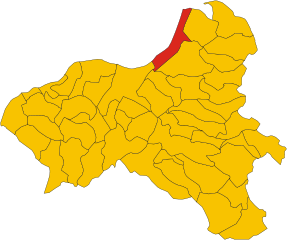
Francavilla Angitola (Francavilla Angitola)
.svg)
- Italian comune
 Hiking in Francavilla Angitola
Francavilla Angitola is a charming village located in the Calabria region of southern Italy, surrounded by beautiful natural landscapes that are perfect for hiking. The area is characterized by rolling hills, mountainous terrain, and proximity to the Tyrrhenian Sea, making it an attractive destination for outdoor enthusiasts.
Hiking Trails
While there may not be an extensive network of official hiking trails specifically marked in Francavilla Angitola, the surrounding area offers plenty of opportunities for exploration:
-
Natural Landscapes: The hills and mountains around the village provide scenic views and opportunities for off-trail hiking. You can enjoy the Mediterranean flora and fauna, which includes various plant species unique to this region.
-
Aspromonte National Park: Located not too far from Francavilla Angitola, this national park offers numerous well-marked trails that range in difficulty. You can experience diverse ecosystems, waterfalls, and panoramic vistas.
-
Coastal Paths: The nearby coastline provides additional hiking options along the shorelines. You might find trails that lead to secluded beaches or offer views of the Tyrrhenian Sea.
Tips for Hiking in Francavilla Angitola
- Maps and Guides: It's advisable to have a detailed map or a local guide to help navigate the more rural paths, as they may not be well-marked.
- Weather Considerations: Be mindful of the weather conditions, especially in the summer when temperatures can soar. Early morning hikes are recommended for cooler temperatures.
- Water and Supplies: Always carry enough water, snacks, and possibly a first-aid kit, as facilities can be sparse on remote trails.
- Cultural Sites: Don't miss the opportunity to explore local cultural sites, churches, and the historic architecture within the village itself, which can often be part of your hiking journey.
Conclusion
Hiking in and around Francavilla Angitola can be a rewarding experience, offering a blend of natural beauty and cultural exploration. Be sure to prepare adequately and take the time to enjoy the stunning landscapes that Calabria has to offer!
- Country:

- Postal Code: 89815
- Local Dialing Code: 0968
- Licence Plate Code: VV
- Coordinates: 38° 47' 0" N, 16° 16' 0" E


- GPS tracks (wikiloc): [Link]
- AboveSeaLevel: 290 м m
- Area: 28.63 sq km
- Population: 1906
- Web site: http://www.comune.francavillaangitola.vv.it
- Wikipedia en: wiki(en)
- Wikipedia: wiki(it)
- Wikidata storage: Wikidata: Q54710
- Wikipedia Commons Category: [Link]
- Freebase ID: [/m/0gr72m]
- GeoNames ID: Alt: [6541788]
- VIAF ID: Alt: [244146755]
- OSM relation ID: [39717]
- GND ID: Alt: [4211674-0]
- Library of Congress authority ID: Alt: [no2016054072]
- UN/LOCODE: [ITZWV]
- Digital Atlas of the Roman Empire ID: [36302]
- ISTAT ID: 102014
- Italian cadastre code: D762
Shares border with regions:
Curinga
- Italian comune
Hiking in Curinga
Curinga, located in the Calabria region of southern Italy, offers some beautiful hiking opportunities, particularly for those looking to explore lush landscapes and enjoy stunning coastal views. While Curinga itself may not be as widely known for extensive hiking trails as other areas in Calabria, there are several noteworthy aspects to consider:...
- Country:
- Postal Code: 88022
- Local Dialing Code: 0968
- Licence Plate Code: CZ
- Coordinates: 38° 49' 36" N, 16° 18' 50" E
- GPS tracks (wikiloc): [Link]
- AboveSeaLevel: 350 м m
- Area: 52.53 sq km
- Population: 6719
- Web site: [Link]


Filadelfia, Calabria
- Italian comune
Hiking in Filadelfia, Calabria
Filadelfia, a charming town in Calabria, Italy, offers some delightful hiking opportunities. Nestled in a hilly region near the Tyrrhenian Sea, it provides a scenic backdrop for outdoor enthusiasts. Here are some highlights for hiking in and around Filadelfia:...
- Country:
- Postal Code: 89814
- Local Dialing Code: 0968
- Licence Plate Code: VV
- Coordinates: 38° 47' 2" N, 16° 17' 28" E
- GPS tracks (wikiloc): [Link]
- AboveSeaLevel: 570 м m
- Area: 31.5 sq km
- Population: 5247
- Web site: [Link]


Maierato
- Italian comune
Hiking in Maierato
Maierato is a small town located in the Calabria region of southern Italy, known for its beautiful landscapes and proximity to the Tyrrhenian Sea. Hiking in and around Maierato can offer a serene experience, with trails that showcase the region's natural beauty, including rolling hills, lush greenery, and panoramic views....
- Country:
- Postal Code: 89843
- Local Dialing Code: 0963
- Licence Plate Code: VV
- Coordinates: 38° 42' 0" N, 16° 12' 0" E
- GPS tracks (wikiloc): [Link]
- AboveSeaLevel: 258 м m
- Area: 39.93 sq km
- Population: 2175
- Web site: [Link]

Pizzo
- Italian comune
Hiking in Pizzo
Pizzo, located in the Calabria region of southern Italy, offers some beautiful hiking opportunities combined with stunning coastal views, historical sites, and natural landscapes. Here are some highlights and tips for hiking in and around Pizzo:...
- Country:
- Postal Code: 89812
- Local Dialing Code: 0963
- Licence Plate Code: VV
- Coordinates: 38° 44' 0" N, 16° 10' 0" E
- GPS tracks (wikiloc): [Link]
- AboveSeaLevel: 44 м m
- Area: 22.89 sq km
- Population: 9329
- Web site: [Link]
Polia
- Italian comune
Hiking in Polia
Polia is a lesser-known yet beautiful region that offers some excellent hiking opportunities, characterized by diverse landscapes, rich flora and fauna, and stunning views. Here are a few highlights about hiking in Polia:...
- Country:
- Postal Code: 89813
- Local Dialing Code: 0963
- Licence Plate Code: VV
- Coordinates: 38° 45' 0" N, 16° 19' 0" E
- GPS tracks (wikiloc): [Link]
- AboveSeaLevel: 400 м m
- Area: 31.51 sq km
- Population: 974
- Web site: [Link]