Fresneville (Fresneville)

- commune in Somme, France
- Country:

- Postal Code: 80140
- Coordinates: 49° 53' 23" N, 1° 49' 35" E


- GPS tracks (wikiloc): [Link]
- Area: 3.4 sq km
- Population: 104
- Wikipedia en: wiki(en)
- Wikipedia: wiki(fr)
- Wikidata storage: Wikidata: Q143965
- Wikipedia Commons Category: [Link]
- Freebase ID: [/m/03nsrxy]
- GeoNames ID: Alt: [6444467]
- SIREN number: [218003416]
- BnF ID: [15276835z]
- INSEE municipality code: 80355
Shares border with regions:


Saint-Maulvis
- commune in Somme, France
- Country:
- Postal Code: 80140
- Coordinates: 49° 54' 18" N, 1° 50' 7" E
- GPS tracks (wikiloc): [Link]
- Area: 6.21 sq km
- Population: 264


Arguel
- commune in Somme, France
- Country:
- Postal Code: 80140
- Coordinates: 49° 52' 0" N, 1° 48' 6" E
- GPS tracks (wikiloc): [Link]
- Area: 2.54 sq km
- Population: 29


Avesnes-Chaussoy
- commune in Somme, France
- Country:
- Postal Code: 80140
- Coordinates: 49° 54' 6" N, 1° 52' 25" E
- GPS tracks (wikiloc): [Link]
- Area: 6.12 sq km
- Population: 65

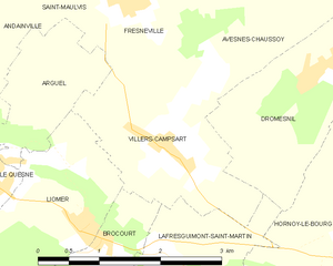
Villers-Campsart
- commune in Somme, France
- Country:
- Postal Code: 80140
- Coordinates: 49° 52' 5" N, 1° 50' 7" E
- GPS tracks (wikiloc): [Link]
- Area: 4.45 sq km
- Population: 153