arrondissement of Abbeville (arrondissement d'Abbeville)

- arrondissement of France
- Country:

- Capital: Abbeville
- Coordinates: 50° 10' 0" N, 1° 45' 0" E


- GPS tracks (wikiloc): [Link]
- Area: 1589 sq km
- Population: 126394
- Wikipedia en: wiki(en)
- Wikipedia: wiki(fr)
- Wikidata storage: Wikidata: Q700354
- Freebase ID: [/m/0954ps]
- GeoNames ID: Alt: [3038788]
- OSM relation ID: [2859189]
- INSEE arrondissement code: [801]
- GNS Unique Feature ID: -1406505
Includes regions:


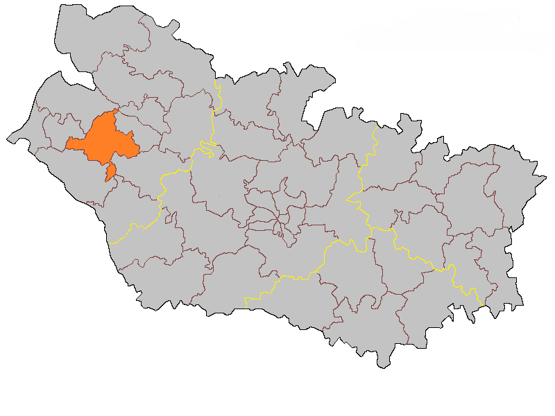
canton of Crécy-en-Ponthieu
- canton of France
- Country:
- Capital: Crécy-en-Ponthieu
- Coordinates: 50° 15' 11" N, 1° 53' 2" E
- GPS tracks (wikiloc): [Link]

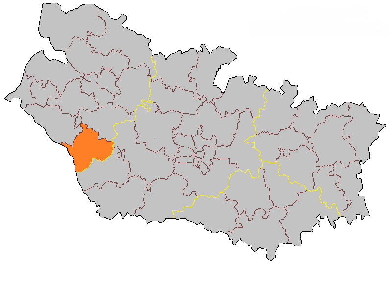
canton of Friville-Escarbotin
- canton of France
- Country:
- Capital: Friville-Escarbotin
- Coordinates: 50° 5' 29" N, 1° 33' 2" E
- GPS tracks (wikiloc): [Link]
- Population: 27364


canton of Hallencourt
- canton of France
- Country:
- Capital: Hallencourt
- Coordinates: 49° 59' 32" N, 1° 52' 40" E
- GPS tracks (wikiloc): [Link]

canton of Moyenneville
- canton of France
- Country:
- Capital: Moyenneville
- Coordinates: 50° 4' 22" N, 1° 45' 2" E
- GPS tracks (wikiloc): [Link]


canton of Rue
- canton of France
- Country:
- Capital: Rue
- Coordinates: 50° 16' 23" N, 1° 40' 7" E
- GPS tracks (wikiloc): [Link]
- Population: 24982

canton of Saint-Valery-sur-Somme
- canton of France
- Country:
- Capital: Saint-Valery-sur-Somme
- Coordinates: 50° 11' 20" N, 1° 37' 50" E
- GPS tracks (wikiloc): [Link]


canton of Gamaches
- canton of France
- Country:
- Capital: Gamaches
- Coordinates: 49° 59' 15" N, 1° 33' 29" E
- GPS tracks (wikiloc): [Link]
- Population: 23906


canton of Ailly-le-Haut-Clocher
- canton of France (until March 2015)
- Country:
- Capital: Ailly-le-Haut-Clocher
- Coordinates: 50° 4' 43" N, 1° 59' 46" E
- GPS tracks (wikiloc): [Link]