Fromeréville-les-Vallons (Fromeréville-les-Vallons)

- commune in Meuse, France
- Country:

- Postal Code: 55100
- Coordinates: 49° 9' 32" N, 5° 17' 13" E


- GPS tracks (wikiloc): [Link]
- Area: 20.3 sq km
- Population: 212
- Web site: http://www.fromereville-les-vallons.fr
- Wikipedia en: wiki(en)
- Wikipedia: wiki(fr)
- Wikidata storage: Wikidata: Q1385052
- Wikipedia Commons Category: [Link]
- Freebase ID: [/m/03qdq_n]
- GeoNames ID: Alt: [6437014]
- SIREN number: [215502006]
- BnF ID: [15264867w]
- INSEE municipality code: 55200
Shares border with regions:


Béthelainville
- commune in Meuse, France
- Country:
- Postal Code: 55100
- Coordinates: 49° 10' 0" N, 5° 14' 5" E
- GPS tracks (wikiloc): [Link]
- Area: 11.94 sq km
- Population: 178

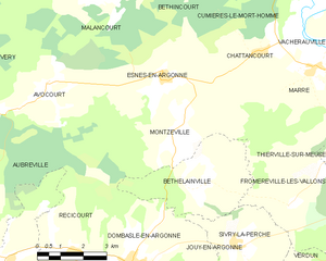
Montzéville
- commune in Meuse, France
- Country:
- Postal Code: 55100
- Coordinates: 49° 11' 29" N, 5° 13' 16" E
- GPS tracks (wikiloc): [Link]
- Area: 17.65 sq km
- Population: 156


Verdun
- commune in Meuse, France
- Country:
- Postal Code: 55100
- Coordinates: 49° 9' 35" N, 5° 22' 58" E
- GPS tracks (wikiloc): [Link]
- AboveSeaLevel: 262 м m
- Area: 31.03 sq km
- Population: 18139
- Web site: [Link]


Thierville-sur-Meuse
- commune in Meuse, France
- Country:
- Postal Code: 55840
- Coordinates: 49° 10' 17" N, 5° 21' 11" E
- GPS tracks (wikiloc): [Link]
- Area: 12.09 sq km
- Population: 3016


Marre
- commune in Meuse, France
- Country:
- Postal Code: 55100
- Coordinates: 49° 12' 40" N, 5° 18' 7" E
- GPS tracks (wikiloc): [Link]
- Area: 10.2 sq km
- Population: 161


Sivry-la-Perche
- commune in Meuse, France
- Country:
- Postal Code: 55100
- Coordinates: 49° 8' 39" N, 5° 15' 1" E
- GPS tracks (wikiloc): [Link]
- AboveSeaLevel: 320 м m
- Area: 12.17 sq km
- Population: 269