Fumane (Fumane)
- Italian comune
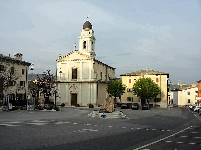
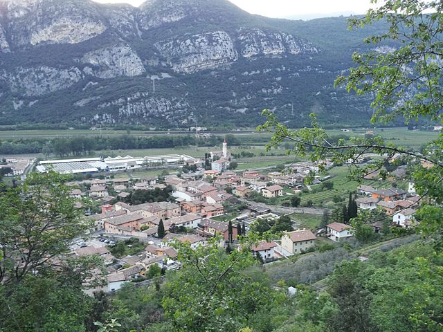
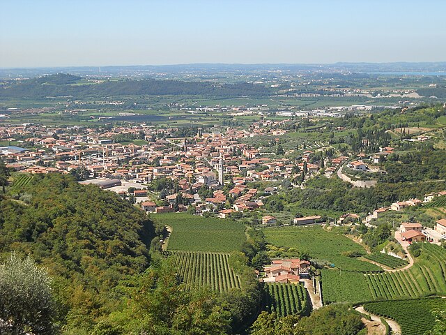
Fumane is a charming area located in the Veneto region of northern Italy, known for its beautiful landscapes, vineyards, and rich archaeological history. It is situated near the Valpolicella region, which is famous for its wine production, and close to the natural wonder of the Lessinia Plateau.
Trails and Hiking Options
-
Panoramic Trails: Fumane offers several hiking trails that provide stunning views of the surrounding hills and valleys. The paths often wind through vineyards and olive groves, giving hikers a taste of the local agriculture.
-
Lessinia Regional Park: This park is nearby and offers extensive hiking opportunities. The park features diverse landscapes, including mountains, pastures, and forests. The trails can vary in difficulty from easy walks to more challenging hikes.
-
Archaeological Sites: The region is home to significant archaeological sites, including prehistoric caves like the Grotta di Fumane. Some trails allow access to these historical areas, making the hike both scenic and educational.
-
Wine Trail: Combining hiking with local culture can be a great experience. Some trails lead through the vineyards of Valpolicella, where hikers can stop for wine tastings and learn about the local winemaking processes.
Tips for Hiking in Fumane
- Prepare for Varying Terrain: The terrain can vary greatly, so wearing proper hiking footwear is essential.
- Check the Weather: The weather can change quickly, especially in mountainous areas, so dress in layers and be prepared for different conditions.
- Stay Hydrated: Always carry enough water, especially during the warmer months.
- Respect Nature: Follow local guidelines to protect the environment, such as staying on marked paths and not disturbing wildlife.
Best Time to Hike
The best times to hike in Fumane are in spring (April to June) and fall (September to October) when temperatures are milder and the scenery is particularly beautiful, with blooming wildflowers or autumn foliage.
By exploring the trails in and around Fumane, hikers can enjoy not only the physical activity but also the natural beauty and cultural richness of this picturesque part of Italy. Always remember to balance your hiking experience with local customs, and enjoy all the region has to offer!
- Country:

- Postal Code: 37022
- Local Dialing Code: 045
- Licence Plate Code: VR
- Coordinates: 45° 32' 35" N, 10° 52' 54" E


- GPS tracks (wikiloc): [Link]
- AboveSeaLevel: 198 м m
- Area: 34.21 sq km
- Population: 4151
- Web site: http://www.comunedifumane.it
- Wikipedia en: wiki(en)
- Wikipedia: wiki(it)
- Wikidata storage: Wikidata: Q47121
- Wikipedia Commons Category: [Link]
- Freebase ID: [/m/0gb284]
- GeoNames ID: Alt: [6540243]
- VIAF ID: Alt: [238124293]
- OSM relation ID: [45261]
- MusicBrainz area ID: [4e05f73b-59c6-407f-bf8d-2cc2e143b378]
- UN/LOCODE: [ITFUM]
- ISTAT ID: 023035
- Italian cadastre code: D818
Shares border with regions:


Sant'Anna d'Alfaedo
- Italian comune
Sant'Anna d'Alfaedo is a beautiful village located in the Province of Verona, in the northern Italian region of Veneto. This area is part of the Lessini Mountains, which are known for their stunning landscapes, diverse wildlife, and numerous hiking trails. Here are some key points about hiking in Sant'Anna d'Alfaedo:...
- Country:

- Postal Code: 37020
- Local Dialing Code: 045
- Licence Plate Code: VR
- Coordinates: 45° 38' 0" N, 10° 57' 0" E


- GPS tracks (wikiloc): [Link]
- AboveSeaLevel: 939 м m
- Area: 43.43 sq km
- Population: 2535
- Web site: [Link]


Dolcè
- Italian comune
Dolcè is a small village located in the province of Verona, Italy, nestled in the beautiful surroundings of the Lessinia Regional Park. This area is characterized by its stunning landscapes, charming rural architecture, and a variety of hiking trails that cater to different skill levels. Here are some key points about hiking in Dolcè:...
- Country:

- Postal Code: 37020
- Local Dialing Code: 045
- Licence Plate Code: VR
- Coordinates: 45° 36' 0" N, 10° 51' 0" E


- GPS tracks (wikiloc): [Link]
- AboveSeaLevel: 115 м m
- Area: 30.95 sq km
- Population: 2575
- Web site: [Link]

Sant'Ambrogio di Valpolicella
- Italian comune
 Hiking in Sant'Ambrogio di Valpolicella
Sant'Ambrogio di Valpolicella is a picturesque commune located in the Veneto region of Italy, known for its stunning landscapes, vineyards, and hiking trails that traverse the hills and valleys of the Valpolicella wine region. Here are some highlights and tips for hiking in this area:...
- Country:

- Postal Code: 37015
- Local Dialing Code: 045
- Licence Plate Code: VR
- Coordinates: 45° 31' 0" N, 10° 50' 0" E


- GPS tracks (wikiloc): [Link]
- AboveSeaLevel: 174 м m
- Area: 23.5 sq km
- Population: 11818
- Web site: [Link]


San Pietro in Cariano
- Italian comune
 Hiking in San Pietro in Cariano
San Pietro in Cariano is a charming town located in the province of Verona, in the Veneto region of Italy. Nestled amidst the picturesque hills of the Valpolicella wine region, it offers various hiking opportunities with stunning views of vineyards, olive groves, and the surrounding countryside....
- Country:

- Postal Code: 37029
- Local Dialing Code: 045
- Licence Plate Code: VR
- Coordinates: 45° 31' 0" N, 10° 53' 0" E


- GPS tracks (wikiloc): [Link]
- AboveSeaLevel: 151 м m
- Area: 20.24 sq km
- Population: 12930
- Web site: [Link]


Marano di Valpolicella
- Italian comune
 Hiking in Marano di Valpolicella
Marano di Valpolicella, located in the Veneto region of Italy, is a picturesque area known for its beautiful landscapes, vineyards, and historic charm. It offers a range of hiking opportunities that appeal to both novice and experienced hikers. Here are some highlights for hiking in this region:...
- Country:

- Postal Code: 37020
- Local Dialing Code: 045
- Licence Plate Code: VR
- Coordinates: 45° 33' 0" N, 10° 55' 0" E


- GPS tracks (wikiloc): [Link]
- AboveSeaLevel: 318 м m
- Area: 18.62 sq km
- Population: 3145
- Web site: [Link]
