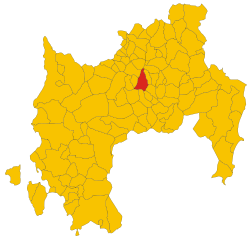
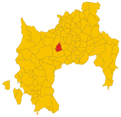
Furtei (Furtei)
%20-%202016.svg)
- Italian comune
 Hiking in Furtei
Furtei is a charming town located in the province of Cagliari in Sardinia, Italy. While Furtei itself is not widely known as a major hiking destination, its location offers access to a variety of trails and natural beauty nearby.
Hiking in the Surrounding Areas:
-
Gutturu Mannu Regional Park: Just a short drive from Furtei, this park features a diverse landscape, including mountains, forests, and unique geological formations. There are several trails of varying difficulty levels, allowing you to explore the rich flora and fauna of the region.
-
Sardinian Coastal Trails: The coastline around Cagliari features stunning cliffs and beautiful beaches. Though not directly in Furtei, the coastal trails are relatively accessible and offer breathtaking views of the Mediterranean Sea.
-
Monte Arquerò: Located nearby, this is a great spot for hiking enthusiasts looking for a more challenging trek. The ascent provides panoramic views of the surrounding valleys and hills.
-
Local Trails: Furtei itself may have some local walking paths that allow you to explore the countryside, vineyards, and traditional Sardinian architecture. It's a good idea to ask local residents or visit a tourism office for maps and recommendations.
Recommendations for Hiking in Furtei:
-
Best Time to Hike: The best times to hike in this region are in the spring and fall when temperatures are milder. Summers can be hot, and it’s essential to stay hydrated and protect yourself from the sun.
-
Safety and Preparation: Always check the weather forecast before heading out. Wear appropriate hiking gear, including sturdy boots, and bring plenty of water and snacks. It's also useful to have a map or GPS device.
-
Local Wildlife: Be aware of the local wildlife and respect the natural environment, ensuring you follow Leave No Trace principles.
-
Cultural Considerations: Engage with local culture; many trails may lead you to historical sites or areas of cultural significance.
If you’re planning a hiking trip around Furtei, consider pairing it with cultural experiences like enjoying local cuisine or visiting historical landmarks in the area. Happy hiking!
- Country:

- Postal Code: 09040
- Local Dialing Code: 070
- Licence Plate Code: SU
- Coordinates: 39° 33' 45" N, 8° 56' 52" E


- GPS tracks (wikiloc): [Link]
- AboveSeaLevel: 90 м m
- Area: 26.11 sq km
- Population: 1633
- Web site: http://www.comune.furtei.ca.it
- Wikipedia en: wiki(en)
- Wikipedia: wiki(it)
- Wikidata storage: Wikidata: Q287490
- Wikipedia Commons Category: [Link]
- Freebase ID: [/m/0gqx9g]
- Freebase ID: [/m/0gqx9g]
- GeoNames ID: Alt: [6537896]
- GeoNames ID: Alt: [6537896]
- OSM relation ID: [39966]
- OSM relation ID: [39966]
- WOEID: [715866]
- WOEID: [715866]
- TGN ID: [1044717]
- TGN ID: [1044717]
- ISTAT ID: 111022
- ISTAT ID: 111022
- Italian cadastre code: D827
- Italian cadastre code: D827
Shares border with regions:


Sanluri
- Italian comune
Hiking in Sanluri
Sanluri is a small town located in the province of South Sardinia, Italy. While not widely known as a prime hiking destination compared to other parts of Sardinia, it offers opportunities to explore the surrounding natural landscapes and the rich history of the region. Here are some highlights for hiking in and around Sanluri:...
- Country:
- Postal Code: 09025
- Local Dialing Code: 070
- Licence Plate Code: SU
- Coordinates: 39° 33' 40" N, 8° 54' 0" E
- GPS tracks (wikiloc): [Link]
- AboveSeaLevel: 633 м m
- Area: 84.23 sq km
- Population: 8464
- Web site: [Link]

Guasila
- Italian comune
Hiking in Guasila
Guasila is a small town located in the province of South Sardinia, Italy. It’s not one of the most famous hiking destinations in Sardinia, but it offers some charming trails and beautiful landscapes, especially for those who enjoy a more tranquil and less crowded environment....
- Country:
- Postal Code: 09040
- Local Dialing Code: 070
- Licence Plate Code: SU
- Coordinates: 39° 33' 37" N, 9° 2' 41" E
- GPS tracks (wikiloc): [Link]
- AboveSeaLevel: 210 м m
- Area: 43.51 sq km
- Population: 2681
- Web site: [Link]

Samassi
- Italian comune
Hiking in Samassi
Samassi is a small town located in the province of Southern Sardinia, Italy. While it may not be widely recognized as a hiking destination, the surrounding areas in Sardinia offer stunning landscapes and a variety of trails for hikers of all levels....
- Country:
- Postal Code: 09030
- Local Dialing Code: 070
- Licence Plate Code: SU
- Coordinates: 39° 28' 53" N, 8° 54' 19" E
- GPS tracks (wikiloc): [Link]
- AboveSeaLevel: 56 м m
- Area: 42.04 sq km
- Population: 5110
- Web site: [Link]
Segariu
- Italian comune
Hiking in Segariu
Segariu is a small commune located in the province of South Sardinia, Italy. While it may not be as well-known as some of the larger tourist destinations in Sardinia, it offers beautiful landscapes and a peaceful hiking experience. The region is characterized by its rolling hills, Mediterranean vegetation, and traditional Sardinian architecture....
- Country:
- Postal Code: 09040
- Local Dialing Code: 070
- Licence Plate Code: SU
- Coordinates: 39° 33' 47" N, 8° 58' 58" E
- GPS tracks (wikiloc): [Link]
- AboveSeaLevel: 129 м m
- Area: 16.69 sq km
- Population: 1177
- Web site: [Link]


Serrenti
- Italian comune
Hiking in Serrenti
Serrenti is a charming town located in the province of Medio Campidano in Sardinia, Italy. While it may not be the most well-known hiking destination, it offers access to beautiful landscapes and trails in the surrounding areas....
- Country:
- Postal Code: 09027
- Local Dialing Code: 070
- Licence Plate Code: SU
- Coordinates: 39° 29' 33" N, 8° 58' 35" E
- GPS tracks (wikiloc): [Link]
- AboveSeaLevel: 114 м m
- Area: 42.78 sq km
- Population: 4808
- Web site: [Link]
Villamar
- Italian comune
Hiking in Villamar
Villamar, located in the province of Cagliari on the island of Sardinia, Italy, offers stunning landscapes and opportunities for hiking enthusiasts. Here are some highlights and tips for hiking in and around Villamar:...
- Country:
- Postal Code: 09020
- Local Dialing Code: 070
- Licence Plate Code: SU
- Coordinates: 39° 37' 12" N, 8° 57' 36" E
- GPS tracks (wikiloc): [Link]
- AboveSeaLevel: 108 м m
- Area: 38.53 sq km
- Population: 2660
- Web site: [Link]