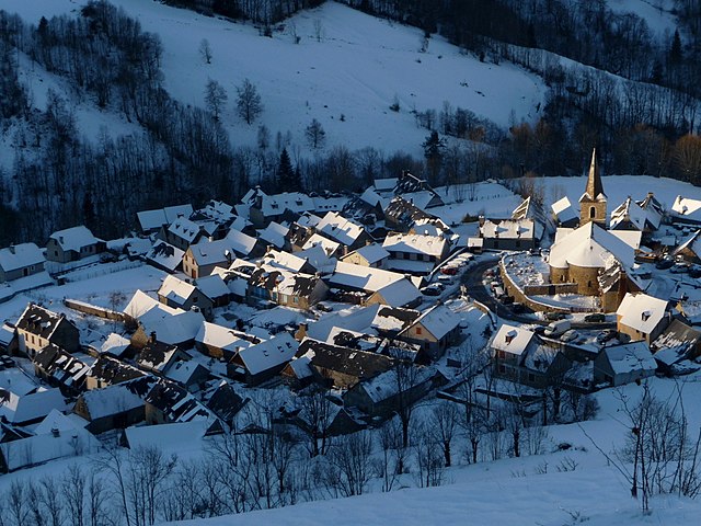
Génos (Génos)

- commune in Hautes-Pyrénées, France
- Country:

- Postal Code: 65240
- Coordinates: 42° 48' 35" N, 0° 24' 7" E


- GPS tracks (wikiloc): [Link]
- AboveSeaLevel: 950 м m
- Area: 23.63 sq km
- Population: 151
- Wikipedia en: wiki(en)
- Wikipedia: wiki(fr)
- Wikidata storage: Wikidata: Q1092829
- Wikipedia Commons Category: [Link]
- Freebase ID: [/m/03w9m7w]
- Freebase ID: [/m/03w9m7w]
- GeoNames ID: Alt: [6617372]
- GeoNames ID: Alt: [6617372]
- SIREN number: [216501957]
- SIREN number: [216501957]
- INSEE municipality code: 65195
- INSEE municipality code: 65195
Shares border with regions:

Azet
- commune in Hautes-Pyrénées, France
- Country:
- Postal Code: 65170
- Coordinates: 42° 48' 38" N, 0° 21' 6" E
- GPS tracks (wikiloc): [Link]
- Area: 26.63 sq km
- Population: 159


Adervielle-Pouchergues
- commune in Hautes-Pyrénées, France
- Country:
- Postal Code: 65240
- Coordinates: 42° 49' 8" N, 0° 24' 14" E
- GPS tracks (wikiloc): [Link]
- AboveSeaLevel: 948 м m
- Area: 9.14 sq km
- Population: 125

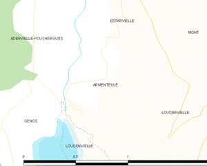
Armenteule
- former commune in Hautes-Pyrénées, France
- Country:
- Postal Code: 65510
- Coordinates: 42° 48' 54" N, 0° 24' 49" E
- GPS tracks (wikiloc): [Link]
- Area: 0.71 sq km
- Population: 60

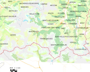
Saint-Lary-Soulan
- commune in Hautes-Pyrénées, France
- Country:
- Postal Code: 65170
- Coordinates: 42° 48' 57" N, 0° 19' 22" E
- GPS tracks (wikiloc): [Link]
- Area: 90.97 sq km
- Population: 854


Loudenvielle
- commune in Hautes-Pyrénées, France
- Country:
- Postal Code: 65510
- Coordinates: 42° 47' 46" N, 0° 24' 40" E
- GPS tracks (wikiloc): [Link]
- Area: 42.65 sq km
- Population: 226