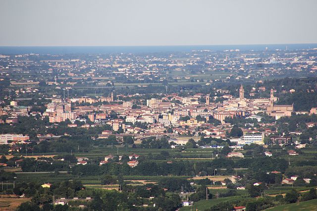
Gambettola (Gambettola)
.svg)
- Italian comune
 Hiking in Gambettola
Gambettola is a small town located in the Emilia-Romagna region of Italy. While it might not be a well-known hiking destination, there are plenty of opportunities for enjoying the outdoors in the surrounding area.
Hiking Opportunities Near Gambettola
-
Local Trails: The countryside around Gambettola features several rural trails that can be explored on foot. These trails often wind through vineyards, olive groves, and picturesque farmland, offering a taste of the local culture and breathtaking views of the Emilian landscape.
-
Cesena: Located not far from Gambettola, Cesena boasts several trails that can be accessed from the town. The hills surrounding Cesena can provide more challenging hikes with rewarding views.
-
Parco Nazionale delle Foreste Casentinesi: A bit further out but worth the drive, this national park offers numerous hiking trails ranging from easy walks to more strenuous hikes. The park is characterized by dense forests, wildlife, and stunning landscapes.
-
Adriatic Coast: While not hiking in the traditional sense, the coastline near Gambettola offers beautiful walking paths along the beach, ideal for those looking to enjoy the sea and sun.
Tips for Hiking in Gambettola
- Gear: Ensure you wear comfortable walking shoes and dress in layers, as weather can change quickly.
- Local Guides: Consider hiring a local guide or joining a hiking group to better explore the area and learn about its history and ecology.
- Hydration and Snacks: Bring enough water and snacks, especially on longer hikes.
- Respect Nature: Follow Leave No Trace principles to preserve the environment and keep trails clean.
Conclusion
While Gambettola itself may not be widely recognized for hiking, its surrounding areas offer a variety of outdoor activities that can satisfy both casual walkers and more serious hikers. Be sure to plan your route, respect local guidelines, and enjoy the beautiful Italian countryside!
- Country:

- Postal Code: 47035
- Local Dialing Code: 0547
- Licence Plate Code: FC
- Coordinates: 44° 7' 0" N, 12° 20' 0" E


- GPS tracks (wikiloc): [Link]
- AboveSeaLevel: 31 м m
- Area: 7.77 sq km
- Population: 10704
- Web site: http://www.comune.gambettola.fc.it
- Wikipedia en: wiki(en)
- Wikipedia: wiki(it)
- Wikidata storage: Wikidata: Q99942
- Wikipedia Commons Category: [Link]
- Freebase ID: [/m/0gklzy]
- GeoNames ID: Alt: [6538489]
- VIAF ID: Alt: [157190920]
- OSM relation ID: [42873]
- WOEID: [715993]
- Quora topic ID: [Gambettola]
- UN/LOCODE: [ITGBT]
- ISTAT ID: 040015
- Italian cadastre code: D899
Shares border with regions:

Cesena
- Italian comune
Hiking in Cesena
Cesena is a beautiful town located in the Emilia-Romagna region of northern Italy. While it may not be as famous for hiking as some of the more mountainous regions in the country, there are still some delightful trails and natural areas that make for enjoyable hikes....
- Country:
- Postal Code: 47023; 47522; 47521
- Local Dialing Code: 0547
- Licence Plate Code: FC
- Coordinates: 44° 8' 0" N, 12° 14' 0" E
- GPS tracks (wikiloc): [Link]
- AboveSeaLevel: 44 м m
- Area: 249.47 sq km
- Population: 96583
- Web site: [Link]


Cesenatico
- Italian comune
Hiking in Cesenatico
Cesenatico, located on the Adriatic coast of Italy in the Emilia-Romagna region, is better known for its beautiful beaches and charming canals rather than for hiking. However, it serves as a great base for exploring the surrounding natural areas and coastal trails in the region....
- Country:
- Postal Code: 47042
- Local Dialing Code: 0547
- Licence Plate Code: FC
- Coordinates: 44° 12' 4" N, 12° 24' 2" E
- GPS tracks (wikiloc): [Link]
- AboveSeaLevel: 3 м m
- Area: 45 sq km
- Population: 25959
- Web site: [Link]


Gatteo
- Italian comune
Hiking in Gatteo
Gatteo is a charming town located in the Emilia-Romagna region of Italy, near the Adriatic coast. While it may not be widely recognized as a major hiking destination, it does offer access to various hiking opportunities in the surrounding areas, particularly in the beautiful landscapes of the nearby Apennine Mountains and coastal regions....
- Country:
- Postal Code: 47043
- Local Dialing Code: 0547; 0541
- Licence Plate Code: FC
- Coordinates: 44° 6' 0" N, 12° 23' 0" E
- GPS tracks (wikiloc): [Link]
- AboveSeaLevel: 20 м m
- Area: 14.14 sq km
- Population: 8988
- Web site: [Link]


Longiano
- Italian comune
Hiking in Longiano
Longiano, a charming town in the Emilia-Romagna region of Italy, offers beautiful hiking opportunities thanks to its picturesque landscapes and proximity to both the Adriatic coast and the Apennine mountains. Here are some highlights and tips for hiking in and around Longiano:...
- Country:
- Postal Code: 47020
- Local Dialing Code: 0547
- Licence Plate Code: FC
- Coordinates: 44° 5' 0" N, 12° 20' 0" E
- GPS tracks (wikiloc): [Link]
- AboveSeaLevel: 169 м m
- Area: 23.58 sq km
- Population: 7190
- Web site: [Link]