Gardie (Gardie)

- commune in Aude, France
- Country:

- Postal Code: 11250
- Coordinates: 43° 4' 28" N, 2° 17' 57" E


- GPS tracks (wikiloc): [Link]
- Area: 4.65 sq km
- Population: 120
- Wikipedia en: wiki(en)
- Wikipedia: wiki(fr)
- Wikidata storage: Wikidata: Q1087751
- Wikipedia Commons Category: [Link]
- Freebase ID: [/m/03m8z1x]
- GeoNames ID: Alt: [6426689]
- SIREN number: [211101613]
- BnF ID: [15246698p]
- INSEE municipality code: 11161
Shares border with regions:
Villebazy
- commune in Aude, France
- Country:
- Postal Code: 11250
- Coordinates: 43° 3' 52" N, 2° 19' 25" E
- GPS tracks (wikiloc): [Link]
- Area: 12.18 sq km
- Population: 128


Pieusse
- commune in Aude, France
- Country:
- Postal Code: 11300
- Coordinates: 43° 4' 47" N, 2° 13' 57" E
- GPS tracks (wikiloc): [Link]
- Area: 12.92 sq km
- Population: 1015
- Web site: [Link]

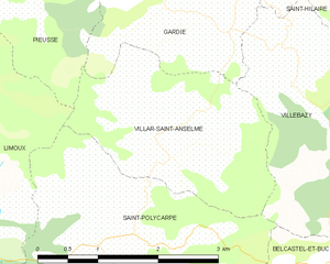
Villar-Saint-Anselme
- commune in Aude, France
- Country:
- Postal Code: 11250
- Coordinates: 43° 3' 14" N, 2° 17' 55" E
- GPS tracks (wikiloc): [Link]
- Area: 5.88 sq km
- Population: 106


Saint-Hilaire
- commune in Aude, France
- Country:
- Postal Code: 11250
- Coordinates: 43° 5' 35" N, 2° 18' 35" E
- GPS tracks (wikiloc): [Link]
- Area: 23.02 sq km
- Population: 772