Gargallo (Gargallo)
- Italian comune
 Hiking in Gargallo
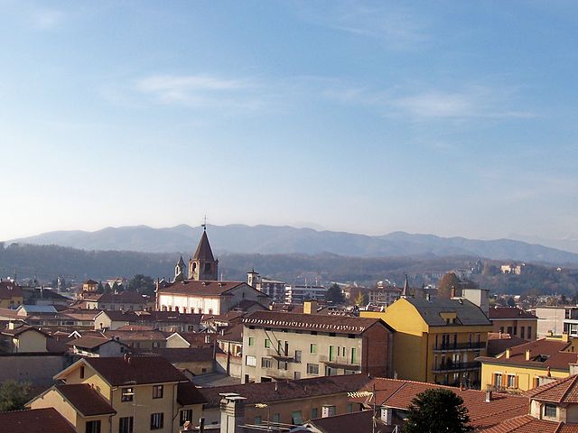
Gargallo is a charming municipality located in the Piedmont region of northern Italy, surrounded by beautiful natural landscapes that make it an attractive destination for hikers. The area features a mix of rolling hills, dense forests, and stunning views of the surrounding mountains, particularly the Alps, which are not too far away.
Hiking Trails
While Gargallo itself may not have numerous well-known trails, it serves as a gateway to explore the wider area of the Piedmont region. Some popular hiking activities nearby include:
-
Sentiero del Fiume Toce: This path runs along the Toce River, providing scenic views and a relaxed hiking experience.
-
Monte Mottarone: Not too far from Gargallo, this mountain offers various hiking trails with panoramic views of Lake Maggiore and the surrounding areas.
-
National Parks: The ValGrande National Park, located a bit further away, offers rugged wilderness and trails for more experienced hikers looking for solitude in nature.
What to Expect
- Difficulty Levels: Trails in and around Gargallo can vary in difficulty, from easy walks suitable for families to challenging hikes requiring good fitness levels and experience.
- Weather: Weather can change quickly in the mountains, so it’s essential to check forecasts and prepare adequately with layers and rain gear.
- Wildlife and Flora: You may encounter diverse wildlife and beautiful alpine flora, especially during the spring and summer months.
Tips for Hiking in Gargallo
- Plan Your Route: Decide on your trail based on your skill level and the amount of time you want to spend hiking.
- Pack Essentials: Bring plenty of water, snacks, a map or GPS, and first-aid supplies.
- Inform Someone: Let someone know your hiking plan and estimated return time for safety.
- Respect Nature: Follow Leave No Trace principles to minimize your impact on the environment.
Additional Activities
Besides hiking, Gargallo and the surrounding area offer various activities such as cycling, wildlife watching, and cultural excursions to nearby towns and historical sites.
Whether you're a seasoned hiker or a newcomer to the great outdoors, Gargallo in Piedmont presents a picturesque landscape that promises a memorable experience in nature.
- Country:

- Postal Code: 28010
- Local Dialing Code: 0322
- Licence Plate Code: NO
- Coordinates: 45° 44' 0" N, 8° 26' 0" E


- GPS tracks (wikiloc): [Link]
- AboveSeaLevel: 396 м m
- Area: 3.75 sq km
- Population: 1832
- Web site: http://www.comune.gargallo.no.it
- Wikipedia en: wiki(en)
- Wikipedia: wiki(it)
- Wikidata storage: Wikidata: Q22450
- Wikipedia Commons Category: [Link]
- Freebase ID: [/m/0g8t37]
- GeoNames ID: Alt: [6543425]
- OSM relation ID: [45879]
- UN/LOCODE: [ITGRL]
- ISTAT ID: 003070
- Italian cadastre code: D921
Shares border with regions:
Borgomanero
- Italian comune
Hiking in Borgomanero
Borgomanero is a charming town located in the Piedmont region of Italy, near Lake Orta and the foothills of the Alps. The area offers a variety of hiking opportunities for outdoor enthusiasts, with trails that showcase stunning landscapes, rich biodiversity, and picturesque views....
- Country:
- Postal Code: 28021
- Local Dialing Code: 0322
- Licence Plate Code: NO
- Coordinates: 45° 42' 0" N, 8° 28' 0" E
- GPS tracks (wikiloc): [Link]
- AboveSeaLevel: 306 м m
- Area: 32.27 sq km
- Population: 21719
- Web site: [Link]

Gozzano, Italy
- Italian comune
Hiking in Gozzano, Italy
Gozzano, located in the Piedmont region of northern Italy, offers a variety of hiking opportunities, mainly due to its proximity to the stunning Lake Orta and the surrounding hilly terrain. Here are some aspects to consider for hiking in and around Gozzano:...
- Country:
- Postal Code: 28024
- Local Dialing Code: 0322
- Licence Plate Code: NO
- Coordinates: 45° 45' 0" N, 8° 26' 0" E
- GPS tracks (wikiloc): [Link]
- AboveSeaLevel: 367 м m
- Area: 12.58 sq km
- Population: 5622
- Web site: [Link]

Maggiora
- Italian comune
Hiking in Maggiora
Maggiora, located in the Piedmont region of Italy, is known for its beautiful landscapes and outdoor activities, including hiking. The area is characterized by rolling hills, lush greenery, and spectacular views of Lake Orta and the surrounding mountains, making it an attractive destination for hikers of all levels....
- Country:
- Postal Code: 28014
- Local Dialing Code: 0322
- Licence Plate Code: NO
- Coordinates: 45° 41' 0" N, 8° 26' 0" E
- GPS tracks (wikiloc): [Link]
- AboveSeaLevel: 397 м m
- Area: 10.66 sq km
- Population: 1684
- Web site: [Link]
Soriso
- Italian comune
Hiking in Soriso
Sorisole, a small town located in the province of Bergamo in northern Italy, is surrounded by stunning natural landscapes, making it a great destination for hiking enthusiasts. Here are some key points to know about hiking in and around Sorisole:...
- Country:
- Postal Code: 28010
- Local Dialing Code: 0322
- Licence Plate Code: NO
- Coordinates: 45° 44' 28" N, 8° 24' 38" E
- GPS tracks (wikiloc): [Link]
- AboveSeaLevel: 452 м m
- Area: 6.37 sq km
- Population: 755
- Web site: [Link]

Valduggia
- Italian comune
Hiking in Valduggia
Valduggia, located in the Valsesia region of northern Italy, offers a beautiful setting for hiking, characterized by stunning natural landscapes, lush forests, and the backdrop of the Alps. Here are some highlights and recommendations for hiking in the Valduggia area:...
- Country:
- Postal Code: 13018
- Local Dialing Code: 0163
- Licence Plate Code: VC
- Coordinates: 45° 44' 0" N, 8° 20' 0" E
- GPS tracks (wikiloc): [Link]
- AboveSeaLevel: 392 м m
- Area: 28.43 sq km
- Population: 1982
- Web site: [Link]