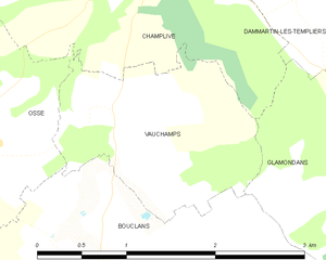
Glamondans (Glamondans)

- commune in Doubs, France
 Hiking in Glamondans
Glamondans is a picturesque commune located in the Doubs department of the Bourgogne-Franche-Comté region in eastern France. While it may not be a widely known hiking destination, its natural beauty and proximity to the Jura Mountains offer some lovely trails and scenic views for outdoor enthusiasts.
Hiking Highlights in Glamondans:
-
Scenic Trails: The area surrounding Glamondans features various hiking trails that provide opportunities for exploring the beautiful forested landscapes, rolling hills, and charming rural scenery.
-
Flore and Fauna: The region is rich in biodiversity, making it an excellent spot for nature lovers. You might encounter various plant species, birds, and wildlife along the trails.
-
Jura Mountains Proximity: Glamondans serves as a great base for accessing the Jura Mountains, where more extensive hiking options are available, including trails that lead to breathtaking lookout points and pristine natural areas.
-
Local Attractions: The commune and surrounding areas may have historical sites, small lakes, and rivers where hikers can take breaks and enjoy picnics or simply the tranquility of nature.
-
Guided Tours: If you're new to the area or hiking in general, consider joining a guided hiking tour, which can provide insights into the local culture, history, and ecology.
Tips for Hiking in Glamondans:
-
Weather Preparedness: Always check the weather before heading out. The Jura region can experience variable weather, so dressing in layers and bringing waterproof gear is advisable.
-
Trail Maps: Make sure to have a trail map or use a reliable hiking app to navigate the paths.
-
Safety: Inform someone of your hiking plans, carry enough water and snacks, and ensure you have a first aid kit. Cell reception may be limited in some areas.
-
Respect Nature: Stick to marked trails, take your litter with you, and respect wildlife.
-
Best Times to Hike: Spring and fall are often ideal for hiking in this region due to milder temperatures and stunning autumn foliage.
Whether you are an experienced hiker or just looking for a leisurely walk in nature, exploring the trails near Glamondans can be a rewarding experience. Enjoy your hiking adventure!
- Country:

- Postal Code: 25360
- Coordinates: 47° 15' 55" N, 6° 16' 40" E


- GPS tracks (wikiloc): [Link]
- Area: 9.76 sq km
- Population: 211
- Wikipedia en: wiki(en)
- Wikipedia: wiki(fr)
- Wikidata storage: Wikidata: Q837493
- Wikipedia Commons Category: [Link]
- Freebase ID: [/m/03mh8pk]
- Freebase ID: [/m/03mh8pk]
- GeoNames ID: Alt: [6429804]
- GeoNames ID: Alt: [6429804]
- SIREN number: [212502736]
- SIREN number: [212502736]
- BnF ID: [15252499q]
- BnF ID: [15252499q]
- INSEE municipality code: 25273
- INSEE municipality code: 25273
Shares border with regions:


Dammartin-les-Templiers
- commune in Doubs, France
Hiking in Dammartin-les-Templiers
Dammartin-les-Templiers is a charming village located in the Haute-Saône department in the Bourgogne-Franche-Comté region of eastern France. This area offers a blend of natural beauty and historical charm, making it an interesting destination for hikers....
- Country:
- Postal Code: 25110
- Coordinates: 47° 17' 27" N, 6° 16' 1" E
- GPS tracks (wikiloc): [Link]
- Area: 9.91 sq km
- Population: 215

Vauchamps
- former commune in Doubs, France
Hiking in Vauchamps
Vauchamps is a beautiful village located in the Doubs department of eastern France, surrounded by picturesque landscapes and forests, making it a great spot for hiking enthusiasts. The area is part of the Jura Mountains, which are known for their varied terrain that includes rolling hills, calm valleys, and magnificent viewpoints....
- Country:
- Postal Code: 25360
- Coordinates: 47° 16' 21" N, 6° 14' 25" E
- GPS tracks (wikiloc): [Link]
- Area: 2.94 sq km
- Population: 128