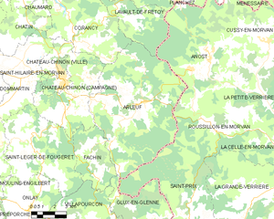
Glux-en-Glenne (Glux-en-Glenne)
- commune in Nièvre, France
- Country:

- Postal Code: 58370
- Coordinates: 46° 57' 23" N, 4° 1' 51" E


- GPS tracks (wikiloc): [Link]
- AboveSeaLevel: 452 м m
- Area: 22.06 sq km
- Population: 97
- Web site: http://www.mairie-glux-en-glenne.fr
- Wikipedia en: wiki(en)
- Wikipedia: wiki(fr)
- Wikidata storage: Wikidata: Q1099914
- Wikipedia Commons Category: [Link]
- Freebase ID: [/m/03qfc_g]
- GeoNames ID: Alt: [6617167]
- SIREN number: [215801283]
- BnF ID: [15266393j]
- VIAF ID: Alt: [156257144]
- archINFORM location ID: [621]
- Library of Congress authority ID: Alt: [no98120741]
- PACTOLS thesaurus ID: [pcrtnYs8axl1Fx]
- INSEE municipality code: 58128
Shares border with regions:
Fâchin
- commune in Nièvre, France
- Country:

- Postal Code: 58430
- Coordinates: 47° 0' 20" N, 3° 58' 4" E


- GPS tracks (wikiloc): [Link]
- Area: 13.88 sq km
- Population: 112


Saint-Prix
- commune in Saône-et-Loire, France
- Country:

- Postal Code: 71990
- Coordinates: 46° 57' 22" N, 4° 4' 19" E


- GPS tracks (wikiloc): [Link]
- Area: 34.14 sq km
- Population: 218


Saint-Léger-sous-Beuvray
- commune in Saône-et-Loire, France
- Country:

- Postal Code: 71990
- Coordinates: 46° 55' 24" N, 4° 6' 4" E


- GPS tracks (wikiloc): [Link]
- Area: 34.97 sq km
- Population: 391
Villapourçon
- commune in Nièvre, France
- Country:

- Postal Code: 58370
- Coordinates: 46° 56' 57" N, 3° 57' 35" E


- GPS tracks (wikiloc): [Link]
- Area: 50.43 sq km
- Population: 427


Arleuf
- commune in Nièvre, France
- Country:

- Postal Code: 58430
- Coordinates: 47° 2' 41" N, 4° 1' 21" E


- GPS tracks (wikiloc): [Link]
- Area: 59.77 sq km
- Population: 757


Larochemillay
- commune in Nièvre, France
- Country:

- Postal Code: 58370
- Coordinates: 46° 52' 38" N, 4° 0' 8" E


- GPS tracks (wikiloc): [Link]
- Area: 41.15 sq km
- Population: 233
