Golbey (Golbey)

- commune in Vosges, France
- Country:

- Postal Code: 88190
- Coordinates: 48° 11' 45" N, 6° 26' 14" E


- GPS tracks (wikiloc): [Link]
- Area: 9.49 sq km
- Population: 8597
- Web site: http://www.golbey.fr
- Wikipedia en: wiki(en)
- Wikipedia: wiki(fr)
- Wikidata storage: Wikidata: Q198543
- Wikipedia Commons Category: [Link]
- Freebase ID: [/m/03qh80d]
- Freebase ID: [/m/03qh80d]
- GeoNames ID: Alt: [6445574]
- GeoNames ID: Alt: [6445574]
- SIREN number: [218802098]
- SIREN number: [218802098]
- BnF ID: [152791363]
- BnF ID: [152791363]
- VIAF ID: Alt: [245137841]
- VIAF ID: Alt: [245137841]
- GND ID: Alt: [4321241-4]
- GND ID: Alt: [4321241-4]
- WOEID: [593084]
- WOEID: [593084]
- Quora topic ID: [Golbey]
- Quora topic ID: [Golbey]
- INSEE municipality code: 88209
- INSEE municipality code: 88209
Shares border with regions:


Épinal
- commune in Vosges, France
- Country:
- Postal Code: 88000
- Coordinates: 48° 10' 25" N, 6° 27' 6" E
- GPS tracks (wikiloc): [Link]
- Area: 59.24 sq km
- Population: 31938
- Web site: [Link]


Les Forges
- commune in Vosges, France
- Country:
- Postal Code: 88390
- Coordinates: 48° 10' 36" N, 6° 23' 33" E
- GPS tracks (wikiloc): [Link]
- Area: 7.14 sq km
- Population: 1912
- Web site: [Link]

Domèvre-sur-Avière
- commune in Vosges, France
- Country:
- Postal Code: 88390
- Coordinates: 48° 12' 49" N, 6° 22' 48" E
- GPS tracks (wikiloc): [Link]
- Area: 9.16 sq km
- Population: 390
- Web site: [Link]


Uxegney
- commune in Vosges, France
- Country:
- Postal Code: 88390
- Coordinates: 48° 11' 39" N, 6° 22' 13" E
- GPS tracks (wikiloc): [Link]
- Area: 8.94 sq km
- Population: 2291
- Web site: [Link]

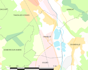
Chavelot
- commune in Vosges, France
- Country:
- Postal Code: 88150
- Coordinates: 48° 14' 14" N, 6° 26' 13" E
- GPS tracks (wikiloc): [Link]
- Area: 6.16 sq km
- Population: 1434
- Web site: [Link]

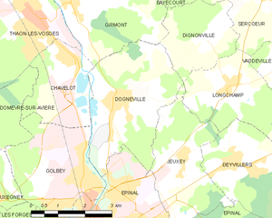
Dogneville
- commune in Vosges, France
- Country:
- Postal Code: 88000
- Coordinates: 48° 13' 24" N, 6° 27' 27" E
- GPS tracks (wikiloc): [Link]
- Area: 11.42 sq km
- Population: 1458


Chantraine
- commune in Vosges, France
- Country:
- Postal Code: 88000
- Coordinates: 48° 10' 11" N, 6° 26' 30" E
- GPS tracks (wikiloc): [Link]
- Area: 6.2 sq km
- Population: 3153
- Web site: [Link]