Gouaux-de-Luchon (Gouaux-de-Luchon)
- commune in Haute-Garonne, France
- Country:

- Postal Code: 31110
- Coordinates: 42° 51' 22" N, 0° 37' 14" E


- GPS tracks (wikiloc): [Link]
- Area: 14.49 sq km
- Population: 47
- Wikipedia en: wiki(en)
- Wikipedia: wiki(fr)
- Wikidata storage: Wikidata: Q1340899
- Wikipedia Commons Category: [Link]
- Freebase ID: [/m/03nszt2]
- Freebase ID: [/m/03nszt2]
- GeoNames ID: Alt: [6431590]
- GeoNames ID: Alt: [6431590]
- SIREN number: [213102221]
- SIREN number: [213102221]
- BnF ID: [152552182]
- BnF ID: [152552182]
- OSM relation ID: [1390307]
- OSM relation ID: [1390307]
- PACTOLS thesaurus ID: [pcrtHNT00m3cHL]
- PACTOLS thesaurus ID: [pcrtHNT00m3cHL]
- INSEE municipality code: 31222
- INSEE municipality code: 31222
Shares border with regions:


Arlos
- commune in Haute-Garonne, France
- Country:

- Postal Code: 31440
- Coordinates: 42° 53' 29" N, 0° 42' 13" E


- GPS tracks (wikiloc): [Link]
- Area: 9.41 sq km
- Population: 99


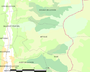
Artigue
- commune in Haute-Garonne, France
- Country:

- Postal Code: 31110
- Coordinates: 42° 49' 55" N, 0° 37' 11" E


- GPS tracks (wikiloc): [Link]
- Area: 9.72 sq km
- Population: 28


Salles-et-Pratviel
- commune in Haute-Garonne, France
- Country:

- Postal Code: 31110
- Coordinates: 42° 49' 47" N, 0° 36' 20" E


- GPS tracks (wikiloc): [Link]
- Area: 2.12 sq km
- Population: 133


Cier-de-Luchon
- commune in Haute-Garonne, France
- Country:

- Postal Code: 31110
- Coordinates: 42° 51' 30" N, 0° 36' 4" E


- GPS tracks (wikiloc): [Link]
- Area: 10.59 sq km
- Population: 250
- Web site: [Link]


Cazaux-Layrisse
- commune in Haute-Garonne, France
- Country:

- Postal Code: 31440
- Coordinates: 42° 52' 6" N, 0° 36' 27" E


- GPS tracks (wikiloc): [Link]
- Area: 2.76 sq km
- Population: 56


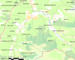
Marignac
- commune in Haute-Garonne, France
- Country:

- Postal Code: 31440
- Coordinates: 42° 54' 51" N, 0° 39' 30" E


- GPS tracks (wikiloc): [Link]
- AboveSeaLevel: 510 м m
- Area: 12.95 sq km
- Population: 477
Baren
- commune in Haute-Garonne, France
- Country:

- Postal Code: 31440
- Coordinates: 42° 52' 8" N, 0° 37' 9" E


- GPS tracks (wikiloc): [Link]
- Area: 3.06 sq km
- Population: 13
