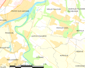
Goyrans (Goyrans)

- commune in Haute-Garonne, France
- Country:

- Postal Code: 31120
- Coordinates: 43° 28' 52" N, 1° 25' 55" E


- GPS tracks (wikiloc): [Link]
- Area: 5.75 sq km
- Population: 850
- Web site: http://www.goyrans.fr
- Wikipedia en: wiki(en)
- Wikipedia: wiki(fr)
- Wikidata storage: Wikidata: Q1431643
- Wikipedia Commons Category: [Link]
- Freebase ID: [/m/03nszw4]
- Freebase ID: [/m/03nszw4]
- GeoNames ID: Alt: [3015427]
- GeoNames ID: Alt: [3015427]
- SIREN number: [213102270]
- SIREN number: [213102270]
- BnF ID: [15255223n]
- BnF ID: [15255223n]
- WOEID: [593344]
- WOEID: [593344]
- INSEE municipality code: 31227
- INSEE municipality code: 31227
Shares border with regions:


Aureville
- commune in Haute-Garonne, France
- Country:
- Postal Code: 31320
- Coordinates: 43° 28' 53" N, 1° 27' 9" E
- GPS tracks (wikiloc): [Link]
- Area: 6.8 sq km
- Population: 851
- Web site: [Link]


Pins-Justaret
- commune in Haute-Garonne, France
- Country:
- Postal Code: 31860
- Coordinates: 43° 28' 47" N, 1° 23' 0" E
- GPS tracks (wikiloc): [Link]
- AboveSeaLevel: 159 м m
- Area: 4.51 sq km
- Population: 4424
- Web site: [Link]


Pinsaguel
- commune in Haute-Garonne, France
- Country:
- Postal Code: 31120
- Coordinates: 43° 30' 30" N, 1° 23' 22" E
- GPS tracks (wikiloc): [Link]
- Area: 5.2 sq km
- Population: 2769
- Web site: [Link]


Labarthe-sur-Lèze
- commune in Haute-Garonne, France
- Country:
- Postal Code: 31860
- Coordinates: 43° 27' 6" N, 1° 24' 0" E
- GPS tracks (wikiloc): [Link]
- Area: 10.43 sq km
- Population: 5602
- Web site: [Link]

Lacroix-Falgarde
- commune in Haute-Garonne, France
- Country:
- Postal Code: 31120
- Coordinates: 43° 29' 57" N, 1° 24' 34" E
- GPS tracks (wikiloc): [Link]
- Area: 6.09 sq km
- Population: 2029
- Web site: [Link]

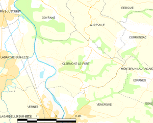
Clermont-le-Fort
- commune in Haute-Garonne, France
- Country:
- Postal Code: 31810
- Coordinates: 43° 27' 29" N, 1° 25' 57" E
- GPS tracks (wikiloc): [Link]
- Area: 10.04 sq km
- Population: 512
- Web site: [Link]