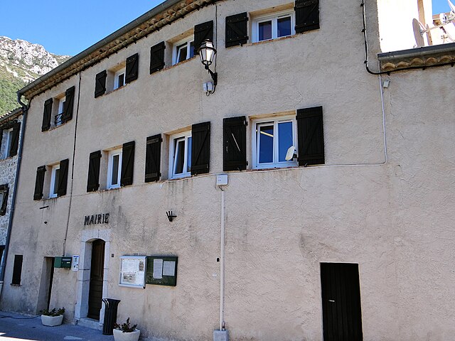
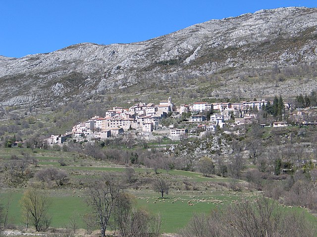
Gréolières (Gréolières)

- commune in Alpes-Maritimes, France
 Hiking in Gréolières
Gréolières is a charming village located in the Alpes-Maritimes region of France, in the foothills of the French Alps, and is known for its stunning landscapes and excellent hiking opportunities. Here are some details that could enhance your hiking experience in the area:
Trails and Routes:
-
Montagne de Gréolières: This mountain offers several hiking trails with varying difficulties. The panoramas from the summit are breathtaking, providing views of the Mediterranean Sea and the surrounding mountain ranges.
-
GR4 Trail: The GR4 long-distance hiking trail passes near Gréolières, giving hikers the chance to explore extended routes through the beautiful Provençal countryside.
-
Le Sentier des Crêtes: This is a scenic ridge trail that provides stunning views while taking you through diverse terrain, perfect for moderate to experienced hikers.
-
Local Nature Trails: There are many shorter trails around the village suitable for families and beginners, allowing you to explore the local flora and fauna.
Best Times to Hike:
- Spring (April to June): Ideal for wildflowers and mild temperatures.
- Autumn (September to November): Beautiful fall colors and comfortable hiking conditions.
- Winter: Gréolières is also a ski resort in the winter, but snow hiking can be an option for those with the right equipment.
Preparation and Tips:
- Gear: Wear sturdy hiking boots and bring weather-appropriate clothing. Even in summer, temperatures can vary at higher elevations.
- Navigation: It’s wise to have a map or a GPS device, as some trails may not be well-marked.
- Water and Snacks: Carry sufficient water and snacks, especially on longer hikes.
- Respect Nature: Stay on marked trails to preserve the local environment.
Local Attractions:
- After hiking, you can enjoy the quaint village atmosphere, local eateries, and possibly some cultural experiences.
- Check out the nearby Gorges du Loup for additional scenic views and activities like canyoning.
Always check local conditions before heading out, as trails can vary with the seasons. Happy hiking!
- Country:

- Postal Code: 06620
- Coordinates: 43° 47' 45" N, 6° 56' 37" E


- GPS tracks (wikiloc): [Link]
- Area: 52.67 sq km
- Population: 606
- Web site: http://www.greolieres.fr
- Wikipedia en: wiki(en)
- Wikipedia: wiki(fr)
- Wikidata storage: Wikidata: Q672657
- Wikipedia Commons Category: [Link]
- Freebase ID: [/m/03m4ytx]
- Freebase ID: [/m/03m4ytx]
- GeoNames ID: Alt: [3014718]
- GeoNames ID: Alt: [3014718]
- SIREN number: [210600706]
- SIREN number: [210600706]
- PACTOLS thesaurus ID: [pcrtxpeUZV0iBd]
- PACTOLS thesaurus ID: [pcrtxpeUZV0iBd]
- INSEE municipality code: 06070
- INSEE municipality code: 06070
Shares border with regions:

Cipières
- commune in Alpes-Maritimes, France
Hiking in Cipières
Cipières is a charming village located in the Alpes-Maritimes department of France, nestled in the beautiful French Riviera region. It offers access to a variety of hiking trails that showcase the stunning natural landscapes of the area, including hills, valleys, and panoramic views of the surrounding mountains and countryside....
- Country:
- Postal Code: 06620
- Coordinates: 43° 47' 0" N, 6° 57' 19" E
- GPS tracks (wikiloc): [Link]
- Area: 38.15 sq km
- Population: 387

La Roque-en-Provence
- commune in Alpes-Maritimes, France
Hiking in La Roque-en-Provence
La Roque-en-Provence is a small village located in the beautiful Vaucluse region of southeastern France, renowned for its stunning landscapes and excellent hiking opportunities. Nestled near the Luberon Mountains and surrounded by picturesque countryside, it offers a perfect backdrop for outdoor enthusiasts....
- Country:
- Postal Code: 06910
- Coordinates: 43° 52' 15" N, 7° 0' 18" E
- GPS tracks (wikiloc): [Link]
- Area: 23.98 sq km
- Population: 77

Le Mas
- commune in Alpes-Maritimes, France
Hiking in Le Mas
Le Mas, located in the beautiful region of Provence in southern France, offers a variety of hiking opportunities that showcase the area's stunning landscapes, charming villages, and rich cultural heritage. Here are some highlights and tips for hiking in Le Mas:...
- Country:
- Postal Code: 06910
- Coordinates: 43° 50' 35" N, 6° 51' 30" E
- GPS tracks (wikiloc): [Link]
- Area: 32.15 sq km
- Population: 158
- Web site: [Link]


Aiglun
- commune in Alpes-Maritimes, France
Hiking in Aiglun
Aiglun, located in the Alpes-Maritimes region of France, offers a unique and picturesque hiking experience. This charming village is perched at a high altitude in the foothills of the French Alps, providing stunning vistas of the surrounding mountains and valleys....
- Country:
- Postal Code: 06910
- Coordinates: 43° 51' 27" N, 6° 54' 52" E
- GPS tracks (wikiloc): [Link]
- Area: 15.37 sq km
- Population: 86
- Web site: [Link]


Courmes
- commune in Alpes-Maritimes, France
Hiking in Courmes
Courmes is a charming village located in the Alpes-Maritimes region of France, in the heart of the stunning French Riviera. It is a fantastic destination for hiking enthusiasts, offering a mix of breathtaking landscapes, diverse trails, and a rich natural environment....
- Country:
- Postal Code: 06620
- Coordinates: 43° 44' 33" N, 7° 0' 32" E
- GPS tracks (wikiloc): [Link]
- Area: 15.71 sq km
- Population: 126

Coursegoules
- commune in Alpes-Maritimes, France
Hiking in Coursegoules
Coursegoules is a charming village located in the Alpes-Maritimes department in southeastern France. It lies in the foothills of the French Alps, offering stunning scenery, diverse landscapes, and a variety of hiking opportunities suitable for different skill levels....
- Country:
- Postal Code: 06140
- Coordinates: 43° 47' 36" N, 7° 2' 38" E
- GPS tracks (wikiloc): [Link]
- Area: 40.98 sq km
- Population: 524
- Web site: [Link]


Andon
- commune in Alpes-Maritimes, France
Hiking in Andon
Andon, located in the Alpes-Maritimes region of France, is a charming village that offers a range of hiking opportunities amidst stunning natural landscapes. Nestled in the foothills of the Alpes, it serves as a gateway to the surrounding mountains and valleys. Here are some highlights and tips for hiking in and around Andon:...
- Country:
- Postal Code: 06750
- Coordinates: 43° 46' 23" N, 6° 47' 11" E
- GPS tracks (wikiloc): [Link]
- Area: 54.3 sq km
- Population: 562
- Web site: [Link]