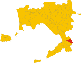
Gragnano (Gragnano)
.svg)
- Italian comune
 Hiking in Gragnano
Gragnano is a charming town located in the Campania region of Italy, known for its stunning landscapes, rich history, and delicious food, particularly its pasta. The surrounding area offers a variety of hiking opportunities, with trails that range from easy walks to more challenging hikes.
Hiking Trails
-
Sentiero degli Dei (Path of the Gods): This famous trail runs from Bomerano (part of Agerola) to Nocelle and offers breathtaking views of the Amalfi Coast. While not directly in Gragnano, it's easily accessible and worth the trip for its stunning panoramas.
-
Monti Lattari: The Lattari Mountains provide various hiking trails that range in difficulty. The trails here offer beautiful views of the coastline and the surrounding countryside. Popular routes include ascents to peaks like Monte Faito.
-
Valley of the Mulini: Near Gragnano, you can explore this picturesque valley full of ancient mills and lush vegetation. The hike features scenic rural landscapes, and you might encounter local wildlife.
-
Sentiero degli Scavi (Excavation Trail): This trail takes you through historical sites and offers insights into the region’s ancient past. It’s a great combination of hiking and cultural exploration.
What to Bring
- Proper Footwear: Good hiking boots or shoes with a solid grip are essential.
- Water: Stay hydrated, especially on warmer days.
- Snacks: Energy-boosting snacks are great for longer hikes.
- Sun Protection: Sunscreen, a hat, and sunglasses are important, especially in summer.
- Map or GPS: While many trails are well-marked, having a map or using a GPS app can help navigate.
Best Time to Hike
The best time to hike in Gragnano is during the spring (April to June) or fall (September to October). The weather is typically mild, and the landscapes are particularly beautiful during these seasons.
Local Tips
- Respect Nature: Stay on marked paths, and take your litter home.
- Check Weather Conditions: The weather can change quickly, so be prepared for different conditions.
- Join Local Groups: If you’re new to hiking or the area, consider joining local hiking groups or guided tours for a more enriching experience.
Hiking in and around Gragnano offers a unique blend of natural beauty and cultural heritage, making it an excellent destination for outdoor enthusiasts!
- Country:

- Postal Code: 80054
- Local Dialing Code: 081
- Licence Plate Code: NA
- Coordinates: 40° 41' 45" N, 14° 30' 56" E


- GPS tracks (wikiloc): [Link]
- AboveSeaLevel: 141 м m
- Area: 14.64 sq km
- Population: 28897
- Web site: http://web.rcm.napoli.it/gragnano
- Wikipedia en: wiki(en)
- Wikipedia: wiki(it)
- Wikidata storage: Wikidata: Q72128
- Wikipedia Commons Category: [Link]
- Freebase ID: [/m/0gn3h5]
- GeoNames ID: Alt: [6540684]
- VIAF ID: Alt: [236996476]
- OSM relation ID: [40678]
- MusicBrainz area ID: [94565ea8-3dcb-4698-a55d-0cf4a86db338]
- UN/LOCODE: [ITGNO]
- ISTAT ID: 063035
- Italian cadastre code: E131
Shares border with regions:


Castellammare di Stabia
- Italian comune
Hiking in Castellammare di Stabia
Castellammare di Stabia, located in the Campania region of Italy, offers a stunning blend of natural beauty and historical significance, making it a fantastic destination for hikers. Situated near the Sorrento Peninsula and overlooking the Bay of Naples, the area provides a variety of hiking trails that cater to different skill levels....
- Country:
- Postal Code: 80053
- Local Dialing Code: 081
- Licence Plate Code: NA
- Coordinates: 40° 42' 0" N, 14° 29' 0" E
- GPS tracks (wikiloc): [Link]
- AboveSeaLevel: 6 м m
- Area: 17.81 sq km
- Population: 66164
- Web site: [Link]


Agerola
- Italian comune
Hiking in Agerola
Agerola, a charming town located in the Campania region of Italy, lies on the scenic Amalfi Coast and is renowned for its stunning landscapes and well-maintained hiking trails. The area offers a fantastic blend of coastal views and mountain scenery, making it a popular destination for hikers. Here are some key points about hiking in Agerola:...
- Country:
- Postal Code: 80051
- Local Dialing Code: 081
- Licence Plate Code: NA
- Coordinates: 40° 38' 0" N, 14° 33' 0" E
- GPS tracks (wikiloc): [Link]
- AboveSeaLevel: 630 м m
- Area: 19.83 sq km
- Population: 7695
- Web site: [Link]
Casola di Napoli
- Italian comune
Hiking in Casola di Napoli
Casola di Napoli is a charming village located in the Campania region of Italy, nestled in the Lattari Mountains, which are part of the larger Sorrento Peninsula mountain range. This area offers stunning landscapes, rich flora and fauna, and a wealth of hiking opportunities, making it an excellent destination for outdoor enthusiasts....
- Country:
- Postal Code: 80050
- Local Dialing Code: 081
- Licence Plate Code: NA
- Coordinates: 40° 41' 40" N, 14° 31' 40" E
- GPS tracks (wikiloc): [Link]
- AboveSeaLevel: 170 м m
- Area: 2.59 sq km
- Population: 3845
- Web site: [Link]

Lettere
- Italian comune
Hiking in Lettere
Lettere is a small town in the Campania region of Italy, located near the Sorrento Peninsula. It offers beautiful landscapes and a range of hiking opportunities, especially for those who appreciate both nature and cultural heritage....
- Country:
- Postal Code: 80050
- Local Dialing Code: 081
- Licence Plate Code: NA
- Coordinates: 40° 42' 0" N, 14° 33' 0" E
- GPS tracks (wikiloc): [Link]
- AboveSeaLevel: 356 м m
- Area: 12.02 sq km
- Population: 6256
- Web site: [Link]


Pimonte
- Italian comune
Hiking in Pimonte
Pimonte, located in the Campania region of Italy, is a charming town that serves as a gateway to the stunning landscapes of the Lattari Mountains and the Amalfi Coast. Hiking in and around Pimonte offers various trails that range from easy walks to more challenging treks, providing options for hikers of all skill levels....
- Country:
- Postal Code: 80050
- Local Dialing Code: 081
- Licence Plate Code: NA
- Coordinates: 40° 40' 25" N, 14° 30' 45" E
- GPS tracks (wikiloc): [Link]
- AboveSeaLevel: 406 м m
- Area: 12.54 sq km
- Population: 6003
- Web site: [Link]
Sant'Antonio Abate
- Italian comune
Hiking in Sant'Antonio Abate
Sant'Antonio Abate is a charming town located in the Campania region of Italy, nestled in the foothills of the Monti Lattari. It's an excellent base for hiking enthusiasts who want to explore the natural beauty of the area, which includes lush landscapes, scenic views, and historical sites....
- Country:
- Postal Code: 80057
- Local Dialing Code: 081
- Licence Plate Code: NA
- Coordinates: 40° 44' 0" N, 14° 33' 0" E
- GPS tracks (wikiloc): [Link]
- AboveSeaLevel: 20 м m
- Area: 7.93 sq km
- Population: 19704
- Web site: [Link]
Santa Maria la Carità
- Italian comune
Hiking in Santa Maria la Carità
Santa Maria la Carità is a charming town located in the Campania region of Italy, nestled close to the foothills of the Monti Lattari. The area is not as well-known for hiking as some of the more famous national parks in Italy, but it does provide access to beautiful landscapes and scenic trails in the nearby region....
- Country:
- Postal Code: 80050
- Local Dialing Code: 081
- Licence Plate Code: NA
- Coordinates: 40° 43' 0" N, 14° 31' 0" E
- GPS tracks (wikiloc): [Link]
- AboveSeaLevel: 26 м m
- Area: 3.98 sq km
- Population: 11706
- Web site: [Link]


Ravello
- Italian comune
Hiking in Ravello
Ravello, located on the Amalfi Coast in Italy, is renowned not just for its stunning views and charming architecture, but also for its beautiful hiking trails. Here are some highlights and tips for hiking in the area:...
- Country:
- Postal Code: 84010
- Local Dialing Code: 089
- Licence Plate Code: SA
- Coordinates: 40° 39' 0" N, 14° 37' 0" E
- GPS tracks (wikiloc): [Link]
- AboveSeaLevel: 365 м m
- Area: 7.94 sq km
- Population: 2487
- Web site: [Link]


Scala, Campania
- Italian comune
Hiking in Scala, Campania
Scala, a charming town located in the Campania region of Italy, is part of the Amalfi Coast and offers stunning hiking opportunities surrounded by breathtaking scenery. Here’s an overview of what you can expect when hiking in the Scala area:...
- Country:
- Postal Code: 84010
- Local Dialing Code: 089
- Licence Plate Code: SA
- Coordinates: 40° 39' 0" N, 14° 36' 0" E
- GPS tracks (wikiloc): [Link]
- AboveSeaLevel: 360 м m
- Area: 13.86 sq km
- Population: 1516
- Web site: [Link]