Gramschatzer Wald (Gramschatzer Wald)

- unincorporated area in Germany
 Hiking in Gramschatzer Wald
Gramschatzer Wald is a beautiful forested area located in the region of Bavaria, Germany. This vast area offers various opportunities for hiking and outdoor activities, making it a great destination for nature enthusiasts. Here’s what you should know about hiking in Gramschatzer Wald:
Trails and Paths
- Well-Marked Trails: The forest has an extensive network of marked trails suitable for different skill levels. Whether you're a beginner or an experienced hiker, you'll find paths that fit your preference.
- Scenic Routes: Many of the trails wind through beautiful woodlands and offer picturesque views of the surrounding countryside. Expect to encounter a variety of flora and fauna along the way.
Accessibility
- Entry Points: There are several entry points to the forest, making it easy to access different areas. Consider starting at one of the designated parking areas.
- Trail Length: Trails can vary in length, from short walks to more extended hikes. Be sure to check the trail maps available online or at local visitor centers.
Nature and Wildlife
- Biodiversity: Gramschatzer Wald is home to a diverse range of wildlife. Keep your eyes peeled for deer, birds, and various small mammals during your hike.
- Flora: The forest features a mix of deciduous and coniferous trees, wildflowers, and other plants, making it a lovely spot for a leisurely stroll or a more vigorous hike.
Tips for Hiking
- Weather Preparedness: Always check the weather before heading out, as conditions can change rapidly. Dress in layers and bring appropriate gear such as sturdy hiking boots.
- Trail Etiquette: Stay on marked paths to protect the ecosystem. If you encounter cyclists or horseback riders, give way as necessary.
- Hydration and Snacks: Carry enough water and snacks to keep your energy up during your hike. There are often no facilities within the forest.
Safety
- Hiking Alone: If hiking alone, inform someone of your intended route and estimated return time.
- Emergency Plan: Familiarize yourself with basic first aid and have a plan for emergencies.
Getting There
- Transportation: Gramschatzer Wald is accessible by car, and public transportation options are available in nearby towns. Check local schedules for the best routes.
Overall, Gramschatzer Wald is a splendid destination for hiking, offering an escape into nature with various trails to explore. Enjoy your time in this serene forest!
- Country:

- Coordinates: 49° 54' 6" N, 9° 56' 46" E


- GPS tracks (wikiloc): [Link]
- Wikidata storage: Wikidata: Q20080744
- Wikipedia Commons Category: [Link]
- OSM relation ID: [182320]
Shares border with regions:
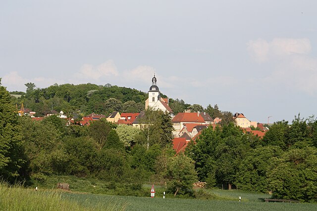
Arnstein
- municipality in Bavaria, Germany
Hiking in Arnstein
Arnstein is a beautiful area for hiking, set amidst picturesque natural landscapes. It is located in Bavaria, Germany, and is characterized by its charming villages, serene countryside, and rolling hills. Here are some highlights and tips for hiking in Arnstein:...
- Country:
- Postal Code: 97450
- Local Dialing Code: 09363
- Licence Plate Code: MSP
- Coordinates: 49° 58' 0" N, 9° 59' 0" E
- GPS tracks (wikiloc): [Link]
- AboveSeaLevel: 228 м m
- Area: 112.12 sq km
- Population: 7640
- Web site: [Link]

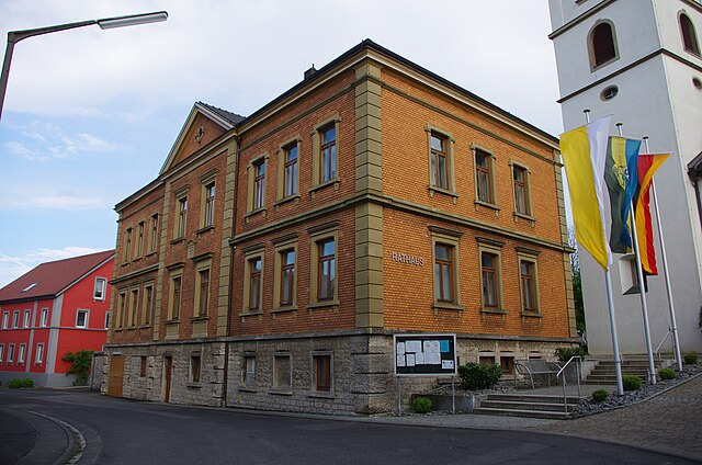
Retzstadt
- municipality of Germany
Hiking in Retzstadt
Retzstadt, a small picturesque village located in Bavaria, Germany, is a charming destination for hiking enthusiasts. It serves as a gateway to the surrounding natural beauty of the region, which is characterized by rolling hills, vineyards, and scenic landscapes....
- Country:
- Postal Code: 97282
- Local Dialing Code: 09364
- Licence Plate Code: MSP
- Coordinates: 49° 55' 0" N, 9° 53' 0" E
- GPS tracks (wikiloc): [Link]
- AboveSeaLevel: 240 м m
- Area: 18.07 sq km
- Population: 1520
- Web site: [Link]


Hausen bei Würzburg
- municipality of Germany
Hiking in Hausen bei Würzburg
Hausen bei Würzburg is a picturesque village located near the city of Würzburg in Bavaria, Germany. The surrounding area offers several hiking opportunities that are suitable for various skill levels, with beautiful landscapes, vineyards, and scenic views over the Main River and the Würzburg area....
- Country:
- Postal Code: 97262
- Local Dialing Code: 09367
- Coordinates: 49° 56' 0" N, 10° 1' 0" E
- GPS tracks (wikiloc): [Link]
- AboveSeaLevel: 272 м m
- Area: 21.97 sq km
- Population: 1954
- Web site: [Link]
Güntersleben
- municipality of Germany
Hiking in Güntersleben
Güntersleben, a quaint village located near Würzburg in Bavaria, Germany, offers several opportunities for hiking enthusiasts. While it may not be as well-known as some larger hiking destinations, the surrounding countryside provides picturesque trails and scenic views....
- Country:
- Postal Code: 97261
- Local Dialing Code: 09365
- Coordinates: 49° 52' 0" N, 9° 54' 0" E
- GPS tracks (wikiloc): [Link]
- AboveSeaLevel: 273 м m
- Area: 16.05 sq km
- Population: 3591
- Web site: [Link]
Unterpleichfeld
- municipality of Germany
Hiking in Unterpleichfeld
Unterpleichfeld is a charming village located in Bavaria, Germany, situated not far from the city of Würzburg. The surrounding region offers a variety of hiking opportunities that cater to different skill levels, making it an inviting destination for both novice and seasoned hikers....
- Country:
- Postal Code: 97294
- Local Dialing Code: 09367
- Coordinates: 49° 52' 8" N, 10° 2' 38" E
- GPS tracks (wikiloc): [Link]
- AboveSeaLevel: 265 м m
- Area: 23.93 sq km
- Population: 2376
- Web site: [Link]


Rimpar
- municipality of Germany
Hiking in Rimpar
Rimpar is a small town in Bavaria, Germany, located near Würzburg. While it may not be a well-known hiking destination compared to larger national parks or mountain ranges, it still offers some pleasant walking and hiking opportunities in the surrounding area. Here are a few key points about hiking in and around Rimpar:...
- Country:
- Postal Code: 97222
- Local Dialing Code: 09365
- Coordinates: 49° 51' 0" N, 9° 57' 0" E
- GPS tracks (wikiloc): [Link]
- AboveSeaLevel: 249 м m
- Area: 36.42 sq km
- Population: 7016
- Web site: [Link]