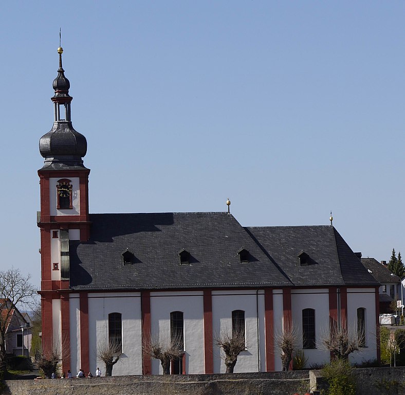
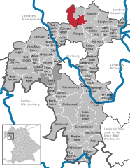
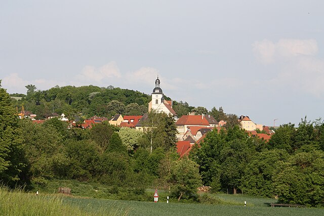
Retzstadt (Retzstadt)

- municipality of Germany
 Hiking in Retzstadt
Retzstadt, a small picturesque village located in Bavaria, Germany, is a charming destination for hiking enthusiasts. It serves as a gateway to the surrounding natural beauty of the region, which is characterized by rolling hills, vineyards, and scenic landscapes.
Hiking Trails
-
Local Trails: Around Retzstadt, there are several well-marked hiking trails that vary in difficulty, catering to both novice hikers and experienced trekkers. Many of these trails will take you through vineyards, offering stunning views of the green countryside and the opportunity to enjoy some local wine.
-
Nature Reserves: The nearby natural areas often feature protected landscapes that include diverse flora and fauna, making them ideal for nature walks and birdwatching.
-
Historical Routes: You might also encounter routes that connect historical sites and villages in the area, giving you a combination of physical activity and cultural enrichment.
Recommended Tips
- Plan Ahead: Research and map out your hiking trail before arriving. Make sure to check the trail conditions and weather forecasts.
- Stay Hydrated: Always carry enough water, especially during warmer months, to stay hydrated.
- Dress Appropriately: Wear comfortable hiking boots and dress in layers to adjust to changing temperatures.
- Local Guidelines: Respect local wildlife and nature preservation guidelines. Stay on the marked trails to protect the surrounding environment.
- Enjoy Local Cuisine: Indulging in local food and wine after a hike can be a delightful way to experience the culture of the region.
Accessibility
Retzstadt is well connected by public transport to nearby cities, making it easy to access starting points for your hikes.
Whether you're exploring alone, with friends, or as part of a guided group, hiking in Retzstadt can provide an enjoyable experience amid Bavaria's scenic beauty. Always ensure you have a good map or GPS device, and enjoy your adventure on the trails!
- Country:

- Postal Code: 97282
- Local Dialing Code: 09364
- Licence Plate Code: MSP
- Coordinates: 49° 55' 0" N, 9° 53' 0" E


- GPS tracks (wikiloc): [Link]
- AboveSeaLevel: 240 м m
- Area: 18.07 sq km
- Population: 1520
- Web site: http://www.retzstadt.de
- Wikipedia en: wiki(en)
- Wikipedia: wiki(de)
- Wikidata storage: Wikidata: Q508945
- Wikipedia Commons Category: [Link]
- Freebase ID: [/m/02q4jk9]
- GeoNames ID: Alt: [6557047]
- VIAF ID: Alt: [131990898]
- OSM relation ID: [335433]
- GND ID: Alt: [4298923-1]
- Bavarikon ID: [ODB_A00000452]
- German municipality key: 09677175
Shares border with regions:
Zellingen
- market municipality in Bavaria, Germany
Hiking in Zellingen
Zellingen, a charming municipality located in Bavaria, Germany, is an ideal location for hiking enthusiasts. It's situated near the Main River, which provides a beautiful backdrop for outdoor activities. Here are some highlights and tips for hiking in and around Zellingen:...
- Country:
- Postal Code: 97225
- Local Dialing Code: 09396; 09364
- Licence Plate Code: MSP
- Coordinates: 49° 54' 0" N, 9° 49' 0" E
- GPS tracks (wikiloc): [Link]
- AboveSeaLevel: 170 м m
- Area: 41.45 sq km
- Population: 5651
- Web site: [Link]

Gramschatzer Wald
- unincorporated area in Germany
Hiking in Gramschatzer Wald
Gramschatzer Wald is a beautiful forested area located in the region of Bavaria, Germany. This vast area offers various opportunities for hiking and outdoor activities, making it a great destination for nature enthusiasts. Here’s what you should know about hiking in Gramschatzer Wald:...
- Country:
- Coordinates: 49° 54' 6" N, 9° 56' 46" E
- GPS tracks (wikiloc): [Link]
Arnstein
- municipality in Bavaria, Germany
Hiking in Arnstein
Arnstein is a beautiful area for hiking, set amidst picturesque natural landscapes. It is located in Bavaria, Germany, and is characterized by its charming villages, serene countryside, and rolling hills. Here are some highlights and tips for hiking in Arnstein:...
- Country:
- Postal Code: 97450
- Local Dialing Code: 09363
- Licence Plate Code: MSP
- Coordinates: 49° 58' 0" N, 9° 59' 0" E
- GPS tracks (wikiloc): [Link]
- AboveSeaLevel: 228 м m
- Area: 112.12 sq km
- Population: 7640
- Web site: [Link]
Güntersleben
- municipality of Germany
Hiking in Güntersleben
Güntersleben, a quaint village located near Würzburg in Bavaria, Germany, offers several opportunities for hiking enthusiasts. While it may not be as well-known as some larger hiking destinations, the surrounding countryside provides picturesque trails and scenic views....
- Country:
- Postal Code: 97261
- Local Dialing Code: 09365
- Coordinates: 49° 52' 0" N, 9° 54' 0" E
- GPS tracks (wikiloc): [Link]
- AboveSeaLevel: 273 м m
- Area: 16.05 sq km
- Population: 3591
- Web site: [Link]

Thüngen
- market municipality in Bavaria, Germany
Hiking in Thüngen
Thüngen is a small village located in Bavaria, Germany, known for its picturesque landscapes and proximity to natural areas suitable for hiking. While specific trails in Thüngen may not be widely publicized, the region surrounding it offers a variety of hiking opportunities that cater to different skill levels....
- Country:
- Postal Code: 97289
- Local Dialing Code: 09360
- Licence Plate Code: MSP
- Coordinates: 49° 56' 32" N, 9° 51' 34" E
- GPS tracks (wikiloc): [Link]
- AboveSeaLevel: 199 м m
- Area: 13.61 sq km
- Population: 1341
- Web site: [Link]


Thüngersheim
- municipality of Germany
Hiking in Thüngersheim
Thüngersheim is a charming village located in the Würzburg district of Bavaria, Germany, known for its picturesque vineyards and beautiful landscapes. Hiking in and around Thüngersheim offers stunning views of the Main Valley and the surrounding countryside, making it a popular destination for nature lovers and outdoor enthusiasts....
- Country:
- Postal Code: 97291
- Local Dialing Code: 09364
- Coordinates: 49° 52' 0" N, 9° 50' 0" E
- GPS tracks (wikiloc): [Link]
- AboveSeaLevel: 169 м m
- Area: 11.06 sq km
- Population: 2453
- Web site: [Link]