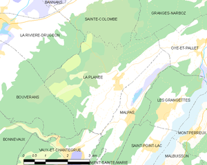
Granges-Narboz (Granges-Narboz)

- commune in Doubs, France
 Hiking in Granges-Narboz
Granges-Narboz, located in the Jura mountains of France, offers various hiking opportunities for nature enthusiasts and outdoor adventurers. This picturesque area is characterized by rolling hills, dense forests, and stunning views of the surrounding landscapes, making it a great spot for hiking.
Key Features:
-
Scenic Trails: The region has numerous well-marked hiking trails that cater to different skill levels, from easy walks to more challenging paths. Whether you’re looking for a leisurely stroll or a vigorous hike, you can find a suitable option.
-
Natural Beauty: The Jura mountains boast beautiful natural scenery, including lush forests, meadows, and rocky outcrops. Hiking in Granges-Narboz provides opportunities to witness local wildlife and varied flora.
-
Historical Sites: Some trails may lead you to historical landmarks and sites of cultural significance, adding an educational component to your hike.
-
Breathtaking Views: Many trails offer panoramic views of the mountains and valleys. The higher you go, the more breathtaking the vistas you can enjoy.
-
Seasonal Hiking: The best times for hiking are typically during spring, summer, and early fall when the weather is mild. However, winter conditions in the Jura can also present opportunities for snowshoeing and winter hiking.
Preparation Tips:
-
Gear Up: Make sure you have proper hiking boots, weather-appropriate clothing, and a good backpack. Don’t forget to pack plenty of water and snacks.
-
Navigation: It’s advisable to have a map or a reliable GPS device, as some trails can be less-traveled and remote.
-
Check the Weather: The weather in the mountains can change quickly, so be prepared for varying conditions.
-
Respect Nature: Follow Leave No Trace principles to ensure the trails remain clean and safe for future hikers.
Before heading out, familiarize yourself with specific trails through local hiking guides or websites that feature Granges-Narboz's hiking routes. Enjoy your adventure!
- Country:

- Postal Code: 25300
- Coordinates: 46° 52' 45" N, 6° 18' 38" E


- GPS tracks (wikiloc): [Link]
- Area: 16.22 sq km
- Population: 1170
- Web site: http://www.grangesnarboz.com
- Wikipedia en: wiki(en)
- Wikipedia: wiki(fr)
- Wikidata storage: Wikidata: Q909977
- Wikipedia Commons Category: [Link]
- Freebase ID: [/m/03mh9xr]
- Freebase ID: [/m/03mh9xr]
- GeoNames ID: Alt: [6429818]
- GeoNames ID: Alt: [6429818]
- SIREN number: [212502934]
- SIREN number: [212502934]
- BnF ID: [15252519h]
- BnF ID: [15252519h]
- INSEE municipality code: 25293
- INSEE municipality code: 25293
Shares border with regions:


Pontarlier
- commune in Doubs, France
Hiking in Pontarlier
Pontarlier, located in the Doubs department of the Bourgogne-Franche-Comté region in eastern France, is a great base for hiking enthusiasts. Known for its stunning natural landscapes, the area features a mix of forests, mountains, and picturesque valleys....
- Country:
- Postal Code: 25300
- Coordinates: 46° 54' 22" N, 6° 21' 17" E
- GPS tracks (wikiloc): [Link]
- AboveSeaLevel: 837 м m
- Area: 41.35 sq km
- Population: 17140
- Web site: [Link]


Sainte-Colombe
- commune in Doubs, France
Hiking in Sainte-Colombe
Sainte-Colombe, located in the Doubs department in the Bourgogne-Franche-Comté region of France, offers a variety of beautiful hiking opportunities. The region is known for its stunning landscapes, including rolling hills, lush forests, and picturesque valleys....
- Country:
- Postal Code: 25300
- Coordinates: 46° 52' 43" N, 6° 16' 3" E
- GPS tracks (wikiloc): [Link]
- Area: 10.49 sq km
- Population: 387

La Planée
- commune in Doubs, France
Hiking in La Planée
Hiking in La Planée, located in the French Alps, offers stunning landscapes and diverse trails suitable for different skill levels. The area is known for its picturesque views, ranging from sweeping valleys to rugged mountain peaks....
- Country:
- Postal Code: 25160
- Coordinates: 46° 50' 25" N, 6° 16' 55" E
- GPS tracks (wikiloc): [Link]
- Area: 13 sq km
- Population: 261


Houtaud
- commune in Doubs, France
Hiking in Houtaud
Houtaud, a quaint village in the Jura region of France, offers some beautiful hiking opportunities that showcase the area’s stunning landscapes, including rolling hills, dense forests, and expansive views of the surrounding countryside. Here are some key points about hiking in Houtaud:...
- Country:
- Postal Code: 25300
- Coordinates: 46° 54' 56" N, 6° 18' 43" E
- GPS tracks (wikiloc): [Link]
- Area: 7.89 sq km
- Population: 1055
- Web site: [Link]


Oye-et-Pallet
- commune in Doubs, France
Hiking in Oye-et-Pallet
Oye-et-Pallet is a small commune in the Hauts-de-France region of France, located in the Nord department. While it may not be a widely recognized hiking destination, the surrounding areas offer opportunities for outdoor activities and exploring the natural beauty of the region....
- Country:
- Postal Code: 25160
- Coordinates: 46° 51' 12" N, 6° 20' 3" E
- GPS tracks (wikiloc): [Link]
- Area: 10.45 sq km
- Population: 726