
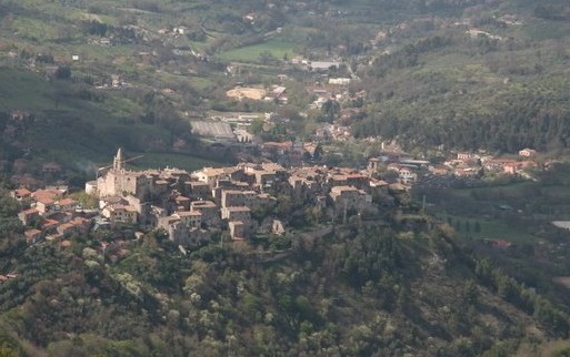
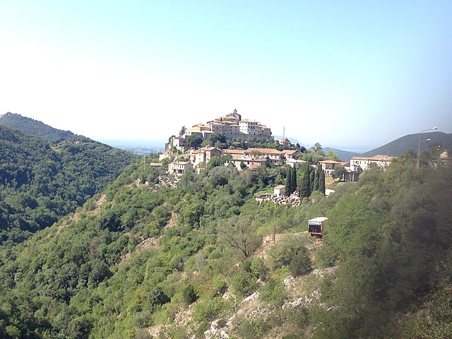
Greccio (Greccio)
.svg)
- Italian comune
 Hiking in Greccio
Greccio is a picturesque village located in the Lazio region of Italy, notable for its beautiful landscapes and historical significance. It's located in the province of Rieti and is known primarily for its connections to St. Francis of Assisi, who established the first nativity scene here in 1223.
Hiking Opportunities
Hiking in and around Greccio offers a variety of trails suited to different skill levels, with beautiful views of the surrounding mountains and valleys.
-
The Nature Trails: The area around Greccio is part of the Monti Reatini Regional Park, which offers numerous trails that vary in difficulty. Some popular routes include:
- Sentiero del Casale: A scenic trail that provides stunning vistas and connects to various points of interest.
- The Historical Trail to the Hermitage: This path leads to the nearby hermitage where St. Francis spent time and offers both historical context and a peaceful setting.
-
Scenic Views: Many hiking paths in the Greccio area provide breathtaking views of the Rieti Valley and the surrounding Apennine mountains, making it a photographer's paradise.
-
Wildlife and Flora: As you hike, you may encounter various species of wildlife and a diverse range of flora. The park is home to deer, foxes, and numerous bird species, making it an ideal spot for nature lovers.
-
Cultural Sites: Along some hiking routes, you can visit historical sites, including churches and monasteries associated with St. Francis. The village of Greccio itself has charming streets and local shops where you can enjoy the culture and cuisine of the area.
Preparation and Tips
- Weather: Check the weather conditions before heading out, as they can change quickly, especially in the mountains.
- Footwear: Wear sturdy hiking boots with good grip, as trails can be rocky and uneven.
- Supplies: Bring water, snacks, and a first-aid kit. A map or GPS device is also recommended to help navigate the trails.
- Respect Nature: Follow Leave No Trace principles to protect the environment.
Conclusion
Hiking in Greccio can be a rewarding experience, combining natural beauty with cultural heritage. Whether you are looking for a short walk or a longer trek, the trails around Greccio provide a variety of options to enjoy the stunning landscapes of central Italy.
- Country:

- Postal Code: 02040
- Local Dialing Code: 0746
- Licence Plate Code: RI
- Coordinates: 42° 27' 0" N, 12° 45' 0" E


- GPS tracks (wikiloc): [Link]
- AboveSeaLevel: 705 м m
- Area: 17.86 sq km
- Population: 1554
- Web site: http://www.comune.greccio.ri.it
- Wikipedia en: wiki(en)
- Wikipedia: wiki(it)
- Wikidata storage: Wikidata: Q224144
- Wikipedia Commons Gallery: [Link]
- Wikipedia Commons Category: [Link]
- Freebase ID: [/m/045m00]
- GeoNames ID: Alt: [3175850]
- VIAF ID: Alt: [240005075]
- OSM relation ID: [42032]
- GND ID: Alt: [4266101-8]
- ISTAT ID: 057031
- Italian cadastre code: E160
Shares border with regions:

Stroncone
- town in the region Umbria, in Italy
Hiking in Stroncone
Stroncone, a charming town in the Umbria region of Italy, is surrounded by beautiful landscapes that offer excellent hiking opportunities. Nestled in the foothills of the Apennines, the area provides a combination of historical sites, nature, and diverse terrains suitable for all levels of hikers....
- Country:
- Postal Code: 05039
- Local Dialing Code: 0744
- Licence Plate Code: TR
- Coordinates: 42° 30' 0" N, 12° 40' 0" E
- GPS tracks (wikiloc): [Link]
- AboveSeaLevel: 451 м m
- Area: 71.17 sq km
- Population: 4814
- Web site: [Link]
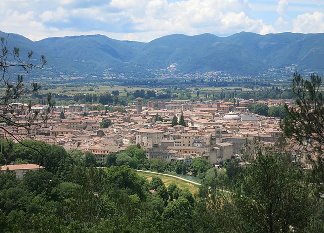

Rieti
- Italian comune
Hiking in Rieti
Rieti, located in the Lazio region of Italy, is a wonderful destination for hiking enthusiasts. This area is characterized by its stunning natural landscapes, rich history, and diverse wildlife. Here are some key points about hiking in Rieti:...
- Country:
- Postal Code: 02100
- Local Dialing Code: 0746
- Licence Plate Code: RI
- Coordinates: 42° 24' 16" N, 12° 51' 24" E
- GPS tracks (wikiloc): [Link]
- AboveSeaLevel: 405 м m
- Area: 206.46 sq km
- Population: 47436
- Web site: [Link]


Contigliano
- Italian comune
Hiking in Contigliano
Contigliano is a beautiful village located in the province of Rieti, in the Italian region of Lazio. Surrounded by stunning landscapes, it offers various hiking opportunities for both beginners and experienced hikers. Here are some key points to consider about hiking in Contigliano:...
- Country:
- Postal Code: 02043
- Local Dialing Code: 0746
- Licence Plate Code: RI
- Coordinates: 42° 25' 0" N, 12° 46' 0" E
- GPS tracks (wikiloc): [Link]
- AboveSeaLevel: 488 м m
- Area: 53.55 sq km
- Population: 3884
- Web site: [Link]

Cottanello
- Italian comune
Hiking in Cottanello
Cottanello is a picturesque village located in the Lazio region of Italy, surrounded by beautiful landscapes, including mountains and lush forests. If you're interested in hiking in and around Cottanello, here are some details you might find useful:...
- Country:
- Postal Code: 02040
- Local Dialing Code: 0746
- Licence Plate Code: RI
- Coordinates: 42° 24' 21" N, 12° 41' 10" E
- GPS tracks (wikiloc): [Link]
- AboveSeaLevel: 551 м m
- Area: 36.7 sq km
- Population: 538
- Web site: [Link]