Grun-Bordas (Grun-Bordas)

- commune in Dordogne, France
- Country:

- Postal Code: 24380
- Coordinates: 45° 2' 47" N, 0° 39' 8" E


- GPS tracks (wikiloc): [Link]
- AboveSeaLevel: 128 м m
- Area: 12.28 sq km
- Population: 218
- Wikipedia en: wiki(en)
- Wikipedia: wiki(fr)
- Wikidata storage: Wikidata: Q1079244
- Wikipedia Commons Category: [Link]
- Freebase ID: [/m/03mg6jz]
- Freebase ID: [/m/03mg6jz]
- GeoNames ID: Alt: [3014472]
- GeoNames ID: Alt: [3014472]
- SIREN number: [212402085]
- SIREN number: [212402085]
- INSEE municipality code: 24208
- INSEE municipality code: 24208
Shares border with regions:


Creyssensac-et-Pissot
- commune in Dordogne, France
- Country:
- Postal Code: 24380
- Coordinates: 45° 4' 46" N, 0° 39' 43" E
- GPS tracks (wikiloc): [Link]
- Area: 8.62 sq km
- Population: 256
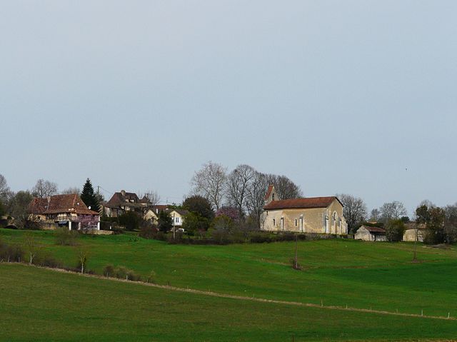
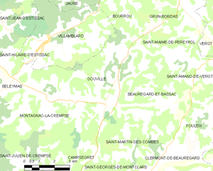
Douville
- commune in Dordogne, France
- Country:
- Postal Code: 24140
- Coordinates: 44° 59' 14" N, 0° 35' 38" E
- GPS tracks (wikiloc): [Link]
- Area: 19.91 sq km
- Population: 452


Bourrou
- commune in Dordogne, France
- Country:
- Postal Code: 24110
- Coordinates: 45° 2' 43" N, 0° 35' 50" E
- GPS tracks (wikiloc): [Link]
- Area: 9.13 sq km
- Population: 133


Saint-Paul-de-Serre
- commune in Dordogne, France
- Country:
- Postal Code: 24380
- Coordinates: 45° 5' 18" N, 0° 38' 1" E
- GPS tracks (wikiloc): [Link]
- Area: 10.44 sq km
- Population: 273


Manzac-sur-Vern
- commune in Dordogne, France
- Country:
- Postal Code: 24110
- Coordinates: 45° 5' 14" N, 0° 35' 8" E
- GPS tracks (wikiloc): [Link]
- Area: 19.96 sq km
- Population: 596


Saint-Maime-de-Péreyrol
- commune in Dordogne, France
- Country:
- Postal Code: 24380
- Coordinates: 45° 0' 53" N, 0° 38' 49" E
- GPS tracks (wikiloc): [Link]
- AboveSeaLevel: 228 м m
- Area: 10.75 sq km
- Population: 282
- Web site: [Link]