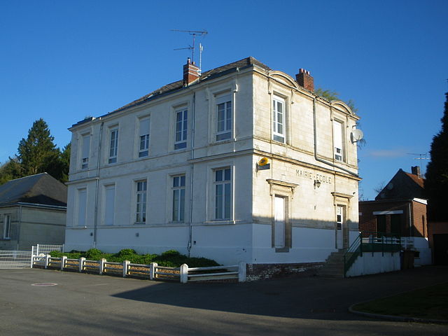
Halloy (Halloy)

- commune in Pas-de-Calais, France
- Country:

- Postal Code: 62760
- Coordinates: 50° 9' 28" N, 2° 25' 33" E


- GPS tracks (wikiloc): [Link]
- Area: 3.4 sq km
- Population: 225
- Wikipedia en: wiki(en)
- Wikipedia: wiki(fr)
- Wikidata storage: Wikidata: Q989758
- Wikipedia Commons Category: [Link]
- Freebase ID: [/m/02z47js]
- GeoNames ID: Alt: [6439588]
- SIREN number: [216204040]
- BnF ID: [15268845j]
- INSEE municipality code: 62404
Shares border with regions:


Pommera
- commune in Pas-de-Calais, France
- Country:
- Postal Code: 62760
- Coordinates: 50° 10' 24" N, 2° 26' 20" E
- GPS tracks (wikiloc): [Link]
- Area: 4.42 sq km
- Population: 317
- Web site: [Link]

Orville
- commune in Pas-de-Calais, France
- Country:
- Postal Code: 62760
- Coordinates: 50° 8' 2" N, 2° 24' 41" E
- GPS tracks (wikiloc): [Link]
- Area: 11.95 sq km
- Population: 403


Grouches-Luchuel
- commune in Somme, France
- Country:
- Postal Code: 80600
- Coordinates: 50° 10' 54" N, 2° 22' 56" E
- GPS tracks (wikiloc): [Link]
- Area: 9.02 sq km
- Population: 604

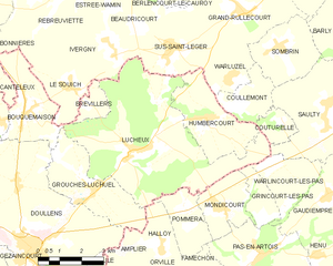
Lucheux
- commune in Somme, France
- Country:
- Postal Code: 80600
- Coordinates: 50° 11' 48" N, 2° 24' 37" E
- GPS tracks (wikiloc): [Link]
- Area: 27.65 sq km
- Population: 545


Amplier
- commune in Pas-de-Calais, France
- Country:
- Postal Code: 62760
- Coordinates: 50° 8' 15" N, 2° 23' 59" E
- GPS tracks (wikiloc): [Link]
- Area: 8.71 sq km
- Population: 305
- Web site: [Link]