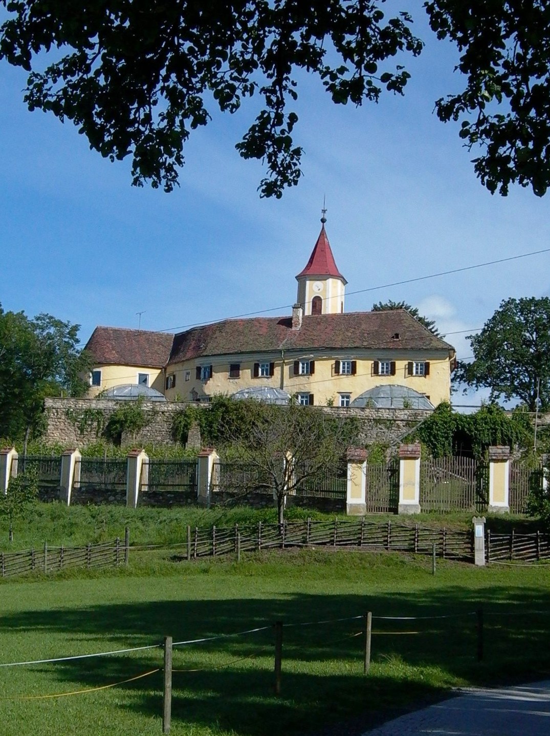
Hartberg-Fürstenfeld District (Bezirk Hartberg-Fürstenfeld)
- district in Austria
 Hiking in Hartberg-Fürstenfeld District
The Hartberg-Fürstenfeld District, located in the Styria region of Austria, offers a variety of hiking opportunities amidst picturesque landscapes. The area is characterized by rolling hills, lush forests, and scenic views of the surrounding mountains, making it an excellent destination for outdoor enthusiasts.
Hiking Trails:
-
Schöckl Mountain: While technically just outside the district, it's a popular starting point. The trails range from easy to moderate difficulty and offer stunning panoramic views of the surrounding area.
-
Hiking around Hartberg: The town of Hartberg itself is a great base for hikes. You can find several well-marked trails that meander through vineyards, meadows, and forests.
-
Kunstwanderweg: This "art hiking trail" features several art installations along its route, providing a unique combination of nature and culture. It is suitable for families and offers educational insights into local art.
-
Rennweg Trails: The Rennweg area features various paths that cater to different skill levels. The terrain here offers a blend of forest paths and open fields.
-
Thermal Spa Trails: The district is home to several thermal spas, and some trails lead you to these wellness spots. This can be a great way to combine a hiking experience with relaxation.
Best Practices:
- Trail Conditions: Always check the trail conditions before heading out, especially after rainfall or snow.
- Supplies: Carry enough water and snacks, as some trails may not have facilities nearby.
- Gear: Dress in layers and wear appropriate hiking boots, especially if the terrain is uneven or steep.
- Weather: Be mindful of the weather forecast, as conditions can change quickly in mountainous areas.
Resources:
- Local hiking maps are usually available at tourist information centers, which can provide detailed information about trail difficulty, lengths, and points of interest.
- Join local hiking clubs or guided tours for a more immersive and informative experience.
Whether you're looking for a leisurely stroll through nature or a challenging hike, the Hartberg-Fürstenfeld District has something to offer for every level of hiker.
- Country:

- Licence Plate Code: HF
- Coordinates: 47° 16' 0" N, 15° 58' 0" E


- GPS tracks (wikiloc): [Link]
- Area: 1228 sq km
- Web site: http://www.bh-hartberg-fuerstenfeld.steiermark.at/
- Wikipedia en: wiki(en)
- Wikipedia: wiki(de)
- Wikidata storage: Wikidata: Q853765
- Wikipedia Commons Category: [Link]
- Wikipedia Commons Maps Category: [Link]
- archINFORM location ID: [14688]
Includes regions:

Sankt Johann bei Herberstein
- former municipality in Austria
Hiking in Sankt Johann bei Herberstein
Sankt Johann bei Herberstein is a charming village located in Styria, Austria, known for its picturesque landscapes and beautiful hiking trails. The surrounding region is characterized by lush forests, rolling hills, and scenic views, making it an excellent destination for outdoor enthusiasts....
- Country:
- Postal Code: 8222
- Local Dialing Code: 03113
- Licence Plate Code: HB
- Coordinates: 47° 12' 39" N, 15° 49' 25" E
- GPS tracks (wikiloc): [Link]
- AboveSeaLevel: 421 м m
- Area: 2.85 sq km
- Population: 381
- Web site: [Link]
Feistritztal
- municipality in Austria
Hiking in Feistritztal
Feistritztal, located in Austria's Styria region, offers beautiful hiking opportunities amidst stunning natural landscapes. The valley is characterized by its lush greenery, diverse flora and fauna, and the gentle flow of the Feistritz River....
- Country:
- Postal Code: 8221, 8222, 8223, 8224, 8265
- Licence Plate Code: HF
- Coordinates: 47° 11' 35" N, 15° 49' 42" E
- GPS tracks (wikiloc): [Link]
- AboveSeaLevel: 358 м m
- Area: 25.7 sq km
- Population: 2417
- Web site: [Link]
Waldbach-Mönichwald
- municipality in Austria
Hiking in Waldbach-Mönichwald
Waldbach-Mönichwald is a beautiful area in Austria that offers a variety of hiking opportunities for outdoor enthusiasts. Nestled in the Styrian region, this area is characterized by stunning landscapes, lush green forests, and peaceful meadows....
- Country:
- Postal Code: 8251, 8252, 8253
- Local Dialing Code: 03336
- Licence Plate Code: HF
- Coordinates: 47° 26' 50" N, 15° 52' 57" E
- GPS tracks (wikiloc): [Link]
- AboveSeaLevel: 574 м m
- Area: 53.97 sq km
- Population: 1523
- Web site: [Link]
Hartberg Umgebung
- municipality in Austria
Hiking in Hartberg Umgebung
Hartberg Umgebung, located in the Styria region of Austria, offers a range of beautiful hiking trails that cater to various skill levels and preferences. The area is characterized by its picturesque landscapes, rolling hills, vineyards, and lush forests, making it an ideal destination for outdoor enthusiasts. Here are some highlights and tips for hiking in Hartberg Umgebung:...
- Country:
- Local Dialing Code: 03332
- Licence Plate Code: HB
- Coordinates: 47° 16' 21" N, 15° 57' 31" E
- GPS tracks (wikiloc): [Link]
- AboveSeaLevel: 360 м m
- Area: 30.42 sq km
- Population: 2248
- Web site: [Link]
Buch-Sankt Magdalena
- municipality in Austria
Hiking in Buch-Sankt Magdalena
Buch-Sankt Magdalena is a picturesque village located in the region of Styria, Austria. Nestled in the foothills of the Alps, it's an ideal base for hiking enthusiasts looking to explore the beautiful landscapes, lush forests, and scenic vistas of the area. Here’s an overview of what you can expect when hiking around Buch-Sankt Magdalena:...
- Country:
- Local Dialing Code: 03332
- Licence Plate Code: HF
- Coordinates: 47° 13' 35" N, 16° 0' 54" E
- GPS tracks (wikiloc): [Link]
- AboveSeaLevel: 430 м m
- Area: 26.40 sq km
- Population: 2171
- Web site: [Link]
Ilz, Styria
- town in Austria
Hiking in Ilz, Styria
Ilz, located in Styria, Austria, offers a variety of hiking opportunities that highlight the natural beauty and diverse landscapes of the region. Here’s an overview of what you can expect when hiking in and around Ilz:...
- Country:
- Local Dialing Code: 3385
- Licence Plate Code: HF
- Coordinates: 47° 5' 12" N, 15° 55' 34" E
- GPS tracks (wikiloc): [Link]
- AboveSeaLevel: 300 м m
- Area: 39.3 sq km
- Population: 3736
- Web site: [Link]

Übersbach
- former municipality in Austria
Hiking in Übersbach
Übersbach, a quaint location often surrounded by beautiful natural landscapes, offers various hiking opportunities for outdoor enthusiasts. While specific trails might vary, you can generally expect a mix of forest paths, scenic views, and perhaps some historical landmarks if the area has them....
- Country:
- Local Dialing Code: 03387
- Licence Plate Code: HF
- Coordinates: 47° 1' 31" N, 16° 3' 13" E
- GPS tracks (wikiloc): [Link]
- AboveSeaLevel: 265 м m
- Area: 15.14 sq km
- Population: 1146

Hartberg
- municipality in Austria
Hiking in Hartberg
Hartberg, located in Styria, Austria, is surrounded by beautiful landscapes that are perfect for hiking enthusiasts. The region offers a variety of trails suitable for different skill levels, from gentle walks to more challenging hikes. Here are some highlights for hiking in the Hartberg area:...
- Country:
- Postal Code: 8230
- Local Dialing Code: 03332
- Licence Plate Code: HF
- Coordinates: 47° 16' 50" N, 15° 58' 12" E
- GPS tracks (wikiloc): [Link]
- AboveSeaLevel: 359 м m
- Area: 21.58 sq km
- Population: 6650
- Web site: [Link]
Sankt Johann in der Haide
- municipality in Austria
Hiking in Sankt Johann in der Haide
Sankt Johann in der Haide is a picturesque village located in Austria, nestled in the scenic Murau district of Styria. This area offers a variety of hiking opportunities that showcase the beautiful landscapes of the region, from lush forests to rolling hills and stunning mountain views. Here are some key points about hiking in Sankt Johann in der Haide:...
- Country:
- Local Dialing Code: 03332
- Licence Plate Code: HB
- Coordinates: 47° 16' 52" N, 16° 1' 29" E
- GPS tracks (wikiloc): [Link]
- AboveSeaLevel: 387 м m
- Area: 23.53 sq km
- Population: 2159
- Web site: [Link]
Schäffern
- municipality in Austria
Hiking in Schäffern
Schäffern, located in Austria, is a picturesque village that offers several beautiful hiking opportunities. The landscape around Schäffern is characterized by rolling hills, lush forests, and scenic views, making it a great destination for nature lovers and outdoor enthusiasts....
- Country:
- Local Dialing Code: 03339
- Licence Plate Code: HB
- Coordinates: 47° 28' 39" N, 16° 6' 43" E
- GPS tracks (wikiloc): [Link]
- AboveSeaLevel: 601 м m
- Area: 32.35 sq km
- Population: 1374
- Web site: [Link]


Altenmarkt bei Fürstenfeld
- former municipality in Austria
Hiking in Altenmarkt bei Fürstenfeld
Altenmarkt bei Fürstenfeld is a picturesque area located in Styria, Austria, known for its natural beauty and favorable hiking conditions. The region boasts a variety of landscapes, including rolling hills, forests, and scenic views of the surrounding mountains, making it an ideal destination for both novice and experienced hikers....
- Country:
- Local Dialing Code: 03382
- Licence Plate Code: FF
- Coordinates: 47° 4' 0" N, 16° 3' 0" E
- GPS tracks (wikiloc): [Link]
- AboveSeaLevel: 260 м m
- Area: 19.98 sq km
- Population: 1133
Rohrbach an der Lafnitz
- municipality in Austria
Hiking in Rohrbach an der Lafnitz
Rohrbach an der Lafnitz is a charming village located in the Burgenland region of Austria, near the border with Hungary. This area is characterized by its picturesque landscapes, rolling hills, and the scenic Lafnitz River, making it an ideal destination for hiking enthusiasts....
- Country:
- Local Dialing Code: 03338
- Licence Plate Code: HB
- Coordinates: 47° 23' 26" N, 15° 59' 44" E
- GPS tracks (wikiloc): [Link]
- AboveSeaLevel: 455 м m
- Area: 2.06 sq km
- Population: 2634
- Web site: [Link]
Tiefenbach bei Kaindorf
- former municipality in Austria
Hiking in Tiefenbach bei Kaindorf
Tiefenbach bei Kaindorf is a beautiful area in Styria, Austria, known for its stunning landscapes and diverse hiking opportunities. When hiking in this region, you'll find a variety of trails that cater to different skill levels, from easy walks suitable for families to more challenging treks for experienced hikers....
- Country:
- Licence Plate Code: HB
- Coordinates: 47° 13' 17" N, 15° 51' 32" E
- GPS tracks (wikiloc): [Link]
- AboveSeaLevel: 371 м m
- Area: 8.39 sq km
- Population: 690
Großsteinbach
- municipality in Austria
Hiking in Großsteinbach
Großsteinbach is a picturesque area located in Styria, Austria, known for its beautiful landscapes, rolling hills, and tranquil surroundings, making it an excellent destination for hiking enthusiasts. Here are some highlights and tips for hiking in Großsteinbach:...
- Country:
- Local Dialing Code: 03386
- Licence Plate Code: FF
- Coordinates: 47° 8' 54" N, 15° 53' 39" E
- GPS tracks (wikiloc): [Link]
- AboveSeaLevel: 331 м m
- Area: 21.24 sq km
- Population: 1248
- Web site: [Link]

Friedberg
- municipality in Austria
Hiking in Friedberg
Friedberg in Styria, Austria, offers a variety of hiking opportunities that showcase the beautiful landscape and natural beauty of the region. The area is characterized by rolling hills, dense forests, and picturesque views of the Styrian countryside. Here are some key points to consider when hiking in Friedberg:...
- Country:
- Local Dialing Code: 03339
- Licence Plate Code: HB
- Coordinates: 47° 26' 29" N, 16° 3' 29" E
- GPS tracks (wikiloc): [Link]
- AboveSeaLevel: 601 м m
- Area: 25.87 sq km
- Population: 2601
- Web site: [Link]

Lafnitz
- municipality in Austria
Hiking in Lafnitz
Lafnitz is a charming area located in Austria, known for its picturesque landscapes that offer ample opportunities for hiking and outdoor activities. The region features a mix of forests, rolling hills, and scenic countryside, making it ideal for both beginners and experienced hikers....
- Country:
- Local Dialing Code: 03338
- Licence Plate Code: HB
- Coordinates: 47° 22' 9" N, 16° 0' 46" E
- GPS tracks (wikiloc): [Link]
- AboveSeaLevel: 412 м m
- Area: 15.61 sq km
- Population: 1451
- Web site: [Link]
Wenigzell
- municipality in Austria
Hiking in Wenigzell
Wenigzell, located in Austria's Styria region, is a charming destination for hiking enthusiasts. The area is characterized by its picturesque landscapes, lush forests, and rolling hills, making it an excellent spot for both novice and experienced hikers....
- Country:
- Local Dialing Code: 03336
- Licence Plate Code: HB
- Coordinates: 47° 25' 32" N, 15° 47' 10" E
- GPS tracks (wikiloc): [Link]
- AboveSeaLevel: 831 м m
- Area: 35.49 sq km
- Population: 1391
- Web site: [Link]

Fürstenfeld
- municipality in Austria
Hiking in Fürstenfeld
Fürstenfeld, located in Austria's Styria region, is an excellent destination for hiking enthusiasts. The area offers a variety of trails that cater to different skill levels, from leisurely walks to more challenging hikes. Here are some highlights:...
- Country:
- Postal Code: 8280, 8362
- Licence Plate Code: HF
- Coordinates: 47° 3' 0" N, 16° 5' 0" E
- GPS tracks (wikiloc): [Link]
- AboveSeaLevel: 276 м m
- Area: 50.31 sq km
- Population: 8549
- Web site: [Link]

Bad Waltersdorf
- municipality in Austria
Hiking in Bad Waltersdorf
Bad Waltersdorf is a picturesque town located in Styria, Austria, known for its thermal spas and beautiful natural landscapes, making it an excellent destination for hiking enthusiasts. The surrounding area offers a variety of trails suitable for different skill levels, allowing you to enjoy the stunning rolling hills, vineyards, and the serene atmosphere of the Styrian countryside....
- Country:
- Postal Code: 8271, 8264
- Local Dialing Code: 03333
- Licence Plate Code: HB
- Coordinates: 47° 10' 10" N, 16° 0' 33" E
- GPS tracks (wikiloc): [Link]
- AboveSeaLevel: 291 м m
- Area: 31.84 sq km
- Population: 3790
- Web site: [Link]
Pöllauberg
- municipality in Austria
Hiking in Pöllauberg
Pöllauberg is a beautiful hiking destination located in Styria, Austria. Known for its stunning landscapes, rolling hills, and the picturesque Pöllau Valley, it offers a variety of hiking trails suitable for different skill levels. Here are some key points about hiking in Pöllauberg:...
- Country:
- Postal Code: 8225
- Local Dialing Code: 03335
- Licence Plate Code: HB
- Coordinates: 47° 18' 58" N, 15° 51' 29" E
- GPS tracks (wikiloc): [Link]
- AboveSeaLevel: 753 м m
- Area: 33.85 sq km
- Population: 2049
- Web site: [Link]
Dienersdorf
- former municipality in Austria
Hiking in Dienersdorf
Dienersdorf is a small village located in the beautiful region of Austria, surrounded by stunning landscapes that are perfect for hiking enthusiasts. While the village itself may not be widely recognized, the surrounding areas offer various hiking trails that showcase the natural beauty of the countryside....
- Country:
- Postal Code: 8224
- Local Dialing Code: 03334
- Licence Plate Code: HB
- Coordinates: 47° 14' 30" N, 15° 54' 1" E
- GPS tracks (wikiloc): [Link]
- AboveSeaLevel: 355 м m
- Area: 7.06 sq km
Vorau
- municipality in Austria
Hiking in Vorau
Vorau is a charming small town located in the Styria region of Austria, known for its stunning landscapes and outdoor activities, particularly hiking. The surrounding areas offer a variety of trails suitable for all skill levels, making it an excellent destination for hikers....
- Country:
- Postal Code: 8250
- Local Dialing Code: 03337
- Licence Plate Code: HF
- Coordinates: 47° 24' 20" N, 15° 53' 17" E
- GPS tracks (wikiloc): [Link]
- AboveSeaLevel: 666 м m
- Area: 4.71 sq km
- Population: 4731
- Web site: [Link]
Rabenwald
- former municipality in Austria
Hiking in Rabenwald
Rabenwald is a beautiful area that offers various hiking opportunities, characterized by lush forests, scenic viewpoints, and diverse wildlife. While specific trails may vary, here are some general insights into what you might expect when hiking in Rabenwald:...
- Country:
- Postal Code: 8225
- Local Dialing Code: 03335
- Licence Plate Code: HB
- Coordinates: 47° 18' 10" N, 15° 47' 51" E
- GPS tracks (wikiloc): [Link]
- AboveSeaLevel: 520 м m
- Area: 16.91 sq km
- Population: 607
Ebersdorf
- municipality in Austria
Hiking in Ebersdorf
Ebersdorf, located in Styria, Austria, is an excellent destination for hiking enthusiasts. Nestled in the heart of the Styrian countryside, this area offers a range of trails suitable for various experience levels, from easy walks to more challenging hikes....
- Country:
- Local Dialing Code: 03333
- Licence Plate Code: HB
- Coordinates: 47° 12' 5" N, 15° 57' 26" E
- GPS tracks (wikiloc): [Link]
- AboveSeaLevel: 315 м m
- Area: 17.19 sq km
- Population: 1275
- Web site: [Link]
Puchegg
- former municipality in Austria
Hiking in Puchegg
Puchegg, located in a picturesque region, offers a range of hiking opportunities for various skill levels. While specific trails can vary, here are some general tips and information that may enhance your hiking experience in the area:...
- Country:
- Postal Code: 8250
- Local Dialing Code: 03337
- Licence Plate Code: HB
- Coordinates: 47° 23' 15" N, 15° 53' 27" E
- GPS tracks (wikiloc): [Link]
- AboveSeaLevel: 740 м m
- Area: 13.64 sq km
- Population: 502
Nestelbach im Ilztal
- former municipality in Austria
Hiking in Nestelbach im Ilztal
Nestelbach im Ilztal is a charming area located in Styria, Austria, known for its beautiful landscapes and outdoor activities, including hiking. Here are some key points to consider when hiking in this region:...
- Country:
- Local Dialing Code: 03385
- Licence Plate Code: FF
- Coordinates: 47° 5' 31" N, 15° 52' 45" E
- GPS tracks (wikiloc): [Link]
- AboveSeaLevel: 302 м m
- Area: 14.43 sq km
- Population: 1147
Großhart
- former municipality in Austria
Hiking in Großhart
Großhart is a picturesque area known for its scenic beauty and outdoor activities, particularly hiking. While it may not be as widely known as some major hiking destinations, it offers a charming environment for both novice and experienced hikers....
- Country:
- Local Dialing Code: 03333
- Licence Plate Code: HB
- Coordinates: 47° 10' 11" N, 15° 56' 56" E
- GPS tracks (wikiloc): [Link]
- AboveSeaLevel: 420 м m
- Area: 10.64 sq km
- Population: 635
Blaindorf
- former municipality in Austria
Hiking in Blaindorf
Blaindorf is a relatively lesser-known destination for hiking, but it can offer beautiful natural scenery and a peaceful atmosphere, making it a great spot for outdoor enthusiasts. Although specific trails and detailed information may vary, here are some general points you might consider when hiking in Blaindorf or similar locations:...
- Country:
- Local Dialing Code: 03386
- Licence Plate Code: HB
- Coordinates: 47° 10' 32" N, 15° 51' 58" E
- GPS tracks (wikiloc): [Link]
- AboveSeaLevel: 358 м m
- Area: 10.55 sq km
- Population: 668
Greinbach
- municipality in Austria
Hiking in Greinbach
Greinbach is a picturesque region located in Styria, Austria, known for its beautiful landscapes and scenic hiking trails. The area is characterized by lush forests, rolling hills, and diverse flora and fauna, making it a great destination for hiking enthusiasts....
- Country:
- Local Dialing Code: 03332
- Licence Plate Code: HB
- Coordinates: 47° 18' 39" N, 15° 57' 53" E
- GPS tracks (wikiloc): [Link]
- AboveSeaLevel: 420 м m
- Area: 23.37 sq km
- Population: 1795
- Web site: [Link]
Dechantskirchen
- municipality in Austria
Hiking in Dechantskirchen
Dechantskirchen is a beautiful area in Styria, Austria, known for its stunning landscapes and outdoor activities, including hiking. The region offers a variety of hiking trails suitable for different skill levels, from leisurely walks to more challenging hikes, all set against the backdrop of picturesque mountains, forests, and hills....
- Country:
- Postal Code: 8241
- Local Dialing Code: 03339
- Licence Plate Code: HB
- Coordinates: 47° 25' 0" N, 16° 1' 1" E
- GPS tracks (wikiloc): [Link]
- AboveSeaLevel: 531 м m
- Area: 23.95 sq km
- Population: 2042
- Web site: [Link]
Schachen bei Vorau
- former municipality in Austria
Hiking in Schachen bei Vorau
Schachen bei Vorau is an excellent location for hiking enthusiasts, set in the picturesque region of Styria, Austria. The area is characterized by its stunning landscapes, lush forests, rolling hills, and tranquil meadows. Here are some highlights and tips for hiking in this region:...
- Country:
- Postal Code: 8250
- Local Dialing Code: 03337
- Licence Plate Code: HB
- Coordinates: 47° 22' 59" N, 15° 51' 24" E
- GPS tracks (wikiloc): [Link]
- AboveSeaLevel: 740 м m
- Area: 19.05 sq km
Saifen-Boden
- former municipality in Austria
Hiking in Saifen-Boden
Saifen-Boden is a charming area located in the South Tyrol region of northern Italy, known for its picturesque landscapes and outdoor activities, including hiking. The region features a combination of lush valleys, rolling hills, and the stunning backdrop of the Dolomites, making it a fantastic destination for hikers of all levels....
- Country:
- Postal Code: 8225
- Local Dialing Code: 03335
- Licence Plate Code: HB
- Coordinates: 47° 19' 27" N, 15° 47' 48" E
- GPS tracks (wikiloc): [Link]
- AboveSeaLevel: 560 м m
- Area: 18.81 sq km
- Population: 1100

Bad Blumau
- municipality in Austria
Hiking in Bad Blumau
Bad Blumau, located in Styria, Austria, is known for its beautiful landscapes, thermal baths, and tranquility, making it a great destination for hiking enthusiasts. The surrounding rolling hills and lush green forests offer a variety of trails suitable for different skill levels....
- Country:
- Postal Code: 8283
- Local Dialing Code: 03383
- Licence Plate Code: FF
- Coordinates: 47° 7' 0" N, 16° 3' 0" E
- GPS tracks (wikiloc): [Link]
- AboveSeaLevel: 284 м m
- Area: 37.31 sq km
- Population: 1594
- Web site: [Link]
Söchau
- municipality in Austria
Hiking in Söchau
Söchau is a picturesque village located in Styria, Austria, surrounded by stunning landscapes that are perfect for hiking enthusiasts. The region offers diverse trails that cater to various skill levels, from gentle walks to more challenging hikes. Here are some highlights of hiking in and around Söchau:...
- Country:
- Local Dialing Code: 03387
- Licence Plate Code: FF
- Coordinates: 47° 1' 49" N, 16° 1' 7" E
- GPS tracks (wikiloc): [Link]
- AboveSeaLevel: 273 м m
- Area: 18.18 sq km
- Population: 1413
- Web site: [Link]
Pinggau
- municipality in Austria
Hiking in Pinggau
Pinggau is a small town located in the Burgenland region of Austria, surrounded by a variety of natural landscapes that offer great opportunities for hiking. While the area may not be as well-known as some larger national parks or mountainous regions, it still has its own charm and scenic routes that can appeal to hikers of all levels....
- Country:
- Local Dialing Code: 03339
- Licence Plate Code: HB
- Coordinates: 47° 26' 38" N, 16° 3' 51" E
- GPS tracks (wikiloc): [Link]
- AboveSeaLevel: 527 м m
- Area: 59 sq km
- Population: 3150
- Web site: [Link]
Grafendorf bei Hartberg
- municipality in Austria
Hiking in Grafendorf bei Hartberg
Grafendorf bei Hartberg, located in Styria, Austria, is a beautiful area for hiking enthusiasts. The region is characterized by rolling hills, lush forests, and picturesque landscapes that provide a perfect backdrop for various hiking trails suitable for all skill levels....
- Country:
- Local Dialing Code: 03338
- Licence Plate Code: HB
- Coordinates: 47° 20' 25" N, 15° 59' 27" E
- GPS tracks (wikiloc): [Link]
- AboveSeaLevel: 383 м m
- Area: 25.10 sq km
- Population: 3082
- Web site: [Link]

Pöllau
- municipality in Austria
Hiking in Pöllau
Pöllau is a picturesque spot located in the eastern part of Austria, particularly known for its charming landscapes, rolling hills, and lush greenery. Hiking in Pöllau offers an excellent opportunity to experience a mix of cultural and natural attractions. Here are some highlights and tips for hiking in the area:...
- Country:
- Postal Code: 8225
- Local Dialing Code: 03335
- Licence Plate Code: HF
- Coordinates: 47° 18' 7" N, 15° 50' 2" E
- GPS tracks (wikiloc): [Link]
- AboveSeaLevel: 425 м m
- Area: 4.62 sq km
- Population: 6054
- Web site: [Link]
Neudau
- municipality in Austria
Hiking in Neudau
Neudau, located in Austria, is nestled in the beautiful region of Styria. While it may not be as well-known as some larger hiking destinations, it offers picturesque landscapes and charming trails that can be perfect for hiking enthusiasts....
- Country:
- Postal Code: 8292
- Local Dialing Code: 03383
- Licence Plate Code: HB
- Coordinates: 47° 10' 28" N, 16° 6' 11" E
- GPS tracks (wikiloc): [Link]
- AboveSeaLevel: 289 м m
- Area: 10.14 sq km
- Population: 1459
- Web site: [Link]
Vornholz
- former municipality in Austria
Hiking in Vornholz
Vornholz, while perhaps not as widely known as some major hiking destinations, can offer beautiful trails and a serene environment for outdoor enthusiasts. Here are some general considerations and tips you can keep in mind while hiking in the area:...
- Country:
- Postal Code: 8250
- Local Dialing Code: 03336
- Licence Plate Code: HB
- Coordinates: 47° 23' 47" N, 15° 49' 36" E
- GPS tracks (wikiloc): [Link]
- AboveSeaLevel: 800 м m
- Area: 18.78 sq km
- Population: 722
Großwilfersdorf
- municipality in Austria
Hiking in Großwilfersdorf
Großwilfersdorf, a small village in Austria, is a great destination for hiking enthusiasts looking to explore the scenic landscapes of Styria. While it may not be as widely known as some larger hiking areas, it offers a variety of trails suitable for different skill levels....
- Country:
- Local Dialing Code: 03385
- Licence Plate Code: FF
- Coordinates: 47° 4' 39" N, 15° 59' 40" E
- GPS tracks (wikiloc): [Link]
- AboveSeaLevel: 274 м m
- Area: 20.91 sq km
- Population: 2071
- Web site: [Link]
Kaindorf
- municipality in Austria
Hiking in Kaindorf
Kaindorf, located in Austria, is surrounded by beautiful landscapes that make it an excellent destination for hiking enthusiasts. The region offers a range of trails suitable for various skill levels, from easy walks to more challenging hikes. Here are some highlights about hiking in Kaindorf and its surrounding areas:...
- Country:
- Postal Code: 8224
- Local Dialing Code: 03334
- Licence Plate Code: HB
- Coordinates: 47° 13' 35" N, 15° 54' 41" E
- GPS tracks (wikiloc): [Link]
- AboveSeaLevel: 342 м m
- Area: 14.18 sq km
- Population: 2935
- Web site: [Link]
Hartl
- municipality in Austria
Hiking in Hartl
Hartl, or Hartlberg, is often not as widely recognized as other hiking destinations, but it can provide rewarding outdoor experiences. If you're planning to hike in this area, here are a few general tips and insights you might find useful:...
- Country:
- Local Dialing Code: 03334
- Licence Plate Code: HB
- Coordinates: 47° 10' 35" N, 15° 54' 53" E
- GPS tracks (wikiloc): [Link]
- AboveSeaLevel: 430 м m
- Area: 14.71 sq km
- Population: 2130
- Web site: [Link]
Hofkirchen bei Hartberg
- former municipality in Austria
Hiking in Hofkirchen bei Hartberg
Hofkirchen bei Hartberg is a charming municipality located in the Styria region of Austria, known for its beautiful natural landscapes that are ideal for hiking. The area is characterized by rolling hills, lush forests, and picturesque views, making it a wonderful destination for outdoor enthusiasts....
- Country:
- Local Dialing Code: 03334
- Licence Plate Code: HB
- Coordinates: 47° 13' 48" N, 15° 52' 3" E
- GPS tracks (wikiloc): [Link]
- AboveSeaLevel: 422 м m
- Area: 6.62 sq km
Stein
- former municipality in Austria
Hiking in Stein
Hiking in Stein, Styria, is a fantastic experience, thanks to the region's picturesque landscapes, diverse trails, and rich natural surroundings. Stein, located in Styria, Austria, offers a variety of hiking options suitable for all levels of hikers, from beginners to experienced trekkers....
- Country:
- Postal Code: 8282
- Local Dialing Code: 03382
- Licence Plate Code: FF
- Coordinates: 46° 59' 58" N, 16° 5' 4" E
- GPS tracks (wikiloc): [Link]
- AboveSeaLevel: 268 м m
- Area: 7.33 sq km
- Population: 495
Kaibing
- former municipality in Austria
Hiking in Kaibing
It seems there might be a typo or confusion with the name "Kaibing." If you meant "Kaibab," as in the Kaibab National Forest in northern Arizona, I can definitely help you with that!...
- Country:
- Local Dialing Code: 03113
- Licence Plate Code: HB
- Coordinates: 47° 11' 51" N, 15° 50' 19" E
- GPS tracks (wikiloc): [Link]
- AboveSeaLevel: 360 м m
- Area: 2.80 sq km
- Population: 392
Limbach bei Neudau
- former municipality in Austria
Hiking in Limbach bei Neudau
Limbach bei Neudau, located in Styria, Austria, offers beautiful landscapes suitable for hiking enthusiasts. The region is characterized by its rolling hills, lush forests, and scenic views, providing a tranquil environment for outdoor activities....
- Country:
- Postal Code: 8292
- Local Dialing Code: 03383
- Licence Plate Code: HB
- Coordinates: 47° 11' 1" N, 16° 3' 49" E
- GPS tracks (wikiloc): [Link]
- AboveSeaLevel: 347 м m
- Area: 7.71 sq km
- Population: 351
Wörth an der Lafnitz
- former municipality in Austria
Hiking in Wörth an der Lafnitz
Wörth an der Lafnitz is a charming village located in Austria, near the border with Hungary. This area is surrounded by picturesque landscapes, making it a great destination for hiking enthusiasts. Here are some highlights and considerations for hiking in the region:...
- Country:
- Postal Code: 8293
- Local Dialing Code: 03332
- Licence Plate Code: HB
- Coordinates: 47° 12' 46" N, 16° 4' 52" E
- GPS tracks (wikiloc): [Link]
- AboveSeaLevel: 330 м m
- Area: 10.93 sq km
- Web site: [Link]
Eichberg
- former municipality in Austria
Hiking in Eichberg
Eichberg in Styria, Austria, is a charming destination for hiking enthusiasts. Nestled in a picturesque landscape of rolling hills, vineyards, and forests, it offers a range of hiking trails suitable for various skill levels. Here are some highlights about hiking in the area:...
- Country:
- Local Dialing Code: 03338
- Licence Plate Code: HB
- Coordinates: 47° 22' 53" N, 15° 58' 24" E
- GPS tracks (wikiloc): [Link]
- AboveSeaLevel: 578 м m
- Area: 18.47 sq km
- Population: 1178

Burgau
- municipality in Austria
Hiking in Burgau
Burgau, located in the Styria region of Austria, is a charming area that offers a variety of hiking opportunities. The landscape around Burgau is characterized by rolling hills, lush forests, and scenic views, making it an ideal destination for nature lovers and outdoor enthusiasts....
- Country:
- Postal Code: 8291
- Local Dialing Code: 03383
- Licence Plate Code: FF
- Coordinates: 47° 8' 35" N, 16° 5' 56" E
- GPS tracks (wikiloc): [Link]
- AboveSeaLevel: 275 м m
- Area: 19.99 sq km
- Population: 1040
- Web site: [Link]
Hainersdorf
- former municipality in Austria
Hiking in Hainersdorf
Hainersdorf, located in Styria, Austria, offers an array of hiking opportunities amidst beautiful natural scenery. The region is characterized by its lush landscapes, rolling hills, and dense forests, making it a perfect destination for both novice and experienced hikers....
- Country:
- Postal Code: 8264
- Local Dialing Code: 03385
- Licence Plate Code: FF
- Coordinates: 47° 6' 51" N, 15° 56' 42" E
- GPS tracks (wikiloc): [Link]
- AboveSeaLevel: 295 м m
- Area: 17.32 sq km
- Population: 685
- Web site: [Link]
Sonnhofen
- former municipality in Austria
Hiking in Sonnhofen
Sonnhofen is a picturesque area in Germany known for its charming landscapes and hiking opportunities. Nestled in the Bavarian region, it offers scenic trails that cater to various skill levels....
- Country:
- Local Dialing Code: 03335
- Licence Plate Code: HB
- Coordinates: 47° 20' 52" N, 15° 48' 37" E
- GPS tracks (wikiloc): [Link]
- AboveSeaLevel: 760 м m
- Area: 21.24 sq km
- Population: 1030
Ottendorf an der Rittschein
- municipality in Austria
Hiking in Ottendorf an der Rittschein
Ottendorf an der Rittschein is a picturesque area in Styria, Austria, surrounded by beautiful landscapes, making it an appealing destination for hiking enthusiasts. Here are some highlights of hiking in and around this charming village:...
- Country:
- Local Dialing Code: 03114
- Licence Plate Code: FF
- Coordinates: 47° 2' 56" N, 15° 54' 2" E
- GPS tracks (wikiloc): [Link]
- AboveSeaLevel: 297 м m
- Area: 14.26 sq km
- Population: 1560
- Web site: [Link]
Waldbach
- former municipality in Austria
Hiking in Waldbach
Waldbach, located in the scenic region of Styria in Austria, offers a variety of hiking opportunities that cater to different skill levels and preferences. Here are some key points to keep in mind when hiking in Waldbach:...
- Country:
- Postal Code: 8253
- Local Dialing Code: 03336
- Licence Plate Code: HB
- Coordinates: 47° 26' 57" N, 15° 50' 14" E
- GPS tracks (wikiloc): [Link]
- AboveSeaLevel: 625 м m
- Area: 18.67 sq km
- Population: 698

Loipersdorf bei Fürstenfeld
- municipality in Austria
Hiking in Loipersdorf bei Fürstenfeld
Loipersdorf bei Fürstenfeld, located in the scenic southeastern part of Austria, is known for its beautiful landscapes and relaxing thermal baths. While its primary attraction is the thermal spa, the surrounding region also offers a variety of opportunities for hiking enthusiasts looking to explore nature....
- Country:
- Local Dialing Code: 03382
- Licence Plate Code: FF
- Coordinates: 47° 0' 48" N, 16° 6' 5" E
- GPS tracks (wikiloc): [Link]
- AboveSeaLevel: 249 м m
- Area: 17.74 sq km
- Population: 1876
- Web site: [Link]
Siegersdorf bei Herberstein
- former municipality in Austria
Hiking in Siegersdorf bei Herberstein
Siegersdorf bei Herberstein is a picturesque village located in Styria, Austria, surrounded by stunning natural landscapes that make it an excellent destination for hiking enthusiasts. The region is characterized by its rolling hills, lush forests, and beautiful meadows, offering a variety of trails suitable for different skill levels....
- Country:
- Postal Code: 8222
- Local Dialing Code: 03113
- Licence Plate Code: HB
- Coordinates: 47° 12' 55" N, 15° 46' 54" E
- GPS tracks (wikiloc): [Link]
- AboveSeaLevel: 560 м m
- Area: 4.97 sq km
- Population: 290
Stambach
- former municipality in Austria
Hiking in Stambach
Stambach is a picturesque village in Germany, surrounded by beautiful natural landscapes that make it a great destination for hiking enthusiasts. The region offers various trails that cater to different skill levels, providing opportunities to explore lush forests, rolling hills, and scenic viewpoints....
- Country:
- Local Dialing Code: 03338
- Licence Plate Code: HB
- Coordinates: 47° 20' 3" N, 15° 57' 30" E
- GPS tracks (wikiloc): [Link]
- AboveSeaLevel: 609 м m
- Area: 20.59 sq km
- Population: 632

Schönegg bei Pöllau
- former municipality in Austria
Hiking in Schönegg bei Pöllau
Schönegg bei Pöllau is a picturesque village located in the Styria region of Austria, surrounded by rolling hills and lush landscapes. It offers great hiking opportunities, especially for those who enjoy scenic views and peaceful natural settings. Here are some highlights and tips for hiking in this area:...
- Country:
- Local Dialing Code: 03335
- Licence Plate Code: HB
- Coordinates: 47° 15' 43" N, 15° 52' 0" E
- GPS tracks (wikiloc): [Link]
- AboveSeaLevel: 587 м m
- Area: 26.53 sq km
- Population: 1376
Sankt Lorenzen am Wechsel
- municipality in Austria
Hiking in Sankt Lorenzen am Wechsel
Sankt Lorenzen am Wechsel is a picturesque village located in the Austrian state of Styria, known for its beautiful landscapes and access to various hiking trails. The area is surrounded by lush forests, rolling hills, and scenic mountains, making it a great destination for outdoor enthusiasts....
- Country:
- Local Dialing Code: 03331
- Licence Plate Code: HB
- Coordinates: 47° 26' 32" N, 15° 57' 13" E
- GPS tracks (wikiloc): [Link]
- AboveSeaLevel: 728 м m
- Area: 48.5 sq km
- Population: 1487
- Web site: [Link]
Schlag bei Thalberg
- former municipality in Austria
Hiking in Schlag bei Thalberg
Schlag bei Thalberg is a picturesque location that offers beautiful hiking opportunities, particularly in the Alpine region of Austria. When hiking in this area, you'll find a mix of forested trails, open meadows, and stunning views of the surrounding landscapes, including the impressive mountains of the Salzkammergut region....
- Country:
- Licence Plate Code: HB
- Coordinates: 47° 25' 1" N, 15° 59' 43" E
- GPS tracks (wikiloc): [Link]
- AboveSeaLevel: 461 м m
- Area: 10.71 sq km
- Population: 911
Mönichwald
- former municipality in Austria
Hiking in Mönichwald
Mönichwald, located in the eastern part of Austria in Styria, is a beautiful area known for its picturesque landscapes, lush forests, and tranquil atmosphere. Here are some aspects to consider if you're planning a hiking trip in Mönichwald:...
- Country:
- Local Dialing Code: 03336
- Licence Plate Code: HB
- Coordinates: 47° 26' 50" N, 15° 52' 57" E
- GPS tracks (wikiloc): [Link]
- AboveSeaLevel: 574 м m
- Area: 35.14 sq km
- Population: 864
Sankt Jakob im Walde
- municipality in Austria
Hiking in Sankt Jakob im Walde
Sankt Jakob im Walde, located in Styria, Austria, is a beautiful destination for hiking enthusiasts. The region is characterized by lush forests, rolling hills, and scenic views, making it an ideal spot for outdoor activities....
- Country:
- Licence Plate Code: HB
- Coordinates: 47° 27' 58" N, 15° 47' 8" E
- GPS tracks (wikiloc): [Link]
- AboveSeaLevel: 913 м m
- Area: 30.25 sq km
- Population: 1056
- Web site: [Link]
Riegersberg
- former municipality in Austria
Hiking in Riegersberg
Riegersberg is a less commonly known hiking destination located in Austria, specifically in the Styria region. It offers a variety of hiking trails that cater to different skill levels, making it ideal for both beginners and experienced hikers. Here are some key points about hiking in Riegersberg:...
- Country:
- Local Dialing Code: 03337
- Licence Plate Code: HB
- Coordinates: 47° 25' 11" N, 15° 52' 58" E
- GPS tracks (wikiloc): [Link]
- AboveSeaLevel: 693 м m
- Area: 24.66 sq km
- Population: 981
Rohr bei Hartberg
- municipality in Austria
Hiking in Rohr bei Hartberg
Rohr bei Hartberg, located in Styria, Austria, is a beautiful area known for its scenic landscapes and a variety of outdoor activities, including hiking. The region is characterized by rolling hills, lush forests, and picturesque rural scenery, making it a great destination for nature enthusiasts....
- Country:
- Local Dialing Code: 03332
- Licence Plate Code: HB
- Coordinates: 47° 14' 15" N, 16° 3' 9" E
- GPS tracks (wikiloc): [Link]
- AboveSeaLevel: 356 м m
- Area: 16.79 sq km
- Population: 1457
- Web site: [Link]
Sebersdorf
- former municipality in Austria
Hiking in Sebersdorf
Sebersdorf, located in Austria, is surrounded by beautiful natural landscapes, making it an appealing destination for hiking enthusiasts. The region boasts a mix of tranquil countryside, rolling hills, and scenic views that can be enjoyed on various trails....
- Country:
- Local Dialing Code: 03333
- Licence Plate Code: HB
- Coordinates: 47° 11' 11" N, 15° 59' 29" E
- GPS tracks (wikiloc): [Link]
- AboveSeaLevel: 295 м m
- Area: 16.12 sq km
- Population: 1407

Stubenberg
- municipality in Austria
Hiking in Stubenberg
Stubenberg, located in Styria, Austria, offers a variety of hiking opportunities that cater to different skill levels and preferences. The region is known for its stunning landscapes, rolling hills, and proximity to various natural attractions. Here are some key features to consider if you're planning to hike in Stubenberg:...
- Country:
- Local Dialing Code: 03176
- Licence Plate Code: HB
- Coordinates: 47° 14' 38" N, 15° 48' 1" E
- GPS tracks (wikiloc): [Link]
- AboveSeaLevel: 449 м m
- Area: 32.56 sq km
- Population: 2171
- Web site: [Link]