
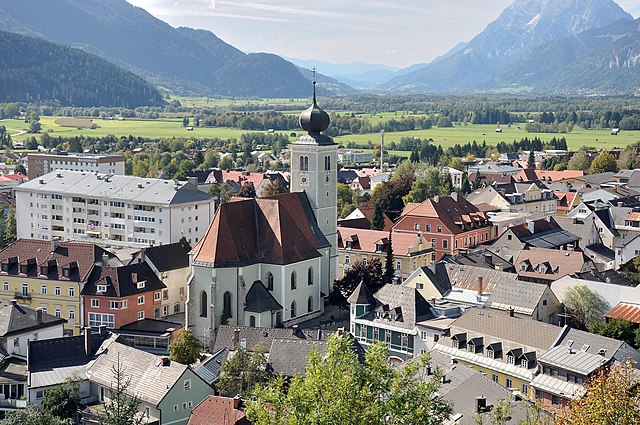
Styria (Steiermark)


- federated state in Austria
 Hiking in Styria
Styria, a beautiful region in Austria, is a fantastic destination for hiking enthusiasts. Known for its diverse landscapes, lush forests, rolling hills, and stunning alpine views, Styria offers a variety of trails suitable for all experience levels. Here’s what you can expect when hiking in Styria:
Key Hiking Areas
-
Gesäuse National Park:
- This park features rugged mountains, deep valleys, and the picturesque Enns River. There are numerous trails ranging from easy walks to challenging hikes. The views of the granite peaks and rushing waters make it a spectacular spot for outdoor activities.
-
Schöckl:
- Near Graz, Schöckl offers well-marked trails and is easily accessible. The summit provides panoramic views of the surrounding area and is a favorite among locals and tourists alike.
-
Ausseerland:
- This region includes beautiful lakes like Lake Altaussee and Lake Grundlsee, providing serene hiking opportunities along the shores and into the surrounding mountains.
-
Stubalpe and the Toten Gebirge:
- These areas contain a network of trails with varying difficulty levels, leading to stunning alpine scenery. The Toten Gebirge, in particular, is known for its high peaks and glacial lakes.
Hiking Tips
- Trail Information: Always check local hiking maps or mobile apps for trail conditions, difficulty levels, and estimated hiking times.
- Weather Conditions: Mountain weather can change quickly. Make sure to check the forecast before heading out and dress in layers.
- Equipment: Sturdy hiking boots, trekking poles, and sufficient water are essential. Depending on the season, consider carrying extra gear, like rain jackets or sun protection.
- Safety: Always let someone know your hiking plans and estimated return time. Carry a first aid kit and familiarize yourself with the area.
Unique Features
- Cultural Experience: Many trails pass through charming villages where you can experience traditional Styrian hospitality, local cuisine, and cultural landmarks.
- Wildlife: Expect to see a variety of wildlife, from deer to numerous bird species, adding to the charm of the nature experience.
- Gastronomy: Take advantage of mountain huts (Almhütten) that offer local dishes and a chance to rest while enjoying the scenery.
Additional Activities
In addition to hiking, Styria offers opportunities for mountain biking, climbing, and winter sports in colder months. The region’s natural beauty and rich culture make it a well-rounded destination for outdoor enthusiasts.
Overall, hiking in Styria is a rewarding experience, combining breathtaking natural landscapes with a chance to immerse yourself in the unique culture of Austria. Happy hiking!
- Country:

- Capital: Graz
- Coordinates: 47° 15' 0" N, 15° 10' 0" E


- GPS tracks (wikiloc): [Link]
- AboveSeaLevel: 2995 м m
- Area: 16400.75 sq km
- Population: 1231865
- Web site: http://www.steiermark.at/
- Wikipedia en: wiki(en)
- Wikipedia: wiki(de)
- Wikidata storage: Wikidata: Q41358
- Wikipedia Commons Gallery: [Link]
- Wikipedia Commons Category: [Link]
- Wikipedia Commons Maps Category: [Link]
- Freebase ID: [/m/01gpzx]
- GeoNames ID: Alt: [2764581]
- BnF ID: [119414032]
- VIAF ID: Alt: [154251299]
- GND ID: Alt: [4057092-7]
- archINFORM location ID: [2921]
- PACTOLS thesaurus ID: [pcrtz4Mnsz62qE]
- MusicBrainz area ID: [7500e764-604e-4576-b51c-5504f0db66a8]
- Quora topic ID: [Styria]
- TGN ID: [7003028]
- Encyclopædia Universalis ID: [styrie]
- EMLO location ID: [bb1ff556-3db4-4454-8f27-677e616d99b7]
- ISNI: Alt: [0000 0004 0521 0031]
- NKCR AUT ID: [ge131557]
- DMOZ ID: Alt: [Regional/Europe/Austria/Provinces/Styria/]
- NUTS code: [AT22]
- Klexikon article ID: [Steiermark]
- Global Anabaptist Mennonite Encyclopedia Online ID: [Styria (Austria)]
- STW Thesaurus for Economics ID: [16952-0]
- ISO 3166-2 code: AT-6
- FIPS 10-4 (countries and regions): AU06
Includes regions:


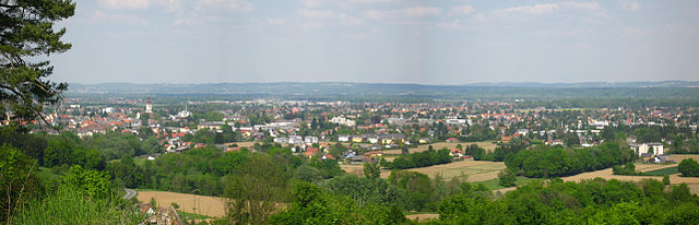
Graz
- city in Styria, Austria
Hiking in Graz
Graz, Austria, is an excellent destination for hiking enthusiasts, offering a mix of urban and natural landscapes. The region around Graz is characterized by rolling hills, wooded areas, and beautiful scenery, making it perfect for a variety of hiking experiences. Here are some key points about hiking in and around Graz:...
- Country:
- Postal Code: 8055; 8054; 8053; 8052; 8051; 8047; 8046; 8045; 8044; 8043; 8042; 8041; 8036; 8020; 8010
- Local Dialing Code: 316
- Licence Plate Code: G
- Coordinates: 47° 4' 0" N, 15° 26' 0" E
- GPS tracks (wikiloc): [Link]
- AboveSeaLevel: 353 м m
- Area: 127.58 sq km
- Population: 289440
- Web site: [Link]
Liezen District
- district of Austria
Hiking in Liezen District
The Liezen District, located in the Styria region of Austria, is a fantastic destination for hiking enthusiasts. It boasts stunning landscapes characterized by rugged mountains, lush forests, and scenic valleys. Here are some highlights and tips for hiking in the Liezen District:...
- Country:
- Capital: Liezen
- Licence Plate Code: LI
- Coordinates: 47° 31' 37" N, 14° 6' 58" E
- GPS tracks (wikiloc): [Link]
- AboveSeaLevel: 945 м m
- Area: 3317 sq km
- Population: 79862
- Web site: [Link]
Mürzzuschlag District
- district of Austria
Hiking in Mürzzuschlag District
Mürzzuschlag District, located in Styria, Austria, is an excellent destination for hiking enthusiasts. The region is characterized by its stunning natural landscapes, including the lush forests, rolling hills, and dramatic mountain ranges of the Eastern Alps....
- Country:
- Licence Plate Code: MZ
- Coordinates: 47° 34' 44" N, 15° 33' 32" E
- GPS tracks (wikiloc): [Link]
- Area: 848.9 sq km
- Population: 39956


Murau District
- district of Austria
Hiking in Murau District
Murau District, located in Styria, Austria, is a fantastic destination for hiking enthusiasts. Characterized by its stunning natural landscapes, lush forests, and picturesque alpine scenery, the area offers a variety of trails suitable for different skill levels, from gentle walks to challenging hikes....
- Country:
- Licence Plate Code: MU
- Coordinates: 47° 7' 1" N, 14° 16' 59" E
- GPS tracks (wikiloc): [Link]
- AboveSeaLevel: 1510 м m
- Area: 1384 sq km
- Population: 28388

Murtal District
- district of Austria
Hiking in Murtal District
Murtal District, located in Styria, Austria, is a great destination for hiking enthusiasts. The region is characterized by its stunning landscapes, which include rolling hills, deep forests, and majestic mountain ranges, making it an ideal spot for nature lovers. Here are some highlights and recommendations for hiking in Murtal District:...
- Country:
- Capital: Judenburg
- Licence Plate Code: JU
- Coordinates: 47° 10' 21" N, 14° 39' 37" E
- GPS tracks (wikiloc): [Link]
- AboveSeaLevel: 714 м m
- Area: 1675.38 sq km
- Web site: [Link]

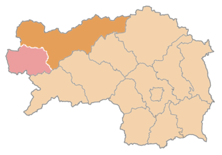
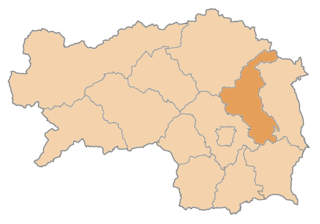
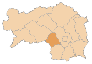
Deutschlandsberg District
- district in Austria
Hiking in Deutschlandsberg District
The Deutschlandsberg District, located in Styria, Austria, offers a varied and picturesque landscape ideal for hiking enthusiasts. Known for its rolling hills, vineyards, and charming villages, this region provides multiple trails suited for all skill levels, from leisurely strolls to more challenging hikes....
- Country:
- Capital: Deutschlandsberg
- Licence Plate Code: DL
- Coordinates: 46° 49' 23" N, 15° 15' 0" E
- GPS tracks (wikiloc): [Link]
- AboveSeaLevel: 557 м m
- Area: 863.5 sq km
- Population: 61498
- Web site: [Link]

Leibnitz District
- district of Austria
Hiking in Leibnitz District
Leibnitz District, located in southern Austria's Styria region, is a fantastic destination for hiking enthusiasts. The region is known for its picturesque landscapes, rolling hills, vineyards, and charming villages. Here are some key points about hiking in the Leibnitz District:...
- Country:
- Capital: Leibnitz
- Licence Plate Code: LB
- Coordinates: 46° 46' 55" N, 15° 31' 59" E
- GPS tracks (wikiloc): [Link]
- AboveSeaLevel: 348 м m
- Area: 726.95 sq km
- Population: 75775
- Web site: [Link]

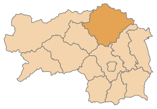
Weiz District
- district of Austria
Hiking in Weiz District
The Weiz District in Austria is a beautiful area for hiking enthusiasts, known for its stunning landscapes, rolling hills, and scenic views. Here are key highlights and insights about hiking in the region:...
- Country:
- Capital: Weiz
- Licence Plate Code: WZ
- Coordinates: 47° 13' 8" N, 15° 41' 24" E
- GPS tracks (wikiloc): [Link]
- AboveSeaLevel: 915 м m
- Area: 1098 sq km
- Population: 86007
- Web site: [Link]


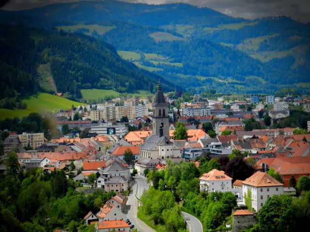
Leoben District
- district of Austria
Hiking in Leoben District
Leoben District, located in Styria, Austria, offers a variety of hiking opportunities for outdoor enthusiasts. The landscape is characterized by rolling hills, rugged mountains, lush forests, and beautiful valleys, making it a picturesque destination for hikers of all skill levels....
- Country:
- Capital: Leoben
- Coordinates: 47° 24' 36" N, 14° 58' 37" E
- GPS tracks (wikiloc): [Link]
- AboveSeaLevel: 849 м m
- Area: 1052 sq km
- Population: 61544
- Web site: [Link]

Graz-Umgebung District
- district in Austria
Hiking in Graz-Umgebung District
Graz-Umgebung District, located around the city of Graz in Austria, offers a wide range of hiking opportunities, featuring scenic landscapes, lush forests, and picturesque hilltops. Here are some highlights and recommendations for hiking in this area:...
- Country:
- Capital: Graz
- Licence Plate Code: GU
- Coordinates: 47° 3' 43" N, 15° 24' 54" E
- GPS tracks (wikiloc): [Link]
- AboveSeaLevel: 522 м m
- Area: 1100.7 sq km
- Population: 148830
- Web site: [Link]

Voitsberg District
- district of Austria
Hiking in Voitsberg District
Voitsberg District, located in the state of Styria, Austria, offers a variety of hiking opportunities that cater to different skill levels and preferences. The region is characterized by its picturesque landscapes, rolling hills, and natural beauty, making it a fantastic destination for outdoor enthusiasts....
- Country:
- Capital: Voitsberg
- Licence Plate Code: VO
- Coordinates: 47° 3' 0" N, 15° 6' 50" E
- GPS tracks (wikiloc): [Link]
- AboveSeaLevel: 509 м m
- Area: 679 sq km
- Population: 51330
- Web site: [Link]

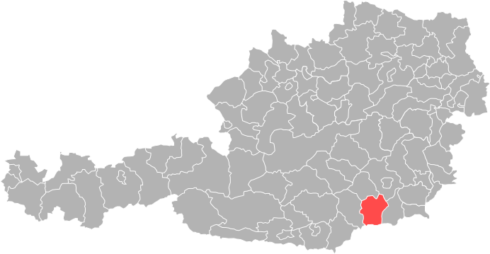
Bruck-Mürzzuschlag District
- district in Austria
Hiking in Bruck-Mürzzuschlag District
Bruck-Mürzzuschlag District, located in the state of Styria, Austria, offers a wealth of hiking opportunities surrounded by stunning natural beauty. The region is characterized by its picturesque mountains, lush forests, and vibrant valleys, making it an ideal destination for both novice and experienced hikers. Here are some highlights and tips for hiking in this area:...
- Country:
- Capital: Bruck an der Mur
- Licence Plate Code: BM
- Coordinates: 47° 25' 0" N, 15° 16' 0" E
- GPS tracks (wikiloc): [Link]
- Area: 2155 sq km
- Web site: [Link]

Hartberg-Fürstenfeld District
- district in Austria
Hiking in Hartberg-Fürstenfeld District
The Hartberg-Fürstenfeld District, located in the Styria region of Austria, offers a variety of hiking opportunities amidst picturesque landscapes. The area is characterized by rolling hills, lush forests, and scenic views of the surrounding mountains, making it an excellent destination for outdoor enthusiasts....
- Country:
- Licence Plate Code: HF
- Coordinates: 47° 16' 0" N, 15° 58' 0" E
- GPS tracks (wikiloc): [Link]
- Area: 1228 sq km
- Web site: [Link]


Südoststeiermark District
- district of Austria
Hiking in Südoststeiermark District
Südoststeiermark District, located in the southern part of Austria, is known for its scenic landscapes, rolling hills, vineyards, and charming villages. Hiking in this region offers a variety of experiences for outdoor enthusiasts, whether you're looking for leisurely walks or more challenging trails....
- Country:
- Capital: Feldbach
- Licence Plate Code: FB
- Coordinates: 46° 57' 0" N, 15° 53' 0" E
- GPS tracks (wikiloc): [Link]
- AboveSeaLevel: 344 м m
- Area: 1009 sq km
- Web site: [Link]
Shares border with regions:


Carinthia
- state of Austria
Hiking in Carinthia
Carinthia, located in the southern part of Austria, is a fantastic destination for hiking enthusiasts. The region is known for its stunning landscapes, which include majestic mountains, deep valleys, pristine lakes, and lush forests. Here are some highlights and tips for hiking in Carinthia:...
- Country:
- Capital: Klagenfurt
- Coordinates: 46° 45' 40" N, 13° 49' 8" E
- GPS tracks (wikiloc): [Link]
- AboveSeaLevel: 1449 м m
- Area: 9535.97 sq km
- Population: 560300
- Web site: [Link]


Upper Austria
- state of Austria
Hiking in Upper Austria
Upper Austria, or "Oberösterreich," offers a diverse range of hiking opportunities, making it a great destination for both beginners and experienced hikers alike. The region is characterized by its picturesque landscapes, including rolling hills, lush valleys, and rugged mountain ranges. Here are some highlights of hiking in Upper Austria:...
- Country:
- Capital: Linz
- Coordinates: 48° 12' 0" N, 14° 0' 0" E
- GPS tracks (wikiloc): [Link]
- AboveSeaLevel: 343 м m
- Area: 11981.92 sq km
- Population: 1453733
- Web site: [Link]

Lower Austria
- federated state of Austria
Hiking in Lower Austria
Lower Austria, known as Niederösterreich in German, is a fantastic destination for hiking enthusiasts. The region is characterized by its diverse landscapes, including rolling hills, vineyards, forests, and the scenic Danube River. Here are some highlights and popular hiking areas in Lower Austria:...
- Country:
- Capital: St. Pölten
- Coordinates: 48° 20' 0" N, 15° 45' 0" E
- GPS tracks (wikiloc): [Link]
- AboveSeaLevel: 279 м m
- Area: 19186.0 sq km
- Population: 1653419
- Web site: [Link]


Burgenland
- state of Austria
Hiking in Burgenland
Burgenland, located in the eastern part of Austria, is a fantastic destination for hiking enthusiasts. This region is known for its diverse landscapes, including rolling hills, vineyards, and scenic views of Lake Neusiedl, which is Central Europe's largest steppe lake. Here are some key aspects of hiking in Burgenland:...
- Country:
- Capital: Eisenstadt
- Coordinates: 47° 30' 0" N, 16° 25' 0" E
- GPS tracks (wikiloc): [Link]
- AboveSeaLevel: 333 м m
- Area: 3961.8 sq km
- Population: 291023
- Web site: [Link]


Salzburg
- state of Austria
Hiking in Salzburg
Salzburg, located in Austria, is renowned for its stunning alpine landscapes and rich cultural heritage, making it a fantastic destination for hiking enthusiasts. Here are some highlights and tips for hiking in the state of Salzburg:...
- Country:
- Capital: Salzburg
- Coordinates: 47° 46' 1" N, 13° 21' 51" E
- GPS tracks (wikiloc): [Link]
- AboveSeaLevel: 827 м m
- Area: 7156.03 sq km
- Population: 545742
- Web site: [Link]