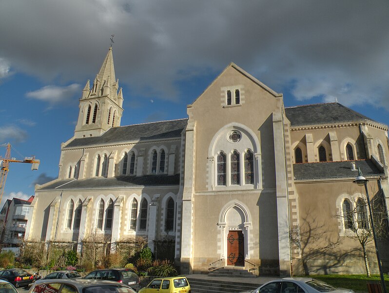
Haute-Goulaine (Haute-Goulaine)

- commune in Loire-Atlantique, France
- Country:

- Postal Code: 44115
- Coordinates: 47° 11' 57" N, 1° 25' 46" E


- GPS tracks (wikiloc): [Link]
- Area: 20.59 sq km
- Population: 5633
- Web site: http://www.mairie-haute-goulaine.fr
- Wikipedia en: wiki(en)
- Wikipedia: wiki(fr)
- Wikidata storage: Wikidata: Q1001970
- Wikipedia Commons Category: [Link]
- Freebase ID: [/m/03nwd8n]
- Freebase ID: [/m/03nwd8n]
- GeoNames ID: Alt: [3013766]
- GeoNames ID: Alt: [3013766]
- SIREN number: [214400715]
- SIREN number: [214400715]
- BnF ID: [152602407]
- BnF ID: [152602407]
- VIAF ID: Alt: [141677523]
- VIAF ID: Alt: [141677523]
- PACTOLS thesaurus ID: [pcrtEzxuKPpMuf]
- PACTOLS thesaurus ID: [pcrtEzxuKPpMuf]
- INSEE municipality code: 44071
- INSEE municipality code: 44071
Shares border with regions:


Le Loroux-Bottereau
- commune in Loire-Atlantique, France
- Country:
- Postal Code: 44430
- Coordinates: 47° 14' 17" N, 1° 20' 57" E
- GPS tracks (wikiloc): [Link]
- Area: 45.31 sq km
- Population: 8031
- Web site: [Link]
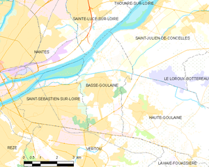
Basse-Goulaine
- commune in Loire-Atlantique, France
- Country:
- Postal Code: 44115
- Coordinates: 47° 12' 42" N, 1° 28' 3" E
- GPS tracks (wikiloc): [Link]
- Area: 13.74 sq km
- Population: 8698
- Web site: [Link]


La Haie-Fouassière
- commune in Loire-Atlantique, France
- Country:
- Postal Code: 44690
- Coordinates: 47° 9' 20" N, 1° 23' 57" E
- GPS tracks (wikiloc): [Link]
- Area: 11.81 sq km
- Population: 4563
- Web site: [Link]


Vertou
- commune in Loire-Atlantique, France
- Country:
- Postal Code: 44120
- Coordinates: 47° 10' 5" N, 1° 28' 17" E
- GPS tracks (wikiloc): [Link]
- Area: 35.68 sq km
- Population: 23124
- Web site: [Link]


Saint-Julien-de-Concelles
- commune in Loire-Atlantique, France
- Country:
- Postal Code: 44450
- Coordinates: 47° 15' 12" N, 1° 23' 8" E
- GPS tracks (wikiloc): [Link]
- Area: 31.74 sq km
- Population: 6860
- Web site: [Link]


La Chapelle-Heulin
- commune in Loire-Atlantique, France
- Country:
- Postal Code: 44330
- Coordinates: 47° 10' 35" N, 1° 20' 26" E
- GPS tracks (wikiloc): [Link]
- Area: 13.47 sq km
- Population: 3266
- Web site: [Link]