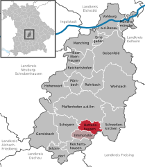
Hettenshausen (Hettenshausen)
- municipality of Germany
Hettenshausen, located in the state of Bavaria, Germany, offers beautiful landscapes ideal for hiking enthusiasts. The area is characterized by rolling hills, lush forests, and scenic views of the surrounding countryside.
Hiking Trails
-
Local Trails: There are several marked trails around Hettenshausen that cater to various skill levels, ranging from easy walks for beginners to more challenging routes for experienced hikers.
-
Nature Paths: You can explore nature paths that provide opportunities to observe local wildlife and flora, adding an educational element to your hike.
-
Scenic Routes: Many trails offer picturesque views of the nearby hills and valleys, and some may take you through charming villages and farmland.
Facilities
- Information Centers: Check for local visitor centers that might provide maps and information about the area’s hiking options.
- Rest Areas: Look for designated rest areas or picnic spots along the trails to enjoy the beauty of nature.
Tips for Hiking in Hettenshausen
- Seasonal Considerations: Be mindful of the weather and the season. Spring and early fall are often ideal for hiking, with mild temperatures and vibrant scenery.
- Footwear and Gear: Wear sturdy hiking boots and bring necessary gear such as water, snacks, and possibly a first-aid kit.
- Safety: Always inform someone of your hiking plans, and try to go with a buddy if possible.
Nearby Attractions
When visiting Hettenshausen, consider exploring other natural and cultural attractions within a short drive or hike, such as the nearby nature reserves or historical sites.
Whether you're looking for a leisurely day hike or a more strenuous adventure, Hettenshausen can provide a rewarding outdoor experience.
- Country:

- Postal Code: 85276
- Local Dialing Code: 08441
- Licence Plate Code: PAF
- Coordinates: 48° 30' 0" N, 11° 30' 0" E


- GPS tracks (wikiloc): [Link]
- AboveSeaLevel: 435 м m
- Area: 18.6 sq km
- Population: 1532
- Web site: http://www.hettenshausen.de
- Wikipedia en: wiki(en)
- Wikipedia: wiki(de)
- Wikidata storage: Wikidata: Q490442
- Wikipedia Commons Category: [Link]
- Freebase ID: [/m/02q6wd9]
- GeoNames ID: Alt: [6556347]
- VIAF ID: Alt: [235212466]
- OSM relation ID: [396551]
- GND ID: Alt: [4471698-9]
- archINFORM location ID: [5865]
- Historical Gazetteer (GOV) ID: [object_300691]
- Bavarikon ID: [ODB_A00001276]
- German municipality key: 09186126

