Hohenthann (Hohenthann)
- municipality of Germany
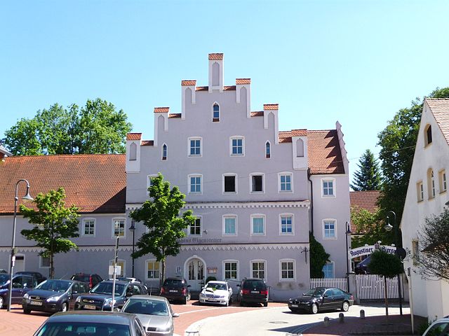
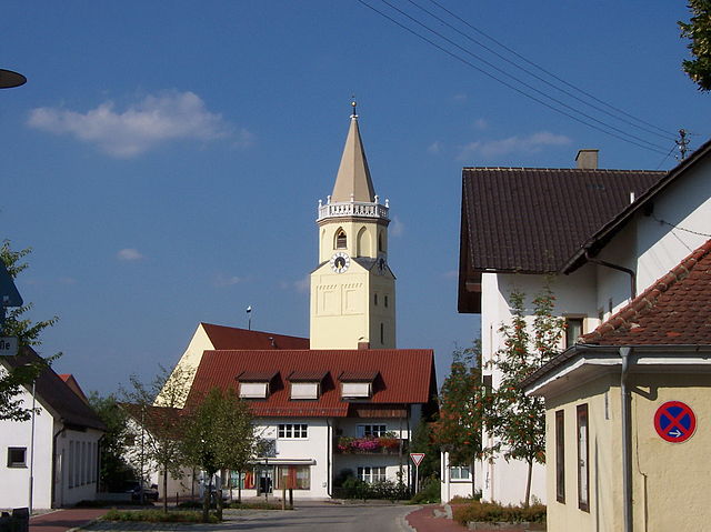
Hohenthann, located in Bavaria, Germany, offers scenic hiking opportunities amidst beautiful natural landscapes. While the specific trails can vary in difficulty, Hohenthann is known for its pleasant countryside, rolling hills, and charming rural scenery.
Hiking Highlights in Hohenthann:
-
Trail Variety: There are a range of hiking trails catering to different skill levels. Some trails are more challenging, while others are suitable for families or casual walkers.
-
Scenic Views: The trails often afford hikers stunning views of the surrounding countryside and the nearby mountains, making for great photo opportunities.
-
Nature: Hohenthann’s trails wind through meadows, forests, and fields, offering a chance to observe local flora and fauna. Keep an eye out for wildlife!
-
Cultural Landmarks: Some hiking routes may take you past historical sites, charming villages, and cultural landmarks that reflect the region's heritage.
-
Local Amenities: Hohenthann may have amenities such as local inns or refreshment stops along the trails, allowing hikers to take a break and enjoy local Bavarian food and drink.
Tips for Hiking in Hohenthann:
- Trail Maps: It’s helpful to have a trail map or a hiking app for navigation, as some trails might not be clearly marked.
- Weather Conditions: Check the weather before heading out, as conditions can change quickly in the region.
- Proper Gear: Wear sturdy hiking boots and dress in layers appropriate for the weather. It’s also wise to carry plenty of water and some snacks.
- Respect Nature: Follow Leave No Trace principles to help maintain the beauty of the area.
Nearby Attractions:
If you have time, explore nearby parks or take a short drive to explore other Bavarian offerings, such as historical towns or natural reserves.
Overall, hiking in Hohenthann can be a rewarding experience, especially for those looking to enjoy the peaceful charm of the Bavarian landscape!
- Country:

- Postal Code: 84098
- Local Dialing Code: 08784
- Licence Plate Code: LA
- Coordinates: 48° 40' 0" N, 12° 6' 0" E


- GPS tracks (wikiloc): [Link]
- AboveSeaLevel: 487 м m
- Area: 68.24 sq km
- Population: 2661
- Web site: http://www.84098-hohenthann.de
- Wikipedia en: wiki(en)
- Wikipedia: wiki(de)
- Wikidata storage: Wikidata: Q512719
- Wikipedia Commons Category: [Link]
- Freebase ID: [/m/02q4fl2]
- GeoNames ID: Alt: [2901398]
- VIAF ID: Alt: [143210587]
- OSM relation ID: [179420]
- GND ID: Alt: [4220787-3]
- archINFORM location ID: [12126]
- Library of Congress authority ID: Alt: [n92062374]
- Bavarikon ID: [ODB_A00001525]
- German municipality key: 09274141
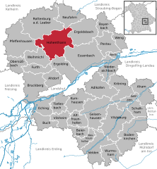
Shares border with regions:


Rottenburg an der Laaber
- municipality of Germany
 Hiking in Rottenburg an der Laaber
Rottenburg an der Laaber is a charming town in Bavaria, Germany, that offers a variety of hiking opportunities in its surrounding landscapes. The region is known for its picturesque countryside, forested areas, and the scenic Laaber River, making it an excellent destination for hikers of all skill levels....
- Country:

- Postal Code: 84056
- Local Dialing Code: 08781
- Coordinates: 48° 42' 7" N, 12° 1' 38" E


- GPS tracks (wikiloc): [Link]
- AboveSeaLevel: 453 м m
- Area: 90.11 sq km
- Population: 7827
- Web site: [Link]


Essenbach
- municipality of Germany
Essenbach, located in Bavaria, Germany, offers a variety of scenic hiking options that cater to different skill levels. The region is characterized by beautiful landscapes, including rolling hills, lush forests, and picturesque fields, making it an attractive destination for outdoor enthusiasts....
- Country:

- Postal Code: 84051
- Local Dialing Code: 08703
- Licence Plate Code: LA
- Coordinates: 48° 37' 0" N, 12° 13' 0" E


- GPS tracks (wikiloc): [Link]
- AboveSeaLevel: 388 м m
- Area: 83.6 sq km
- Population: 7736
- Web site: [Link]
