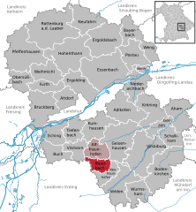
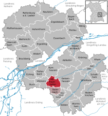
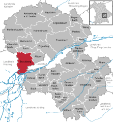
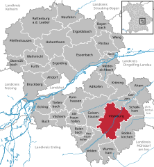
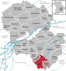
Landshut (Landkreis Landshut)
.svg)
- district in Bavaria, Germany
 Hiking in Landshut
Landshut district, located in Bavaria, Germany, offers a variety of hiking opportunities that cater to different skill levels and preferences. The landscape is characterized by rolling hills, picturesque villages, and lush forests, providing a beautiful backdrop for outdoor activities.
Key Hiking Areas:
-
Isar River Valley: The banks of the Isar River offer scenic trails that are great for leisurely hikes. You can enjoy the natural beauty while following the river, making it ideal for both walking and cycling.
-
Bavarian Forest: While not directly in Landshut district, the outline of the Bavarian Forest National Park isn't far. This extensive protected area is full of well-marked trails for different skill levels, from gentle walks to more challenging hikes.
-
Altmühltal Nature Park: A short drive away, this area features impressive limestone formations, caves, and historical sites. Trails here often lead through charming villages and along the Altmühl River.
Popular Hikes:
-
Trails around Landshut City: There are several trails that start within or near Landshut city itself. These paths mix urban scenery with nature, often leading to viewpoints overlooking the city or the Isar River.
-
Vilstal: The valley of the Vils River offers a range of trails, often featuring wooden footbridges and opportunities to observe local wildlife.
Tips for Hiking in Landshut:
-
Trail Markings: Most trails are well-marked with signs and maps available at trailheads. It's a good idea to have a trail map or download a navigation app for mobile use.
-
Seasonal Considerations: Spring and fall are particularly pleasant for hiking, with mild temperatures and vibrant scenery, but ensure to check weather conditions as they can change rapidly.
-
Gear: Wear comfortable hiking shoes, dress in layers, and always carry enough water and snacks, especially on longer hikes.
-
Local Attractions: Many hikes can combine sightseeing, such as visiting historic landmarks in Landshut like the Trausnitz Castle or the St. Martin's Church.
Conclusion:
Hiking in the Landshut district provides an excellent way to experience the natural beauty and cultural heritage of Bavaria. Whether you’re a seasoned hiker or a casual walker, there’s a trail waiting for you to explore. Remember to respect nature and local regulations while enjoying the great outdoors.
- Country:

- Capital: Landshut
- Licence Plate Code: LA
- Coordinates: 48° 34' 14" N, 12° 10' 50" E


- GPS tracks (wikiloc): [Link]
- AboveSeaLevel: 383 м m
- Area: 1348 sq km
- Population: 115644
- Web site: http://www.landkreis-landshut.de/
- Wikipedia en: wiki(en)
- Wikipedia: wiki(de)
- Wikidata storage: Wikidata: Q10475
- Wikipedia Commons Category: [Link]
- Freebase ID: [/m/01__x7]
- GeoNames ID: Alt: [3220811]
- VIAF ID: Alt: [128044955]
- OSM relation ID: [62657]
- GND ID: Alt: [4034369-8]
- archINFORM location ID: [2488]
- Library of Congress authority ID: Alt: [n2004039680]
- TGN ID: [7077307]
- Historical Gazetteer (GOV) ID: [adm_139274]
- Bavarikon ID: [ODB_A00001509]
- NUTS code: [DE227]
- BabelNet ID: [03023527n]
- German district key: 09274
Includes regions:


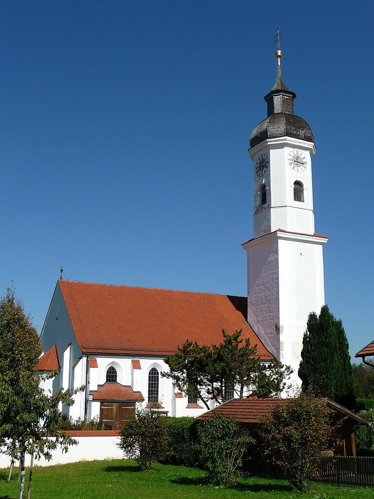
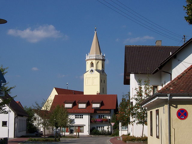
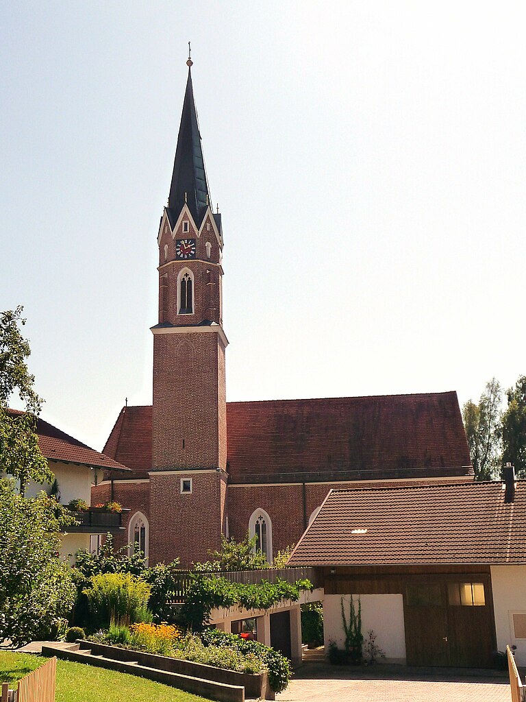
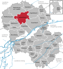
Gerzen
- municipality of Germany
Hiking in Gerzen
Gerzen is a small town located in Bavaria, Germany, and is surrounded by beautiful natural landscapes that make it suitable for hiking. While specific trails may vary, the region typically offers a mix of gentle hills, forests, and scenic views that are great for both beginners and experienced hikers. Here are some tips and information for hiking in and around Gerzen:...
- Country:
- Postal Code: 84175
- Local Dialing Code: 08744
- Licence Plate Code: LA
- Coordinates: 48° 31' 0" N, 12° 25' 0" E
- GPS tracks (wikiloc): [Link]
- AboveSeaLevel: 433 м m
- Area: 17.02 sq km
- Population: 1727
- Web site: [Link]

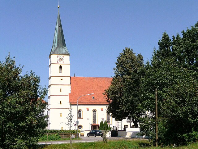
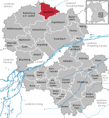
Rottenburg an der Laaber
- municipality of Germany
Hiking in Rottenburg an der Laaber
Rottenburg an der Laaber is a charming town in Bavaria, Germany, that offers a variety of hiking opportunities in its surrounding landscapes. The region is known for its picturesque countryside, forested areas, and the scenic Laaber River, making it an excellent destination for hikers of all skill levels....
- Country:
- Postal Code: 84056
- Local Dialing Code: 08781
- Coordinates: 48° 42' 7" N, 12° 1' 38" E
- GPS tracks (wikiloc): [Link]
- AboveSeaLevel: 453 м m
- Area: 90.11 sq km
- Population: 7827
- Web site: [Link]
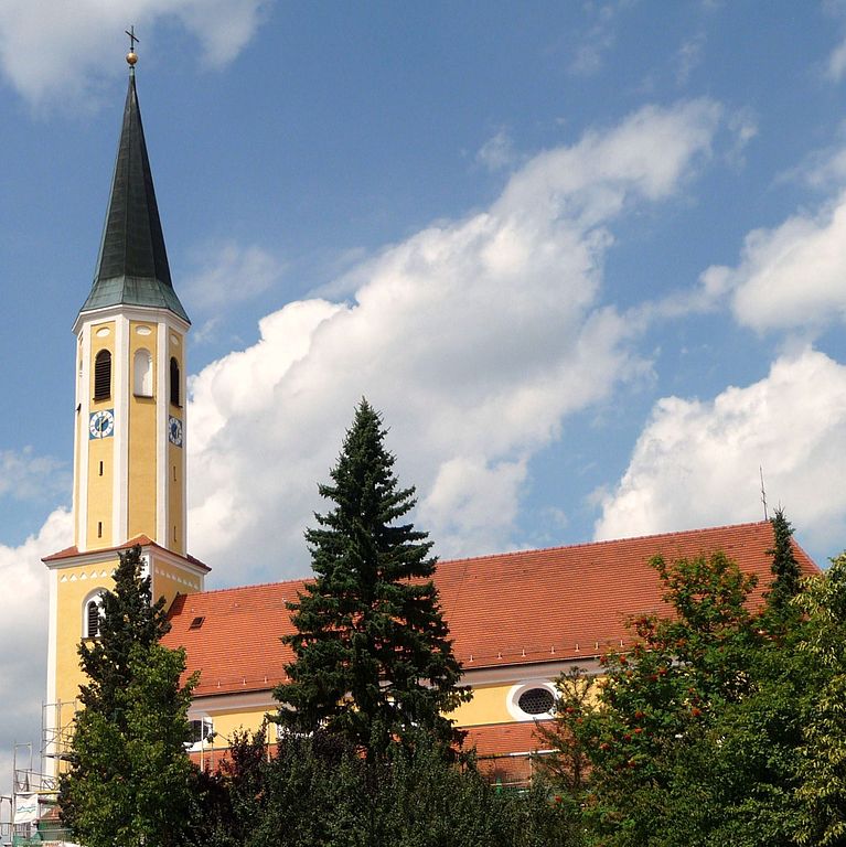
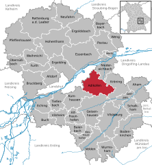
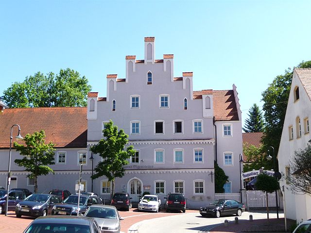
Adlkofen
- municipality of Germany
Hiking in Adlkofen
Adlkofen is a charming municipality located in Bavaria, Germany, not far from Landshut. While it may not be widely known for extensive hiking trails, the region offers a beautiful landscape with rural charm, making it suitable for leisurely walks and exploration of nature....
- Country:
- Postal Code: 84166
- Local Dialing Code: 08707
- Licence Plate Code: LA
- Coordinates: 48° 33' 0" N, 12° 16' 0" E
- GPS tracks (wikiloc): [Link]
- AboveSeaLevel: 499 м m
- Area: 47.85 sq km
- Population: 3090
- Web site: [Link]


Aham
- municipality of Germany
Hiking in Aham
It seems there may be a typo in your request, as "Aham" does not correspond to any known hiking destination. If you meant "Ahwa," located in the Dangs district of Gujarat, India, I can provide information about that area....
- Country:
- Postal Code: 84168
- Local Dialing Code: 08744
- Licence Plate Code: LA
- Coordinates: 48° 32' 0" N, 12° 28' 0" E
- GPS tracks (wikiloc): [Link]
- AboveSeaLevel: 420 м m
- Area: 38.01 sq km
- Population: 1781
- Web site: [Link]

Bayerbach bei Ergoldsbach
- municipality of Germany
Hiking in Bayerbach bei Ergoldsbach
Bayerbach bei Ergoldsbach, located in Bavaria, Germany, is a quaint village surrounded by beautiful landscapes that are perfect for hiking enthusiasts. The area is part of the larger Lower Bavaria region, known for its rolling hills, dense forests, and picturesque meadows....
- Country:
- Postal Code: 84092
- Local Dialing Code: 08774
- Licence Plate Code: LA
- Coordinates: 48° 42' 0" N, 12° 18' 0" E
- GPS tracks (wikiloc): [Link]
- AboveSeaLevel: 409 м m
- Area: 25.41 sq km
- Population: 1349
- Web site: [Link]


Buch am Erlbach
- municipality of Germany
Hiking in Buch am Erlbach
Buch am Erlbach, a municipality in Bavaria, Germany, is surrounded by beautiful natural landscapes, making it a great location for hiking enthusiasts. While it may not be a well-known hiking destination, the area offers several trails that showcase the picturesque Bavarian countryside....
- Country:
- Postal Code: 84172
- Local Dialing Code: 08709
- Licence Plate Code: LA
- Coordinates: 48° 27' 0" N, 12° 3' 0" E
- GPS tracks (wikiloc): [Link]
- AboveSeaLevel: 441 м m
- Area: 26.73 sq km
- Population: 2378
- Web site: [Link]

Ergoldsbach
- municipality of Germany
Hiking in Ergoldsbach
Ergoldsbach, located in Bavaria, Germany, offers some picturesque hiking opportunities that highlight the natural beauty of the region. While it may not be as famous as some larger hiking destinations, it provides a charming and peaceful experience for those looking to escape into nature....
- Country:
- Postal Code: 84061
- Local Dialing Code: 08771
- Licence Plate Code: LA
- Coordinates: 48° 41' 0" N, 12° 12' 0" E
- GPS tracks (wikiloc): [Link]
- AboveSeaLevel: 416 м m
- Area: 56.98 sq km
- Population: 6189
- Web site: [Link]


Eching
- municipality in Landshut, Germany
Hiking in Eching
Eching, located near Landshut in Bavaria, Germany, offers a beautiful countryside setting that is great for hiking enthusiasts. The region is characterized by rolling hills, lush forests, and scenic views of the surrounding landscapes, including the Isar River. While Eching itself may not have extensive hiking trails, it serves as a good starting point for exploring the nearby areas....
- Country:
- Postal Code: 84174
- Local Dialing Code: 08709
- Licence Plate Code: LA
- Coordinates: 48° 30' 0" N, 12° 4' 0" E
- GPS tracks (wikiloc): [Link]
- AboveSeaLevel: 427 м m
- Area: 30.10 sq km
- Population: 2093
- Web site: [Link]


Kumhausen
- municipality of Germany
Hiking in Kumhausen
Kumhausen, located near Landshut in Bavaria, Germany, offers a charming and scenic environment for hiking enthusiasts. While it may not be as well-known as some of the larger hiking areas in the Alps, it still has a lot to offer. Here are some highlights and tips for hiking in and around Kumhausen:...
- Country:
- Postal Code: 84036
- Local Dialing Code: 08743
- Licence Plate Code: LA
- Coordinates: 48° 30' 0" N, 12° 10' 0" E
- GPS tracks (wikiloc): [Link]
- AboveSeaLevel: 488 м m
- Area: 37.04 sq km
- Population: 3416
- Web site: [Link]
Baierbach
- municipality of Germany
Hiking in Baierbach
Baierbach is a small village located in Bavaria, Germany, and it's surrounded by picturesque landscapes, making it an excellent destination for hiking enthusiasts. While it may not be as well-known as some larger hiking areas, it offers a variety of trails that allow hikers to explore the natural beauty of the region....
- Country:
- Postal Code: 84171
- Local Dialing Code: 08705
- Licence Plate Code: LA
- Coordinates: 48° 25' 0" N, 12° 12' 0" E
- GPS tracks (wikiloc): [Link]
- AboveSeaLevel: 418 м m
- Area: 16.76 sq km
- Population: 606
- Web site: [Link]

Bodenkirchen
- municipality of Germany
Hiking in Bodenkirchen
Bodenkirchen is a picturesque village located in Bavaria, Germany. While it may not be as widely known as some of the larger towns in Bavaria, it offers a charming backdrop for hiking enthusiasts. Here are some aspects to consider when planning a hiking trip in and around Bodenkirchen:...
- Country:
- Postal Code: 84155
- Local Dialing Code: 08745
- Licence Plate Code: LA, MAI, MAL, ROL, VIB
- Coordinates: 48° 22' 0" N, 12° 22' 0" E
- GPS tracks (wikiloc): [Link]
- AboveSeaLevel: 470 м m
- Area: 61.99 sq km
- Population: 4476
- Web site: [Link]


Ergolding
- municipality of Germany
Hiking in Ergolding
Ergolding, located in Bavaria, Germany, is a charming area known for its beautiful landscapes and proximity to nature, making it a great spot for hiking enthusiasts. While it may not be as famous as some larger hiking destinations, there are still plenty of opportunities to enjoy the outdoors....
- Country:
- Postal Code: 84030
- Local Dialing Code: 0871
- Coordinates: 48° 35' 0" N, 12° 10' 0" E
- GPS tracks (wikiloc): [Link]
- AboveSeaLevel: 392 м m
- Area: 37.16 sq km
- Population: 9201
- Web site: [Link]

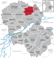
Altfraunhofen
- municipality of Germany
Hiking in Altfraunhofen
Altfraunhofen is a small and picturesque community in Bavaria, Germany, located not far from the Isar River and surrounded by scenic countryside. While it's not one of the more famous hiking destinations in Bavaria, it offers a variety of trails and routes that are suitable for different skill levels. Here are some insights for hiking in and around Altfraunhofen:...
- Country:
- Postal Code: 84169
- Local Dialing Code: 08705
- Licence Plate Code: LA
- Coordinates: 48° 26' 55" N, 12° 10' 2" E
- GPS tracks (wikiloc): [Link]
- AboveSeaLevel: 466 м m
- Area: 24.29 sq km
- Population: 1363
- Web site: [Link]

Essenbach
- municipality of Germany
Hiking in Essenbach
Essenbach, located in Bavaria, Germany, offers a variety of scenic hiking options that cater to different skill levels. The region is characterized by beautiful landscapes, including rolling hills, lush forests, and picturesque fields, making it an attractive destination for outdoor enthusiasts....
- Country:
- Postal Code: 84051
- Local Dialing Code: 08703
- Licence Plate Code: LA
- Coordinates: 48° 37' 0" N, 12° 13' 0" E
- GPS tracks (wikiloc): [Link]
- AboveSeaLevel: 388 м m
- Area: 83.6 sq km
- Population: 7736
- Web site: [Link]


Tiefenbach
- municipality of Germany
Hiking in Tiefenbach
Tiefenbach, located near Landshut in Bavaria, Germany, offers a variety of hiking opportunities that cater to different skill levels and preferences. The region is characterized by beautiful landscapes, including rolling hills, forests, and scenic views of the surrounding countryside....
- Country:
- Postal Code: 84184
- Local Dialing Code: 08709
- Licence Plate Code: LA
- Coordinates: 48° 30' 10" N, 12° 5' 56" E
- GPS tracks (wikiloc): [Link]
- AboveSeaLevel: 454 м m
- Area: 24.71 sq km
- Population: 2590
- Web site: [Link]

Bruckberg
- municipality in Bavaria in Germany
Hiking in Bruckberg
Bruckberg, located in Lower Bavaria, Germany, offers a variety of hiking opportunities that cater to different skill levels. The region is characterized by its scenic landscapes, rolling hills, and lush forests, making it a great destination for outdoor enthusiasts....
- Country:
- Postal Code: 84079
- Local Dialing Code: 08765
- Licence Plate Code: LA
- Coordinates: 48° 32' 0" N, 12° 0' 0" E
- GPS tracks (wikiloc): [Link]
- AboveSeaLevel: 409 м m
- Area: 51.09 sq km
- Population: 3911
- Web site: [Link]


Altdorf
- municipality in the district of Landshut, Bavaria, Germany
Hiking in Altdorf
Altdorf, located in Lower Bavaria, Germany, offers a variety of hiking opportunities in the picturesque landscape of the region. The area is characterized by its rolling hills, forests, and proximity to the Danube River, making it a great destination for outdoor enthusiasts. Here are some highlights and tips for hiking in Altdorf:...
- Country:
- Postal Code: 84032
- Local Dialing Code: 0871
- Licence Plate Code: LA
- Coordinates: 48° 34' 0" N, 12° 7' 0" E
- GPS tracks (wikiloc): [Link]
- AboveSeaLevel: 396 м m
- Area: 22.99 sq km
- Population: 9185
- Web site: [Link]


Postau
- municipality of Germany
Hiking in Postau
Postau is a small town in Bavaria, Germany, known for its serene landscapes and proximity to nature, making it an attractive destination for hiking enthusiasts. While the town itself might not be as widely recognized as major hiking locations, there are beautiful trails and scenic routes in the surrounding region, offering opportunities for varied hiking experiences....
- Country:
- Postal Code: 84103
- Local Dialing Code: 08702
- Licence Plate Code: LA
- Coordinates: 48° 39' 0" N, 12° 20' 0" E
- GPS tracks (wikiloc): [Link]
- AboveSeaLevel: 388 м m
- Area: 34.8 sq km
- Population: 1350
- Web site: [Link]

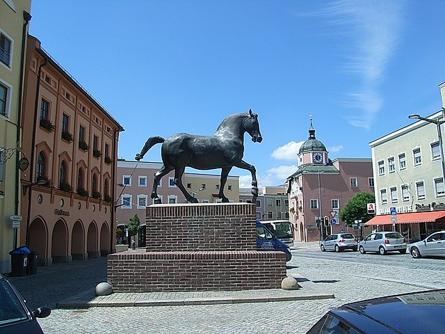
Wurmsham
- municipality of Germany
Hiking in Wurmsham
Wurmsham is a lesser-known area for hiking, so specific information might be limited. However, if you’re looking to explore the outdoors in a region like Wurmsham, you could consider the following tips:...
- Country:
- Postal Code: 84189
- Local Dialing Code: 08745
- Licence Plate Code: LA
- Coordinates: 48° 21' 0" N, 12° 20' 0" E
- GPS tracks (wikiloc): [Link]
- AboveSeaLevel: 480 м m
- Area: 28.17 sq km
- Population: 1232
- Web site: [Link]


Neufraunhofen
- municipality of Germany
Hiking in Neufraunhofen
Neufraunhofen is a charming village located in Bavaria, Germany, surrounded by beautiful landscapes and opportunities for hiking. The region offers a variety of trails suitable for different skill levels, allowing hikers to enjoy the picturesque Bavarian countryside....
- Country:
- Postal Code: 84181
- Local Dialing Code: 08742
- Licence Plate Code: LA
- Coordinates: 48° 24' 0" N, 12° 13' 0" E
- GPS tracks (wikiloc): [Link]
- AboveSeaLevel: 495 м m
- Area: 17.95 sq km
- Population: 969
- Web site: [Link]


Niederaichbach
- municipality of Germany
Hiking in Niederaichbach
Niederaichbach, located in Bavaria, Germany, is surrounded by picturesque landscapes that are ideal for hiking enthusiasts. The region offers a variety of trails suitable for different skill levels, ranging from leisurely walks to more challenging hikes. Here are some key points about hiking in Niederaichbach:...
- Country:
- Postal Code: 84100
- Local Dialing Code: 08702
- Licence Plate Code: LA
- Coordinates: 48° 36' 0" N, 12° 19' 0" E
- GPS tracks (wikiloc): [Link]
- AboveSeaLevel: 376 м m
- Area: 34.06 sq km
- Population: 2396
- Web site: [Link]
Hohenthann
- municipality of Germany
Hiking in Hohenthann
Hohenthann, located in Bavaria, Germany, offers scenic hiking opportunities amidst beautiful natural landscapes. While the specific trails can vary in difficulty, Hohenthann is known for its pleasant countryside, rolling hills, and charming rural scenery....
- Country:
- Postal Code: 84098
- Local Dialing Code: 08784
- Licence Plate Code: LA
- Coordinates: 48° 40' 0" N, 12° 6' 0" E
- GPS tracks (wikiloc): [Link]
- AboveSeaLevel: 487 м m
- Area: 68.24 sq km
- Population: 2661
- Web site: [Link]


Obersüßbach
- municipality of Germany
Hiking in Obersüßbach
Obersüßbach, located in the Bavarian region of Germany, is known for its picturesque landscapes and inviting hiking trails. The area offers a range of hiking options suitable for various skill levels, from leisurely walks suitable for families to more challenging routes for experienced hikers....
- Country:
- Postal Code: 84101
- Local Dialing Code: 08766; 08754; 08708
- Licence Plate Code: LA
- Coordinates: 48° 36' 0" N, 11° 56' 0" E
- GPS tracks (wikiloc): [Link]
- AboveSeaLevel: 472 м m
- Area: 23.6 sq km
- Population: 1128
- Web site: [Link]


Pfeffenhausen
- municipality of Germany
Hiking in Pfeffenhausen
Pfeffenhausen is a charming town located in Bavaria, Germany, which offers a variety of scenic landscapes and hiking opportunities. Whether you're a beginner or an experienced hiker, there are trails and routes suited for different skill levels. Here are some key points to consider when hiking in and around Pfeffenhausen:...
- Country:
- Postal Code: 84076
- Local Dialing Code: 08782
- Licence Plate Code: LA
- Coordinates: 48° 40' 0" N, 11° 58' 0" E
- GPS tracks (wikiloc): [Link]
- AboveSeaLevel: 436 м m
- Area: 71.76 sq km
- Population: 4179
- Web site: [Link]


Schalkham
- municipality of Germany
Hiking in Schalkham
Schalkham is a small village located in Bavaria, Germany, offering a serene environment for outdoor enthusiasts. While it may not be as well-known as some larger hiking destinations, there are several hiking opportunities around the area that you can explore....
- Country:
- Postal Code: 84175
- Local Dialing Code: 08744
- Licence Plate Code: LA
- Coordinates: 48° 28' 0" N, 12° 25' 0" E
- GPS tracks (wikiloc): [Link]
- AboveSeaLevel: 430 м m
- Area: 22.67 sq km
- Population: 888
- Web site: [Link]

Vilsbiburg
- municipality of Germany
Hiking in Vilsbiburg
Vilsbiburg is a charming town located in Bavaria, Germany, and offers several beautiful hiking opportunities in its surrounding areas. Here are some highlights about hiking near Vilsbiburg:...
- Country:
- Postal Code: 84137
- Local Dialing Code: 08741
- Coordinates: 48° 27' 0" N, 12° 20' 0" E
- GPS tracks (wikiloc): [Link]
- AboveSeaLevel: 449 м m
- Area: 68.84 sq km
- Population: 9908
- Web site: [Link]


Vilsheim
- municipality of Germany
Hiking in Vilsheim
Vilsheim, located in Bavaria, Germany, is a charming area that offers various hiking opportunities for outdoor enthusiasts. The region is characterized by picturesque landscapes, including rolling hills, lush forests, and scenic farmland. Here are some highlights you might consider when planning your hiking trip in and around Vilsheim:...
- Country:
- Postal Code: 84186
- Local Dialing Code: 08706
- Licence Plate Code: LA
- Coordinates: 48° 27' 0" N, 12° 7' 0" E
- GPS tracks (wikiloc): [Link]
- AboveSeaLevel: 467 м m
- Area: 21.71 sq km
- Population: 1674
- Web site: [Link]

Weihmichl
- municipality of Germany
Hiking in Weihmichl
Weihmichl is a small village located in Bavaria, Germany, surrounded by beautiful natural landscapes that are perfect for hiking enthusiasts. The region offers a variety of hiking trails that cater to different skill levels, from easy walks to more challenging treks....
- Country:
- Postal Code: 84107
- Local Dialing Code: 08708; 08704
- Licence Plate Code: LA
- Coordinates: 48° 36' 0" N, 12° 3' 0" E
- GPS tracks (wikiloc): [Link]
- AboveSeaLevel: 440 м m
- Area: 32.17 sq km
- Population: 1804
- Web site: [Link]


Wörth an der Isar
- municipality of Germany
Hiking in Wörth an der Isar
Wörth an der Isar is a lovely small town in Bavaria, Germany, located along the banks of the Isar River. It offers a range of outdoor activities, particularly hiking, thanks to its picturesque landscapes and proximity to natural parks....
- Country:
- Postal Code: 84109
- Local Dialing Code: 08702
- Licence Plate Code: LA
- Coordinates: 48° 37' 23" N, 12° 20' 22" E
- GPS tracks (wikiloc): [Link]
- AboveSeaLevel: 369 м m
- Area: 4.84 sq km
- Population: 2851
- Web site: [Link]
Neufahrn in Niederbayern
- municipality of Germany
Hiking in Neufahrn in Niederbayern
Neufahrn in Niederbayern is a charming village located in the Lower Bavaria region of Germany. While it may not be as widely known for its hiking trails as some of the larger national parks or mountainous areas, there are still opportunities for outdoor enthusiasts to explore the beautiful landscapes of the region....
- Country:
- Postal Code: 84088
- Local Dialing Code: 08773
- Licence Plate Code: LA
- Coordinates: 48° 44' 0" N, 12° 11' 0" E
- GPS tracks (wikiloc): [Link]
- AboveSeaLevel: 404 м m
- Area: 38.76 sq km
- Population: 3133
- Web site: [Link]


Weng
- municipality in the district of Landshut in Bavaria in Germany
Hiking in Weng
Weng, located in Bavaria, Germany, is a charming destination for hiking enthusiasts. Nestled in the foothills of the Alps, the area is characterized by stunning landscapes, lush green valleys, and picturesque mountain views. Here are some key points to consider when hiking in Weng:...
- Country:
- Postal Code: 84187
- Local Dialing Code: 08702
- Licence Plate Code: LA
- Coordinates: 48° 40' 0" N, 12° 23' 0" E
- GPS tracks (wikiloc): [Link]
- AboveSeaLevel: 378 м m
- Area: 15.62 sq km
- Population: 1028
- Web site: [Link]

Geisenhausen
- municipality of Germany
Hiking in Geisenhausen
Geisenhausen, located in Bavaria, Germany, offers a variety of hiking opportunities that showcase the beauty of the surrounding countryside and the scenic landscapes of the region. While the area may not be as famous for hiking as some larger national parks in Germany, there are several trails and paths suitable for different skill levels....
- Country:
- Postal Code: 84144
- Local Dialing Code: 08743
- Licence Plate Code: LA
- Coordinates: 48° 28' 0" N, 12° 15' 0" E
- GPS tracks (wikiloc): [Link]
- AboveSeaLevel: 460 м m
- Area: 62.5 sq km
- Population: 5256
- Web site: [Link]


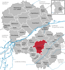
Kröning
- municipality in the district of Landshut in Bavaria in Germany
Hiking in Kröning
Kröning is a small town located in Bavaria, Germany, surrounded by beautiful scenery and opportunities for outdoor activities, including hiking. While it's not as widely known as some other hiking destinations in Germany, the region around Kröning offers picturesque landscapes and a range of trails for all experience levels....
- Country:
- Postal Code: 84178
- Local Dialing Code: 08744
- Licence Plate Code: LA
- Coordinates: 48° 32' 0" N, 12° 22' 0" E
- GPS tracks (wikiloc): [Link]
- AboveSeaLevel: 458 м m
- Area: 39.6 sq km
- Population: 1754
- Web site: [Link]


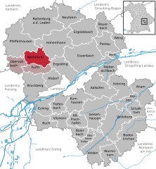
Furth
- municipality of Germany
Hiking in Furth
Furth in Lower Bavaria is a charming village offering a range of hiking opportunities, highlighting the beautiful landscapes and cultural heritage of the region. Here are some aspects to consider when planning a hike in Furth:...
- Country:
- Postal Code: 84032; 84095
- Local Dialing Code: 08704
- Licence Plate Code: LA
- Coordinates: 48° 36' 0" N, 12° 1' 0" E
- GPS tracks (wikiloc): [Link]
- AboveSeaLevel: 429 м m
- Area: 20.96 sq km
- Population: 2154
- Web site: [Link]

Velden
- municipality in Bavaria, Germany
Hiking in Velden
Velden (Vils) is a charming village situated in Bavaria, Germany, nestled near the scenic Vils River and surrounded by picturesque landscapes. Hiking in and around Velden offers a wonderful mix of natural beauty, tranquil paths, and cultural experiences....
- Country:
- Postal Code: 84149
- Local Dialing Code: 08742
- Licence Plate Code: LA
- Coordinates: 48° 22' 0" N, 12° 15' 0" E
- GPS tracks (wikiloc): [Link]
- AboveSeaLevel: 477 м m
- Area: 49.43 sq km
- Population: 4860
- Web site: [Link]
Shares border with regions:

Regensburg
- district of Bavaria, Germany
Hiking in Regensburg
Regensburg is located in the state of Bavaria, Germany, and it offers a variety of hiking opportunities that showcase the region's natural beauty and historical significance. Here's what you can expect when hiking in and around the Regensburg district:...
- Country:
- Capital: Regensburg
- Licence Plate Code: R
- Coordinates: 49° 4' 48" N, 12° 10' 12" E
- GPS tracks (wikiloc): [Link]
- AboveSeaLevel: 390 м m
- Area: 1396.00 sq km
- Population: 144278
- Web site: [Link]

Kelheim
- district in Bavaria, Germany
Hiking in Kelheim
Kelheim, located in Bavaria, Germany, is a beautiful area for hiking, characterized by its stunning landscapes, historical sites, and natural attractions. Here are some highlights you might consider when planning a hiking trip in Kelheim:...
- Country:
- Capital: Kelheim
- Licence Plate Code: ROL; RID; PAR; MAI; KEH
- Coordinates: 48° 49' 48" N, 11° 49' 48" E
- GPS tracks (wikiloc): [Link]
- AboveSeaLevel: 369 м m
- Area: 1067.00 sq km
- Population: 90040
- Web site: [Link]
Rottal-Inn
- district of Bavaria, Germany
Hiking in Rottal-Inn
Rottal-Inn, located in Bavaria, Germany, is a picturesque area known for its natural beauty and diverse landscapes, making it an excellent destination for hiking enthusiasts. The region is characterized by rolling hills, lush forests, and charming villages, providing a variety of hiking trails suitable for all skill levels. Here are some highlights to consider when hiking in Rottal-Inn:...
- Country:
- Capital: Pfarrkirchen
- Licence Plate Code: PAN; VIB; GRI; EG
- Coordinates: 48° 25' 12" N, 12° 55' 12" E
- GPS tracks (wikiloc): [Link]
- AboveSeaLevel: 461 м m
- Area: 1.28 sq km
- Population: 104013
- Web site: [Link]


Dingolfing-Landau
- district in Bavaria, Germany
Hiking in Dingolfing-Landau
Dingolfing-Landau, located in Bavaria, Germany, offers a variety of hiking opportunities for enthusiasts of all levels. The region is known for its picturesque landscapes, charming villages, and diverse flora and fauna. Here are some highlights of hiking in Dingolfing-Landau:...
- Country:
- Capital: Dingolfing
- Licence Plate Code: DGF
- Coordinates: 48° 40' 12" N, 12° 34' 48" E
- GPS tracks (wikiloc): [Link]
- AboveSeaLevel: 372 м m
- Area: 878.00 sq km
- Population: 75517
- Web site: [Link]
Straubing-Bogen
- district of Bavaria, Germany
Hiking in Straubing-Bogen
Straubing-Bogen is a beautiful district located in Bavaria, Germany, known for its picturesque landscapes and varied terrain, making it a great destination for hiking enthusiasts. Here are some highlights and tips for hiking in the region:...
- Country:
- Capital: Straubing
- Licence Plate Code: MAL; BOG; SR
- Coordinates: 48° 55' 12" N, 12° 34' 48" E
- GPS tracks (wikiloc): [Link]
- AboveSeaLevel: 337 м m
- Area: 1202.24 sq km
- Population: 81062
- Web site: [Link]

Freising
- district of Bavaria, Germany
Hiking in Freising
Freising, located in Bavaria, Germany, offers a variety of hiking opportunities suitable for different skill levels and preferences. The district is known for its picturesque landscapes, including rolling hills, scenic views, and lush forests. Here are some highlights if you’re considering hiking in Freising:...
- Country:
- Capital: Freising
- Licence Plate Code: FS
- Coordinates: 48° 30' 0" N, 11° 49' 48" E
- GPS tracks (wikiloc): [Link]
- AboveSeaLevel: 433 м m
- Area: 800.00 sq km
- Population: 118518
- Web site: [Link]

Mühldorf
- district of Bavaria, Germany
Hiking in Mühldorf
Mühldorf District, located in Bavaria, Germany, offers a range of hiking opportunities that cater to different skill levels and preferences. The area features scenic landscapes, including rolling hills, forests, and rivers, making it an attractive destination for nature lovers and outdoor enthusiasts....
- Country:
- Capital: Mühldorf
- Licence Plate Code: MÜ
- Coordinates: 48° 15' 0" N, 12° 25' 12" E
- GPS tracks (wikiloc): [Link]
- AboveSeaLevel: 447 м m
- Area: 805.32 sq km
- Population: 92882

District of Erding
- district of Bavaria, Germany
Hiking in District of Erding
Erding, located in Bavaria, Germany, offers a variety of hiking opportunities for enthusiasts of all skill levels. This district is characterized by its beautiful landscapes, rolling hills, and picturesque villages, making it a wonderful destination for outdoor activities....
- Country:
- Licence Plate Code: ED
- Coordinates: 48° 19' 48" N, 11° 55' 12" E
- GPS tracks (wikiloc): [Link]
- AboveSeaLevel: 480 м m
- Area: 870.44 sq km
- Population: 89190
- Web site: [Link]

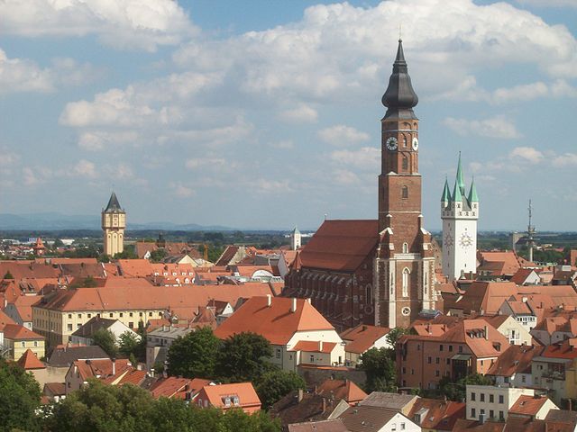
Landshut
- town in Bavaria, Germany
Hiking in Landshut
Landshut, located in Bavaria, Germany, is a charming town with beautiful surrounding landscapes that offer various hiking opportunities. While the town itself is rich in history and culture, the nearby countryside is perfect for outdoor enthusiasts looking to explore nature....
- Country:
- Postal Code: 84028–84036
- Local Dialing Code: 0871
- Licence Plate Code: LA
- Coordinates: 48° 32' 23" N, 12° 9' 3" E
- GPS tracks (wikiloc): [Link]
- AboveSeaLevel: 393 м m
- Area: 65700000 sq km
- Population: 71193
- Web site: [Link]