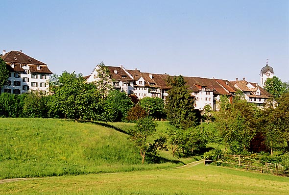
Hombrechtikon (Hombrechtikon)
- municipality in Switzerland
Hombrechtikon is a charming area located in the Zurich Oberland region of Switzerland, surrounded by beautiful landscapes, forests, and lakes. Hiking in and around Hombrechtikon offers a variety of trails that cater to different skill levels and preferences.
Key Hiking Trails:
-
Pfaffhausen to Hombrechtikon: This trail offers a moderate hike with stunning views of the Zurich area. It is well marked and takes you through picturesque meadows and forests.
-
Hombrechtikon to Lake Zurich: A shorter, scenic route leading down to the shores of Lake Zurich. This trail is perfect for those looking for a leisurely walk with beautiful lake views.
-
Uetliberg Mountain: While a bit further away, hiking to Uetliberg is a popular choice for those in the region. It provides stunning panoramic views of the Alps and the city of Zurich.
-
Zürich Oberland Wanderweg: This long-distance trail passes through Hombrechtikon. It connects various charming villages and offers a chance to experience the rural Swiss landscape while enjoying the tranquility of nature.
What to Expect:
- Scenic Views: The region is known for its rolling hills, wooded areas, and stunning views of Lake Zurich and the Alps on clear days.
- Wildlife and Flora: As you hike, you might spot various local wildlife and enjoy the diverse flora that the area has to offer.
- Accessibility: The area is generally accessible for hikers of all ages, but make sure to wear appropriate footwear, as some trails can be steep or uneven.
Tips for Hiking in Hombrechtikon:
- Weather: Always check the weather forecast before heading out, as conditions can change quickly in the mountains.
- Trail Maps: Make use of local maps or GPS apps to navigate the trails effectively.
- Respect Nature: Stay on marked paths, and make sure to pack out what you pack in to help preserve the natural beauty of the area.
- Hydration and Snacks: Bring enough water and snacks, especially on longer hikes.
Overall, hiking in Hombrechtikon is a rewarding experience that allows you to immerse yourself in nature while enjoying the stunning backdrop of the Swiss countryside.
- Country:

- Postal Code: 8634
- Local Dialing Code: 055
- Licence Plate Code: ZH
- Coordinates: 47° 15' 10" N, 8° 46' 7" E


- GPS tracks (wikiloc): [Link]
- AboveSeaLevel: 501 м m
- Area: 12.19 sq km
- Population: 8595
- Web site: http://www.hombrechtikon.ch
- Wikipedia en: wiki(en)
- Wikipedia: wiki(de)
- Wikidata storage: Wikidata: Q69188
- Wikipedia Commons Category: [Link]
- Freebase ID: [/m/0gv0zq]
- GeoNames ID: Alt: [7286106]
- VIAF ID: Alt: [235202488]
- OSM relation ID: [1682143]
- GND ID: Alt: [4368999-1]
- archINFORM location ID: [15647]
- HDS ID: [108]
- Swiss municipality code: [0153]
Shares border with regions:


Bubikon
- municipality in Switzerland
Bubikon, located in the Zurich region of Switzerland, offers picturesque hiking opportunities with breathtaking views of the surrounding landscape. It is part of the Zurich Oberland and is situated near the eastern shores of Lake Zurich. Here are some highlights and tips for hiking in Bubikon:...
- Country:

- Postal Code: 8608
- Local Dialing Code: 055
- Licence Plate Code: ZH
- Coordinates: 47° 16' 10" N, 8° 49' 13" E


- GPS tracks (wikiloc): [Link]
- AboveSeaLevel: 523 м m
- Area: 11.58 sq km
- Population: 7194
- Web site: [Link]


Grüningen
- municipality in Switzerland
Grüningen is a charming municipality located in Switzerland, near the city of Zurich. It offers beautiful landscapes and trails that cater to varying skill levels, making it a great destination for hiking enthusiasts. Here are some highlights about hiking in Grüningen:...
- Country:

- Postal Code: 8627
- Local Dialing Code: 044; 043
- Licence Plate Code: ZH
- Coordinates: 47° 17' 3" N, 8° 45' 45" E


- GPS tracks (wikiloc): [Link]
- AboveSeaLevel: 502 м m
- Area: 8.78 sq km
- Population: 3361
- Web site: [Link]


Oetwil am See
- municipality in Switzerland
Oetwil am See, located in the Zurich district of Switzerland, is a picturesque area that offers lovely hiking opportunities. Nestled near the shores of Lake Zurich, it provides a mix of beautiful natural scenery, trails through lush forests, and views of the lake and the surrounding countryside....
- Country:

- Postal Code: 8618
- Local Dialing Code: 044
- Licence Plate Code: ZH
- Coordinates: 47° 16' 15" N, 8° 43' 16" E


- GPS tracks (wikiloc): [Link]
- AboveSeaLevel: 538 м m
- Area: 6.11 sq km
- Population: 4754
- Web site: [Link]


Stäfa
- municipality in Switzerland
Stäfa, located on the eastern shore of Lake Zurich in Switzerland, is a charming town that offers various hiking opportunities with stunning views of the lake and surrounding landscapes. Here are some highlights for hiking in and around Stäfa:...
- Country:

- Postal Code: 8712
- Local Dialing Code: 044; 043
- Licence Plate Code: ZH
- Coordinates: 47° 14' 24" N, 8° 43' 58" E


- GPS tracks (wikiloc): [Link]
- AboveSeaLevel: 523 м m
- Area: 8.59 sq km
- Population: 14389
- Web site: [Link]


Freienbach
- municipality in the canton of Schwyz, Switzerland
Freienbach, located in the canton of Schwyz in Switzerland, offers beautiful hiking opportunities with stunning views of Lake Zurich and the surrounding mountains. Here are some highlights and tips for hiking in the area:...
- Country:

- Postal Code: 8807
- Local Dialing Code: 055
- Licence Plate Code: SZ
- Coordinates: 47° 11' 45" N, 8° 46' 16" E


- GPS tracks (wikiloc): [Link]
- AboveSeaLevel: 463 м m
- Area: 20.30 sq km
- Population: 16269
- Web site: [Link]

