Meilen District (Bezirk Meilen)
- district of the canton of Zürich, Switzerland
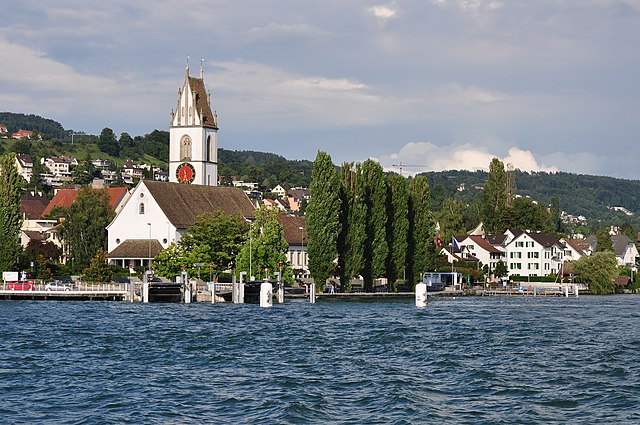
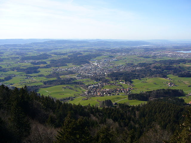
Meilen District, located in the Canton of Zurich in Switzerland, offers several beautiful hiking opportunities with stunning views of Lake Zurich and the surrounding landscapes. Here are some highlights and recommended trails for hiking in the area:
Scenic Trails
-
Zürichsee Promenade: This trail runs along the shores of Lake Zurich and provides a lovely walking experience with views of the water, the city, and the mountains in the distance. It's a relatively easy hike, suitable for all levels.
-
Uetliberg Mountain: Just a short distance from Meilen, the Uetliberg is a popular hiking destination. The trail to the summit offers panoramic views of Zurich, the lake, and the Alps. The ascent can be a bit steep, but the views are rewarding.
-
Wine Trail: The Meilen area is known for its vineyards. Hiking through the wine region allows you to explore terraced vineyards and enjoy wine tasting at local wineries. The trail is picturesque, especially in the fall when the leaves change color.
-
Nature Trails: There are numerous nature trails in the vicinity, which highlight the region's flora and fauna. These trails can vary in difficulty and offer a chance to immerse yourself in the local environment.
Tips for Hiking in Meilen
- Check Weather Conditions: Always check the local weather forecast before heading out, as conditions can change rapidly.
- Wear Proper Footwear: Good hiking shoes are essential, especially on uneven terrain.
- Stay Hydrated and Energized: Bring enough water and snacks to keep your energy up during your hike.
- Trail Markings: Make sure to follow the signs, as Swiss hiking trails are generally well-marked, but it's easy to get turned around in more wooded areas.
- Respect Nature: Follow Leave No Trace principles to help preserve the beautiful natural environment.
Accessibility
Meilen is accessible by public transportation, making it easy to reach the starting points of various hiking trails. The area is well served by local trains and buses.
Conclusion
Meilen District is a great destination for hikers of all levels, offering a mix of scenic walks, challenging hikes, and charming local culture. Whether you're looking for a leisurely stroll along the lake or a more challenging mountain hike, you'll find something to enjoy in this beautiful region of Switzerland.
- Country:

- Capital: Meilen
- Licence Plate Code: ZH
- Coordinates: 47° 16' 0" N, 8° 40' 0" E


- GPS tracks (wikiloc): [Link]
- AboveSeaLevel: 568 м m
- Area: 84.64 sq km
- Wikipedia en: wiki(en)
- Wikipedia: wiki(de)
- Wikidata storage: Wikidata: Q656714
- Wikipedia Commons Category: [Link]
- Freebase ID: [/m/026mm7j]
- GeoNames ID: Alt: [2659702]
- archINFORM location ID: [42722]
- HDS ID: [9423]
Includes regions:


Männedorf
- municipality in Switzerland
Männedorf is a picturesque town located on the shores of Lake Zurich in Switzerland, offering beautiful hiking opportunities with stunning views of the lake and the surrounding mountains. Here are some highlights about hiking in and around Männedorf:...
- Country:

- Postal Code: 8708
- Local Dialing Code: 044
- Licence Plate Code: ZH
- Coordinates: 47° 15' 35" N, 8° 41' 59" E


- GPS tracks (wikiloc): [Link]
- AboveSeaLevel: 498 м m
- Area: 4.78 sq km
- Population: 10957
- Web site: [Link]


Zumikon
- municipality in Switzerland
Zumikon, located in the Zurich district of Switzerland, offers a peaceful hiking experience with beautiful landscapes and easy access to nature. The region is known for its picturesque countryside, forests, and proximity to Lake Zurich, making it an ideal location for both casual and more experienced hikers....
- Country:

- Postal Code: 8126
- Local Dialing Code: 01
- Licence Plate Code: ZH
- Coordinates: 47° 20' 3" N, 8° 37' 34" E


- GPS tracks (wikiloc): [Link]
- AboveSeaLevel: 681 м m
- Area: 5.44 sq km
- Population: 5120
- Web site: [Link]


Uetikon am See
- municipality in Switzerland
Uetikon am See is a charming municipality located on the shores of Lake Zurich in Switzerland, surrounded by picturesque landscapes and natural beauty. Here are some key points about hiking in and around Uetikon am See:...
- Country:

- Postal Code: 8707
- Local Dialing Code: 044
- Licence Plate Code: ZH
- Coordinates: 47° 16' 1" N, 8° 40' 38" E


- GPS tracks (wikiloc): [Link]
- AboveSeaLevel: 450 м m
- Area: 3.49 sq km
- Population: 6145
- Web site: [Link]


Oetwil am See
- municipality in Switzerland
Oetwil am See, located in the Zurich district of Switzerland, is a picturesque area that offers lovely hiking opportunities. Nestled near the shores of Lake Zurich, it provides a mix of beautiful natural scenery, trails through lush forests, and views of the lake and the surrounding countryside....
- Country:

- Postal Code: 8618
- Local Dialing Code: 044
- Licence Plate Code: ZH
- Coordinates: 47° 16' 15" N, 8° 43' 16" E


- GPS tracks (wikiloc): [Link]
- AboveSeaLevel: 538 м m
- Area: 6.11 sq km
- Population: 4754
- Web site: [Link]


Meilen
- municipality in the canton of Zürich, Switzerland
Meilen, located on the shores of Lake Zurich in Switzerland, is a picturesque village that offers a range of hiking trails suitable for different skill levels. Here are some highlights and tips for hiking in the Meilen area:...
- Country:

- Postal Code: 8706
- Local Dialing Code: 01
- Licence Plate Code: ZH
- Coordinates: 47° 16' 13" N, 8° 38' 28" E


- GPS tracks (wikiloc): [Link]
- AboveSeaLevel: 420 м m
- Area: 11.93 sq km
- Population: 13999
- Web site: [Link]


Hombrechtikon
- municipality in Switzerland
Hombrechtikon is a charming area located in the Zurich Oberland region of Switzerland, surrounded by beautiful landscapes, forests, and lakes. Hiking in and around Hombrechtikon offers a variety of trails that cater to different skill levels and preferences....
- Country:

- Postal Code: 8634
- Local Dialing Code: 055
- Licence Plate Code: ZH
- Coordinates: 47° 15' 10" N, 8° 46' 7" E


- GPS tracks (wikiloc): [Link]
- AboveSeaLevel: 501 м m
- Area: 12.19 sq km
- Population: 8595
- Web site: [Link]


Erlenbach
- municipality in Switzerland
Erlenbach, located in the picturesque region of Switzerland, is a fantastic area for hiking enthusiasts. Nestled near Lake Zurich and surrounded by stunning landscapes, it offers a variety of trails that cater to different skill levels, from leisurely strolls to more challenging hikes. Here are some highlights of hiking in and around Erlenbach:...
- Country:

- Postal Code: 8703
- Local Dialing Code: 044
- Licence Plate Code: ZH
- Coordinates: 47° 18' 16" N, 8° 35' 32" E


- GPS tracks (wikiloc): [Link]
- AboveSeaLevel: 412 м m
- Area: 2.97 sq km
- Population: 5567
- Web site: [Link]


Küsnacht
- municipality in Switzerland
Küsnacht, located on the shores of Lake Zurich in Switzerland, offers a range of beautiful hiking opportunities, making it an attractive destination for both novice and experienced hikers. Here are some highlights of hiking in and around Küsnacht:...
- Country:

- Postal Code: 8700
- Local Dialing Code: 01
- Licence Plate Code: ZH
- Coordinates: 47° 19' 5" N, 8° 34' 57" E


- GPS tracks (wikiloc): [Link]
- AboveSeaLevel: 427 м m
- Area: 12.35 sq km
- Population: 14250
- Web site: [Link]


Herrliberg
- municipality in Switzerland
Herrliberg is a picturesque municipality located on the shores of Lake Zurich in Switzerland, nestled amid the breathtaking landscapes of the Swiss Alps. Hiking in Herrliberg offers a wonderful combination of scenic beauty, tranquil lakeside paths, and stunning mountain views....
- Country:

- Postal Code: 8704
- Local Dialing Code: 044; 043
- Licence Plate Code: ZH
- Coordinates: 47° 17' 50" N, 8° 37' 49" E


- GPS tracks (wikiloc): [Link]
- AboveSeaLevel: 646 м m
- Area: 8.97 sq km
- Population: 6290
- Web site: [Link]


Stäfa
- municipality in Switzerland
Stäfa, located on the eastern shore of Lake Zurich in Switzerland, is a charming town that offers various hiking opportunities with stunning views of the lake and surrounding landscapes. Here are some highlights for hiking in and around Stäfa:...
- Country:

- Postal Code: 8712
- Local Dialing Code: 044; 043
- Licence Plate Code: ZH
- Coordinates: 47° 14' 24" N, 8° 43' 58" E


- GPS tracks (wikiloc): [Link]
- AboveSeaLevel: 523 м m
- Area: 8.59 sq km
- Population: 14389
- Web site: [Link]
Shares border with regions:


Uster District
- district of the canton of Zürich, Switzerland
Uster District, located in the canton of Zurich in Switzerland, offers a variety of hiking opportunities that cater to different skill levels and preferences. The lush landscapes, scenic lakes, and picturesque hills make it an appealing destination for nature lovers and outdoor enthusiasts. Here are some highlights and suggestions for hiking in Uster District:...
- Country:

- Capital: Uster
- Licence Plate Code: ZH
- Coordinates: 47° 21' 0" N, 8° 41' 0" E


- GPS tracks (wikiloc): [Link]
- AboveSeaLevel: 433 м m
- Area: 112.35 sq km


Hinwil District
- district of the canton of Zürich, Switzerland
Hinwil District, located in the canton of Zurich in Switzerland, offers a variety of hiking opportunities that cater to all levels of experience. The beautiful landscapes, lush forests, and scenic views make it an attractive destination for outdoor enthusiasts....
- Country:

- Capital: Hinwil
- Licence Plate Code: ZH
- Coordinates: 47° 18' 0" N, 8° 51' 0" E


- GPS tracks (wikiloc): [Link]
- AboveSeaLevel: 558 м m


Zürich District
Hiking in the Zürich District offers a wonderful blend of urban and natural experiences. The area provides a variety of trails that cater to different skill levels, from easy walks suitable for families to more challenging hikes for seasoned adventurers. Here are some popular hiking spots and trails you might consider:...
- Country:

- Capital: Zürich
- Licence Plate Code: ZH
- Coordinates: 47° 23' 0" N, 8° 32' 0" E


- GPS tracks (wikiloc): [Link]
- AboveSeaLevel: 412 м m
- Area: 87.78 sq km
- Web site: [Link]

