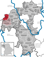
Homburg am Main (Homburg am Main)
- Ortsteil of Triefenstein
 Hiking in Homburg am Main
Homburg am Main, located in Bavaria, Germany, offers a beautiful setting for hiking enthusiasts. Nestled along the banks of the Main River, this quaint town is surrounded by scenic landscapes, including forested hills, vineyards, and picturesque valleys.
Hiking Opportunities:
-
Hiking Trails: The region features a variety of hiking trails suitable for different skill levels. The trails often provide stunning views of the Main River and the surrounding countryside. Popular paths might include sections of the Mainweg, a long-distance trail that follows the river.
-
Nature Reserves: The nearby nature reserves and forests, such as the Spessart Forest, are perfect for longer hikes and nature walks. These areas are rich in wildlife and offer diverse ecosystems.
-
Vineyard Trails: Given its proximity to wine country, some trails might lead through vineyards, allowing hikers to experience the local viticulture and enjoy the beautiful seasonal colors of the grapevines.
-
Historic Sites: Along certain trails, you may encounter historical landmarks, such as old castles, bridges, and traditional Franconian architecture, enriching your hiking experience with cultural insights.
Tips for Hiking in Homburg am Main:
- Local Maps: Make sure to grab a local hiking map or use a reliable GPS app to navigate the trails.
- Weather Preparedness: The weather can change quickly, so dress in layers and check the forecast before heading out.
- Safety: Carry enough water, snacks, and a basic first-aid kit. Share your plans with someone before you set off.
- Wildlife Awareness: Be mindful of the local fauna and flora, respecting nature by following stay-on-path guidelines.
Additional Activities:
- Cycling: In addition to hiking, the area is also suitable for cycling, particularly along the river.
- Local Cuisine: After your hike, treat yourself to local Franconian dishes in the town’s restaurants or wine taverns.
Overall, hiking in Homburg am Main can be a delightful experience, combining natural beauty with cultural heritage. Whether you’re looking for a leisurely stroll or a more challenging hike, the region has something to offer for everyone.
- Country:

- Postal Code: 97855
- Local Dialing Code: 09395
- Coordinates: 49° 47' 35" N, 9° 37' 12" E


- GPS tracks (wikiloc): [Link]
- AboveSeaLevel: 176 м m
- Population: 1301
- Wikidata storage: Wikidata: Q14866511
- OSM relation ID: [5622275]
- GND ID: Alt: [4095606-4]
Shares border with regions:

Trennfeld
- Ortsteil of Triefenstein
Hiking in Trennfeld
Trennfeld is a small municipality located in Bavaria, Germany, which offers a variety of beautiful hiking opportunities. Although it's not as widely known as some larger hiking destinations, it does provide access to scenic landscapes typical of the Franconian countryside....
- Country:
- Postal Code: 97855
- Local Dialing Code: 09395
- Coordinates: 49° 47' 38" N, 9° 36' 57" E
- GPS tracks (wikiloc): [Link]
- AboveSeaLevel: 149 м m
- Area: 10.07 sq km
- Population: 1077

Dertingen
- quarter of Wertheim, Baden-Württemberg, Germany
Hiking in Dertingen
Dertingen is a small district in the municipality of Tauberbischofsheim in Baden-Württemberg, Germany. While it may not be a widely known hiking destination, the surrounding areas in the Tauber Valley and the neighboring regions offer beautiful landscapes, picturesque villages, and various hiking trails....
- Country:
- Postal Code: 97877
- Local Dialing Code: 09397
- Coordinates: 49° 46' 0" N, 9° 37' 10" E
- GPS tracks (wikiloc): [Link]
- AboveSeaLevel: 168 м m
Bettingen
- quarter of Wertheim, Baden-Württemberg, Germany
Hiking in Bettingen
Bettingen is a picturesque area located near Wertheim, Germany, which is known for its beautiful landscapes and rich history. Hiking in this region offers a variety of trails that cater to different skill levels, allowing hikers to experience stunning views, local flora and fauna, and historical landmarks....
- Country:
- Postal Code: 97877
- Local Dialing Code: 09342
- Coordinates: 49° 46' 20" N, 9° 33' 45" E
- GPS tracks (wikiloc): [Link]
- AboveSeaLevel: 150 м m
Tiefenthal
- Part of the municipality Erlenbach bei Marktheidenfeld
Hiking in Tiefenthal
Tiefenthal, a district of Erlenbach bei Marktheidenfeld in Bavaria, Germany, offers a variety of hiking opportunities that showcase the natural beauty of the region. Situated near the banks of the Main River and surrounded by picturesque landscapes, this area is ideal for both leisurely walks and more adventurous hikes....
- Country:
- Postal Code: 97837
- Local Dialing Code: 09391
- Coordinates: 49° 48' 42" N, 9° 39' 29" E
- GPS tracks (wikiloc): [Link]
- AboveSeaLevel: 224 м m
Erlenbach
- Part of the municipality Erlenbach bei Marktheidenfeld
Hiking in Erlenbach
Erlenbach bei Marktheidenfeld is located in the Bavaria region of Germany, nestled within the scenic Main-Spessart district. The area offers numerous hiking opportunities amidst beautiful landscapes that include rolling hills, forests, and the banks of the Main River....
- Country:
- Postal Code: 97837
- Local Dialing Code: 09391
- Coordinates: 49° 49' 8" N, 9° 37' 41" E
- GPS tracks (wikiloc): [Link]
- AboveSeaLevel: 201 м m
Lengfurt
- Ortsteil of Triefenstein
Hiking in Lengfurt
Lengfurt is a charming village located in Bavaria, Germany, positioned along the banks of the Main River. It’s part of the picturesque landscape that offers several opportunities for hiking and enjoying nature. If you're planning to hike in and around Lengfurt, here are some aspects to consider:...
- Country:
- Postal Code: 97855
- Local Dialing Code: 09395
- Coordinates: 49° 48' 36" N, 9° 36' 14" E
- GPS tracks (wikiloc): [Link]
- AboveSeaLevel: 152 м m
- Population: 1609

Remlingen
- market municipality in Bavaria, Germany
Hiking in Remlingen
Remlingen, located in Bavaria, Germany, is a charming small village that offers a variety of outdoor activities, including hiking. Nestled in the scenic landscapes of Southern Germany, it serves as a great starting point for exploring the natural beauty of the region. Here are some highlights and suggestions for hiking in and around Remlingen:...
- Country:
- Postal Code: 97280
- Local Dialing Code: 09369
- Coordinates: 49° 48' 16" N, 9° 41' 39" E
- GPS tracks (wikiloc): [Link]
- AboveSeaLevel: 261 м m
- Area: 20.44 sq km
- Population: 1371
- Web site: [Link]
Wüstenzell
- Ortsteil of Holzkirchen, Lower Franconia
Hiking in Wüstenzell
Wüstenzell, a small village in Germany, is situated in the picturesque region of Bavaria. While it might not be as widely known as some other hiking destinations, it offers excellent opportunities for outdoor enthusiasts looking to explore beautiful landscapes....
- Country:
- Postal Code: 97292
- Local Dialing Code: 09369
- Coordinates: 49° 46' 35" N, 9° 39' 13" E
- GPS tracks (wikiloc): [Link]
- AboveSeaLevel: 197 м m