Hundelshausen (Hundelshausen)
%20in%20SW.svg)
- unincorporated area in Germany
 Hiking in Hundelshausen
Hundelshausen is a small, gemeindefreies Gebiet (unincorporated area) located in the district of Göttingen, Lower Saxony, Germany. This area is not as well-known for its hiking trails compared to larger national parks or established hiking regions, but it offers a serene environment for those looking to immerse themselves in nature.
Hiking in Hundelshausen
-
Scenic Trails: While specific trails may not be extensively marked, the region's countryside is characterized by forested areas, meadows, and rolling hills, providing ample opportunity for exploration. Look for local paths that might lead through woodlands or along small streams.
-
Nature Observation: The tranquility of Hundelshausen makes it a good location for wildlife observation. Bring binoculars to spot local bird species or enjoy the diverse flora that grows in the area.
-
Nearby Attractions: If you want to extend your hiking trip, consider venturing into nearby areas like the Harz Mountains or the Göttingen region, where you'll find more established hiking trails with varied difficulty levels.
-
Preparation: Since Hundelshausen may lack amenities, it’s wise to prepare accordingly. Bring sufficient water, snacks, and a map/GPS device, as mobile service might be limited. Comfortable, sturdy footwear is essential.
-
Respect Nature: As always, practice Leave No Trace principles. Stay on designated trails where possible, pack out what you bring in, and respect wildlife and plant life.
-
Local Resources: Check with local tourism offices or online resources for any seasonal events or guided hikes that may be available, as they can offer valuable insights and enhance your hiking experience.
Whether you’re looking for a peaceful day hike or a more adventurous exploration, Hundelshausen's natural beauty can provide a refreshing experience away from the hustle and bustle of city life.
- Country:

- Coordinates: 49° 55' 48" N, 10° 27' 36" E


- GPS tracks (wikiloc): [Link]
- Wikidata storage: Wikidata: Q9294980
- Wikipedia Commons Category: [Link]
- OSM relation ID: [2593292]
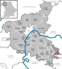
Shares border with regions:

Wustvieler Forst
- unincorporated area in Germany
Hiking in Wustvieler Forst
Wustvieler Forst is a picturesque forest located near the town of Wustweiler in Germany. It offers a range of hiking opportunities suitable for various skill levels, making it a popular destination for both nature enthusiasts and casual walkers....
- Country:
- Coordinates: 49° 54' 45" N, 10° 29' 23" E
- GPS tracks (wikiloc): [Link]