Schweinfurt (Landkreis Schweinfurt)
- district of Bavaria, Germany
Schweinfurt, located in the northern part of Bavaria, Germany, offers a variety of hiking opportunities that showcase the beautiful landscapes of the region. The area is characterized by rolling hills, forests, and scenic valleys, making it ideal for both leisurely strolls and more challenging hikes.
Hiking Options in Schweinfurt:
-
Nature Trails: There are several well-marked nature trails in the region. These often loop through forests and fields, providing hikers with an opportunity to enjoy the local flora and fauna. The trails are generally suitable for all skill levels and can be a great way to experience the tranquility of the Bavarian countryside.
-
Biodiversity Trails: Some trails focus on the region's biodiversity, highlighting local wildlife and plant species. Informational boards along the way can enhance the hiking experience, offering insights into the ecology of the area.
-
Frankenweg: This long-distance hiking trail runs through Franconia and connects various scenic spots. You can explore segments of this trail around Schweinfurt, experiencing a mix of landscapes, local culture, and historical sites.
-
Riverside Paths: The Main River runs near Schweinfurt, and hiking along its banks can offer pleasant views and a chance to see local wildlife, especially bird species. The paths are usually well-maintained and provide a peaceful environment for walking.
-
Local Parks and Recreation Areas: There are several parks within and around Schweinfurt that offer shorter hiking trails. These parks often include picnic areas and benches, making them suitable for family outings.
Hiking Tips:
-
Seasonal Considerations: Spring and fall are particularly beautiful times to hike, with wildflowers blooming and autumn colors painting the landscape. However, winter hikes are also popular if you are prepared for colder weather.
-
Equipment: Wear sturdy hiking shoes and dress in layers, as the weather can change. Bring enough water and snacks, especially on longer hikes.
-
Maps and Navigation: While trails are generally well-marked, having a map or a hiking app on your phone can be helpful. If you're venturing off more popular trails, make sure to familiarize yourself with the area.
-
Local Guidance: Consider joining local hiking groups or guided tours for a more in-depth experience of the area.
Overall, hiking in Schweinfurt and its surrounding district offers a mix of scenic beauty, tranquility, and opportunities to connect with nature, making it a rewarding destination for both novice and experienced hikers.
- Country:

- Capital: Schweinfurt
- Licence Plate Code: GEO; SW
- Coordinates: 50° 1' 12" N, 10° 15' 36" E


- GPS tracks (wikiloc): [Link]
- AboveSeaLevel: 222 м m
- Area: 842.00 sq km
- Population: 103697
- Web site: http://www.landkreis-schweinfurt.de/
- Wikipedia en: wiki(en)
- Wikipedia: wiki(de)
- Wikidata storage: Wikidata: Q10461
- Wikipedia Commons Gallery: [Link]
- Wikipedia Commons Category: [Link]
- Freebase ID: [/m/02mkw3]
- GeoNames ID: Alt: [3220896]
- VIAF ID: Alt: [144271349]
- OSM relation ID: [62530]
- GND ID: Alt: [4053865-5]
- archINFORM location ID: [2607]
- Library of Congress authority ID: Alt: [n82116509]
- TGN ID: [7077075]
- Bavarikon ID: [ODB_A00000462]
- NUTS code: [DE26B]
- German district key: 09678
Includes regions:
Nonnenkloster
- unincorporated area in Germany
Nonnenkloster, located in the Unterfranken region of Germany, offers a serene and picturesque setting for hiking enthusiasts. The area is known for its beautiful landscapes, including forests, rolling hills, and charming villages. Here are some insights into hiking in Nonnenkloster:...
- Country:

- Coordinates: 49° 53' 24" N, 10° 26' 0" E


- GPS tracks (wikiloc): [Link]

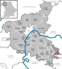
Wustvieler Forst
- unincorporated area in Germany
Wustvieler Forst is a picturesque forest located near the town of Wustweiler in Germany. It offers a range of hiking opportunities suitable for various skill levels, making it a popular destination for both nature enthusiasts and casual walkers....
- Country:

- Coordinates: 49° 54' 45" N, 10° 29' 23" E


- GPS tracks (wikiloc): [Link]

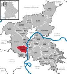
Waigolshausen
- municipality of Germany
Waigolshausen is a small village located in Germany, specifically in the state of Bavaria. While it may not be as widely recognized as a hiking destination compared to larger national parks or mountainous regions, the surrounding areas in Bavaria offer plenty of opportunities for outdoor activities, including hiking....
- Country:

- Postal Code: 97534
- Local Dialing Code: 09722
- Licence Plate Code: SW
- Coordinates: 49° 57' 0" N, 10° 8' 0" E


- GPS tracks (wikiloc): [Link]
- AboveSeaLevel: 247 м m
- Area: 23.74 sq km
- Population: 2614
- Web site: [Link]
Stollbergerforst
- unincorporated area in Germany
Stollbergerforst, located in Germany, is known for its beautiful natural landscapes and diverse hiking trails. The forest offers a mix of terrain, including wooded areas, hills, and charming vistas, making it a great destination for hikers of all skill levels....
- Country:

- Coordinates: 49° 52' 48" N, 10° 26' 35" E


- GPS tracks (wikiloc): [Link]


Röthlein
- municipality of Germany
Röthlein is a small village located in Bavaria, Germany, near the Main river. While it's not a widely known hiking destination, there are opportunities for outdoor activities in the surrounding areas, which feature beautiful landscapes typical of the region....
- Country:

- Postal Code: 97520
- Local Dialing Code: 09723
- Licence Plate Code: SW
- Coordinates: 49° 58' 0" N, 10° 13' 0" E


- GPS tracks (wikiloc): [Link]
- AboveSeaLevel: 211 м m
- Area: 19.09 sq km
- Population: 3933
- Web site: [Link]
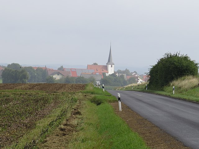
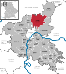
Üchtelhausen
- municipality of Germany
Üchtelhausen is a small municipality located in Bavaria, Germany, surrounded by picturesque landscapes, woodlands, and farmland that make it an inviting destination for hiking enthusiasts. While there may not be extensive trail networks as found in larger national parks or mountain areas, there are still plenty of opportunities for enjoyable hikes in and around the region....
- Country:

- Postal Code: 97532
- Local Dialing Code: 09720
- Licence Plate Code: SW
- Coordinates: 50° 5' 0" N, 10° 16' 0" E


- GPS tracks (wikiloc): [Link]
- AboveSeaLevel: 322 м m
- Area: 62.12 sq km
- Population: 3717
- Web site: [Link]


Stadtlauringen
- municipality of Germany
Stadtlauringen is a picturesque village located in the Lower Franconia region of Bavaria, Germany. While it might not be the most famous hiking destination, it offers a variety of trails and natural beauty that can appeal to both novice and experienced hikers....
- Country:

- Postal Code: 97488
- Local Dialing Code: 09724
- Licence Plate Code: SW
- Coordinates: 50° 11' 17" N, 10° 21' 34" E


- GPS tracks (wikiloc): [Link]
- AboveSeaLevel: 290 м m
- Area: 63.61 sq km
- Population: 4055
- Web site: [Link]


Gerolzhofen
- municipality of Germany
Gerolzhofen is a charming town located in Bavaria, Germany, surrounded by beautiful landscapes that offer great hiking opportunities. The region is characterized by rolling hills, vineyards, and scenic countryside, making it ideal for outdoor enthusiasts. Here are some key points about hiking in and around Gerolzhofen:...
- Country:

- Postal Code: 97447
- Local Dialing Code: 09382
- Coordinates: 49° 54' 0" N, 10° 21' 0" E


- GPS tracks (wikiloc): [Link]
- AboveSeaLevel: 244 м m
- Area: 18.35 sq km
- Population: 6902
- Web site: [Link]


Werneck
- town in Bavaria, Germany
Werneck is a picturesque town located in Bavaria, Germany, known for its scenic landscapes and outdoor activities, including hiking. While it might not be one of the most famous hiking destinations in Germany, there are several opportunities to enjoy nature and explore the surrounding areas. Here are some key points about hiking in and around Werneck:...
- Country:

- Postal Code: 97440
- Local Dialing Code: 09722
- Licence Plate Code: SW
- Coordinates: 49° 59' 0" N, 10° 6' 0" E


- GPS tracks (wikiloc): [Link]
- AboveSeaLevel: 222 м m
- Area: 73.56 sq km
- Population: 10177
- Web site: [Link]


Dingolshausen
- municipality of Germany
Dingolshausen, a quaint village in Bavaria, Germany, offers picturesque hiking opportunities amidst scenic landscapes. While the area may not be widely known as a hiking hotspot, it benefits from the rich natural surroundings typical of the Franconian countryside....
- Country:

- Postal Code: 97497
- Local Dialing Code: 09382
- Licence Plate Code: SW
- Coordinates: 49° 54' 0" N, 10° 24' 0" E


- GPS tracks (wikiloc): [Link]
- AboveSeaLevel: 270 м m
- Area: 10.23 sq km
- Population: 1105
- Web site: [Link]
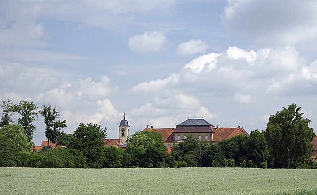

Sulzheim
- municipality of Germany
Sulzheim is a small town in Bavaria, Germany, surrounded by picturesque landscapes that are ideal for hiking enthusiasts. The region offers a mix of rolling hills, forested areas, and agricultural fields, providing a range of hiking options suitable for different skill levels....
- Country:

- Postal Code: 97529
- Local Dialing Code: 09382
- Licence Plate Code: SW
- Coordinates: 49° 57' 0" N, 10° 20' 0" E


- GPS tracks (wikiloc): [Link]
- AboveSeaLevel: 227 м m
- Area: 26.77 sq km
- Population: 1764
- Web site: [Link]


Frankenwinheim
- municipality of Germany
Frankenwinheim is a picturesque area located in Bavaria, Germany, known for its beautiful landscapes and outdoor activities, including hiking. The region offers a variety of hiking trails that cater to different skill levels, allowing both beginners and experienced hikers to enjoy the natural beauty of the countryside....
- Country:

- Postal Code: 97447
- Local Dialing Code: 09382
- Licence Plate Code: SW
- Coordinates: 49° 53' 14" N, 10° 18' 51" E


- GPS tracks (wikiloc): [Link]
- AboveSeaLevel: 237 м m
- Area: 14.73 sq km
- Population: 890
- Web site: [Link]


Wipfeld
- municipality of Germany
Wipfeld is a charming village located in Bavaria, Germany, near the banks of the Main River. While it's not one of the most widely recognized hiking destinations, it offers access to beautiful natural landscapes and a taste of local culture. Here are some highlights of hiking in and around Wipfeld:...
- Country:

- Postal Code: 97537
- Local Dialing Code: 09384
- Licence Plate Code: SW
- Coordinates: 49° 55' 0" N, 10° 10' 0" E


- GPS tracks (wikiloc): [Link]
- AboveSeaLevel: 225 м m
- Area: 5.24 sq km
- Population: 1027
- Web site: [Link]


Schonungen
- municipality of Germany
Schönungen is located in Bavaria, Germany, and offers a variety of opportunities for hiking enthusiasts. The region is characterized by its picturesque landscapes, including lush forests, rolling hills, and scenic river valleys, particularly along the Main River....
- Country:

- Postal Code: 97453
- Local Dialing Code: 09727; 09721; 09526
- Licence Plate Code: SW
- Coordinates: 50° 3' 0" N, 10° 19' 0" E


- GPS tracks (wikiloc): [Link]
- AboveSeaLevel: 218 м m
- Area: 81.03 sq km
- Population: 7739
- Web site: [Link]


Schwebheim
- municipality in the district of Schweinfurt in Bavaria, Germany
Schwebheim is a charming municipality located in Bavaria, Germany, near the city of Schweinfurt. While it may not be as widely recognized as some larger hiking destinations, it offers a range of scenic trails and outdoor opportunities for hiking enthusiasts....
- Country:

- Postal Code: 97525
- Local Dialing Code: 09723
- Licence Plate Code: SW
- Coordinates: 49° 59' 50" N, 10° 14' 45" E


- GPS tracks (wikiloc): [Link]
- AboveSeaLevel: 213 м m
- Area: 8.10 sq km
- Population: 3312
- Web site: [Link]


Bergrheinfeld
- municipality of Germany
Bergrheinfeld is a small village located in Bavaria, Germany, known for its picturesque landscapes and proximity to natural areas suitable for hiking. Here are some highlights regarding hiking in and around Bergrheinfeld:...
- Country:

- Postal Code: 97493
- Local Dialing Code: 09722; 09721
- Licence Plate Code: SW
- Coordinates: 50° 0' 0" N, 10° 10' 0" E


- GPS tracks (wikiloc): [Link]
- AboveSeaLevel: 208 м m
- Area: 19.87 sq km
- Population: 4456
- Web site: [Link]
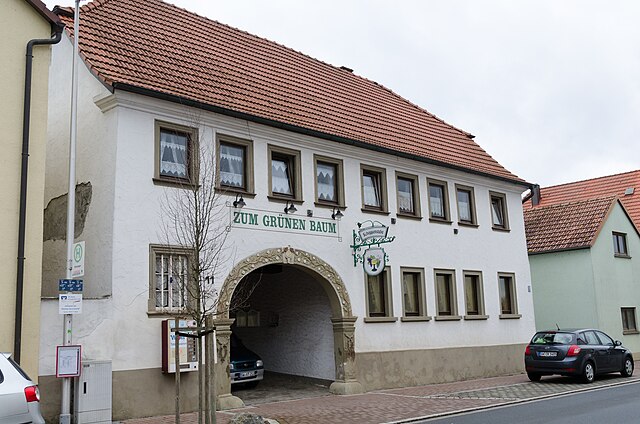

Poppenhausen
- municipality of Germany
Poppenhausen, located in the picturesque Rhön region of Germany, offers a variety of hiking opportunities for both beginners and experienced hikers alike. This charming village is an ideal starting point for exploring the stunning landscapes, diverse ecosystems, and unique geological formations that the Rhön has to offer....
- Country:

- Postal Code: 97490
- Local Dialing Code: 09725
- Licence Plate Code: SW
- Coordinates: 50° 6' 0" N, 10° 9' 0" E


- GPS tracks (wikiloc): [Link]
- AboveSeaLevel: 250 м m
- Area: 39.13 sq km
- Population: 3682
- Web site: [Link]


Donnersdorf
- municipality of Germany
Donnersdorf is a small municipality located in Bavaria, Germany, known for its picturesque landscapes and serene natural surroundings. While it may not be as famous as some larger hiking destinations, it offers several opportunities for those looking to explore the outdoors. Here are some key points about hiking in and around Donnersdorf:...
- Country:

- Postal Code: 97499
- Local Dialing Code: 09528
- Licence Plate Code: SW
- Coordinates: 49° 58' 0" N, 10° 25' 0" E


- GPS tracks (wikiloc): [Link]
- AboveSeaLevel: 251 м m
- Area: 26.97 sq km
- Population: 1699
- Web site: [Link]


Geldersheim
- municipality of Germany
Geldersheim is a small village located in the Bavaria region of Germany, offering various opportunities for hiking enthusiasts. While it may not be widely known as a hiking hotspot, its surrounding areas feature beautiful landscapes and trails that appeal to nature lovers....
- Country:

- Postal Code: 97505
- Local Dialing Code: 09721
- Licence Plate Code: SW
- Coordinates: 50° 3' 0" N, 10° 9' 0" E


- GPS tracks (wikiloc): [Link]
- AboveSeaLevel: 234 м m
- Area: 15.33 sq km
- Population: 2350
- Web site: [Link]

Kolitzheim
- municipality of Germany
Kolitzheim is a small town in Bavaria, Germany, which offers a picturesque setting for hiking enthusiasts. Surrounded by beautiful natural landscapes, including forests, rivers, and rolling hills, it serves as an excellent base for several hiking opportunities....
- Country:

- Postal Code: 97509
- Local Dialing Code: 09723; 09385; 09381
- Licence Plate Code: SW
- Coordinates: 49° 55' 0" N, 10° 14' 0" E


- GPS tracks (wikiloc): [Link]
- AboveSeaLevel: 229 м m
- Area: 59.02 sq km
- Population: 4990
- Web site: [Link]


Schwanfeld
- municipality of Germany
Schwanfeld is a charming village located in the Lower Franconia region of Bavaria, Germany. While it may not be as well-known as some major hiking destinations, the surrounding countryside offers some lovely outdoor experiences for those looking to hike in this area....
- Country:

- Postal Code: 97523
- Local Dialing Code: 09384
- Licence Plate Code: SW
- Coordinates: 49° 55' 0" N, 10° 8' 0" E


- GPS tracks (wikiloc): [Link]
- AboveSeaLevel: 242 м m
- Area: 12.00 sq km
- Population: 1643
- Web site: [Link]


Oberschwarzach
- human settlement in Germany
Oberschwarzach is a charming area located in Bavaria, Germany, known for its picturesque landscapes and opportunities for outdoor activities, including hiking. The region is characterized by rolling hills, lush forests, and well-marked trails, making it an excellent destination for both casual walkers and more experienced hikers....
- Country:

- Postal Code: 97516
- Local Dialing Code: 09382
- Licence Plate Code: SW
- Coordinates: 49° 52' 0" N, 10° 25' 0" E


- GPS tracks (wikiloc): [Link]
- AboveSeaLevel: 278 м m
- Area: 24.51 sq km
- Population: 1397
- Web site: [Link]

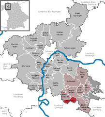
Lülsfeld
- municipality of Germany
Lülsfeld, a quaint village located in the Franconia region of Germany, offers various opportunities for hiking and outdoor activities. The surrounding area is characterized by picturesque landscapes, rolling hills, and scenic woodlands, making it an excellent destination for nature enthusiasts....
- Country:

- Postal Code: 97511
- Local Dialing Code: 09382
- Licence Plate Code: SW
- Coordinates: 49° 52' 0" N, 10° 20' 0" E


- GPS tracks (wikiloc): [Link]
- AboveSeaLevel: 252 м m
- Area: 11.20 sq km
- Population: 819
- Web site: [Link]
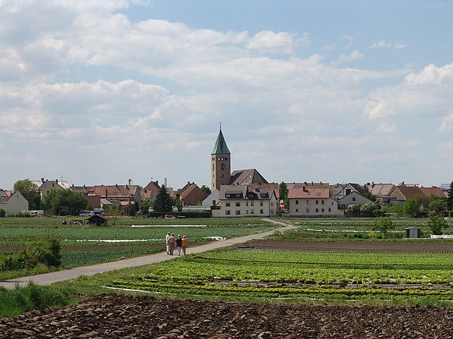

Sennfeld
- municipality of Germany
Sennfeld, a charming area located in Germany, offers several hiking opportunities that allow you to enjoy its picturesque landscapes and nature. While it's not as widely known as some major hiking destinations, it does provide a mixture of scenic routes, historical insights, and cultural experiences....
- Country:

- Postal Code: 97526
- Local Dialing Code: 09721
- Licence Plate Code: SW
- Coordinates: 50° 1' 0" N, 10° 16' 0" E


- GPS tracks (wikiloc): [Link]
- AboveSeaLevel: 214 м m
- Area: 6.98 sq km
- Population: 3970
- Web site: [Link]

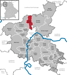
Dittelbrunn
- municipality of Germany
Dittelbrunn is a charming municipality located in Bavaria, Germany, near the larger city of Schweinfurt. The surrounding area boasts beautiful landscapes and nature, making it a great destination for hiking enthusiasts....
- Country:

- Postal Code: 97456
- Local Dialing Code: 09738; 09725; 09721
- Licence Plate Code: SW
- Coordinates: 50° 5' 42" N, 10° 12' 34" E


- GPS tracks (wikiloc): [Link]
- AboveSeaLevel: 237 м m
- Area: 23.84 sq km
- Population: 6838
- Web site: [Link]


Euerbach
- municipality of Germany
Euerbach, located in the picturesque region of Bavaria, Germany, is a great destination for hiking enthusiasts. The area offers a range of trails that cater to various skill levels, from leisurely strolls to more challenging hikes. Here are some key points about hiking in Euerbach:...
- Country:

- Postal Code: 97502
- Local Dialing Code: 09726
- Licence Plate Code: SW
- Coordinates: 50° 4' 0" N, 10° 7' 0" E


- GPS tracks (wikiloc): [Link]
- AboveSeaLevel: 238 м m
- Area: 17.40 sq km
- Population: 2627
- Web site: [Link]

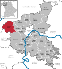
Wasserlosen
- municipality of Germany
Wasserlosen is a small municipality in Bavaria, Germany, known for its peaceful landscapes and rural charm. While it may not be a bustling hiking destination like some larger national parks, it offers several opportunities for hiking and enjoying nature....
- Country:

- Postal Code: 97535
- Local Dialing Code: 09726
- Licence Plate Code: SW
- Coordinates: 50° 5' 41" N, 10° 1' 49" E


- GPS tracks (wikiloc): [Link]
- AboveSeaLevel: 340 м m
- Area: 51.32 sq km
- Population: 3170
- Web site: [Link]
Grettstadt
- municipality of Germany
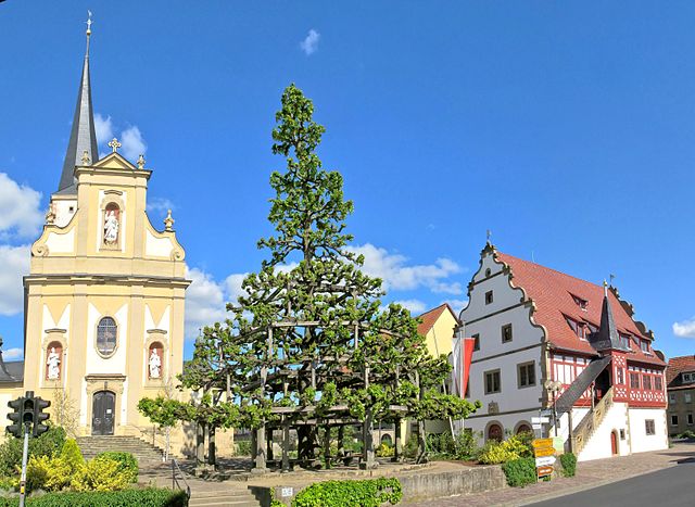
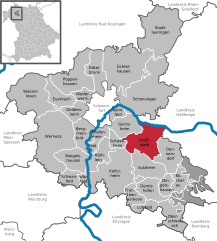
Grettstadt is a small municipality located in Bavaria, Germany, known for its picturesque landscapes and scenic surroundings. While it may not be as well-known as some larger hiking destinations, it offers the charm of the Bavarian countryside, making it a lovely spot for hiking enthusiasts who appreciate quieter trails and the beauty of nature....
- Country:

- Postal Code: 97508
- Local Dialing Code: 09729
- Licence Plate Code: SW
- Coordinates: 49° 59' 0" N, 10° 19' 0" E


- GPS tracks (wikiloc): [Link]
- AboveSeaLevel: 232 м m
- Area: 34.93 sq km
- Population: 3527
- Web site: [Link]


Gochsheim
- municipality of Germany
Gochsheim is a charming area in Germany, specifically located in the Bavaria region near the city of Schweinfurt. While the town itself might not be a prominent hiking destination compared to larger parks and national forests, it offers access to beautiful scenic landscapes and trails that can be enjoyed by hikers of various skill levels....
- Country:

- Postal Code: 97469
- Local Dialing Code: 09721
- Licence Plate Code: SW
- Coordinates: 50° 1' 0" N, 10° 17' 0" E


- GPS tracks (wikiloc): [Link]
- AboveSeaLevel: 236 м m
- Area: 21.00 sq km
- Population: 5997
- Web site: [Link]


Michelau im Steigerwald
- municipality of Germany
 Hiking in Michelau im Steigerwald
Michelau im Steigerwald is a charming village located in the Steigerwald region of Bavaria, Germany. This area is known for its beautiful landscapes, dense forests, and rolling hills, making it an excellent destination for hiking enthusiasts. Here are some highlights and tips for hiking in and around Michelau im Steigerwald:...
- Country:

- Postal Code: 97513
- Local Dialing Code: 09382
- Licence Plate Code: SW
- Coordinates: 49° 53' 59" N, 10° 25' 59" E


- GPS tracks (wikiloc): [Link]
- AboveSeaLevel: 291 м m
- Area: 14.15 sq km
- Population: 1068
- Web site: [Link]


Niederwerrn
- municipality of Germany
Niederwerrn is a small village in Bavaria, Germany, and while it may not be as well-known for hiking as larger national parks or mountainous regions, it offers some charming opportunities for outdoor enthusiasts. The surrounding countryside features scenic rural landscapes, fields, and wooded areas that can provide a variety of trails for walking and hiking....
- Country:

- Postal Code: 97464
- Local Dialing Code: 09721
- Licence Plate Code: SW
- Coordinates: 50° 4' 0" N, 10° 10' 59" E


- GPS tracks (wikiloc): [Link]
- AboveSeaLevel: 240 м m
- Area: 9.77 sq km
- Population: 6146
- Web site: [Link]


Grafenrheinfeld
- municipality of Germany
Grafenrheinfeld is a small municipality located in Bavaria, Germany, near the Main River and not far from larger cities like Schweinfurt. While it might not be as famous for hiking as some other regions in Germany, there are opportunities for outdoor activities in and around Grafenrheinfeld....
- Country:

- Postal Code: 97506
- Local Dialing Code: 09723
- Licence Plate Code: SW
- Coordinates: 50° 0' 0" N, 10° 12' 0" E


- GPS tracks (wikiloc): [Link]
- AboveSeaLevel: 208 м m
- Area: 11.35 sq km
- Population: 2918
- Web site: [Link]

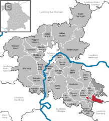
Bürgerwald
- unincorporated area in Germany
Bürgerwald, located in Landkreis Schweinfurt in Bavaria, Germany, is a beautiful area well-suited for hiking enthusiasts. The region is characterized by lush forests, serene landscapes, and a rich variety of flora and fauna, making it a great destination for outdoor activities....
- Country:

- Coordinates: 49° 53' 0" N, 10° 27' 0" E


- GPS tracks (wikiloc): [Link]
Geiersberg
- unincorporated area in Germany
Geiersberg, located in a gemeindefreies Gebiet (municipality-free zone) in Bavaria, Germany, is an excellent destination for hiking enthusiasts. The region is characterized by its serene natural beauty, dense forests, rolling hills, and diverse wildlife. Here are some key points to consider when planning a hike in this area:...
- Country:

- Coordinates: 49° 51' 50" N, 10° 26' 0" E


- GPS tracks (wikiloc): [Link]
Hundelshausen
- unincorporated area in Germany
Hundelshausen is a small, gemeindefreies Gebiet (unincorporated area) located in the district of Göttingen, Lower Saxony, Germany. This area is not as well-known for its hiking trails compared to larger national parks or established hiking regions, but it offers a serene environment for those looking to immerse themselves in nature....
- Country:

- Coordinates: 49° 55' 48" N, 10° 27' 36" E


- GPS tracks (wikiloc): [Link]
Vollburg
- unincorporated area in Germany
Vollburg, located in Germany, is a delightful destination for hiking enthusiasts, offering picturesque landscapes, rich wildlife, and a variety of trails suitable for different skill levels. While it may not be as widely known as some other hiking destinations, it provides a peaceful escape into nature....
- Country:

- Coordinates: 49° 54' 18" N, 10° 27' 36" E


- GPS tracks (wikiloc): [Link]
Shares border with regions:
Bamberg
- district in Bavaria, Germany
Bamberg district, located in Bavaria, Germany, offers a variety of scenic hiking opportunities amidst its charming landscapes, historical sites, and cultural attractions. Here’s an overview of what you can expect when hiking in the region:...
- Country:

- Capital: Bamberg
- Licence Plate Code: BA
- Coordinates: 49° 49' 48" N, 10° 49' 48" E


- GPS tracks (wikiloc): [Link]
- AboveSeaLevel: 275 м m
- Area: 1168.00 sq km
- Population: 119829
- Web site: [Link]


Würzburg
- district of Bavaria, Germany
Würzburg, located in the Lower Franconia region of Bavaria, Germany, is surrounded by beautiful landscapes, making it a great starting point for hiking adventures. Here are some highlights and considerations for hiking in and around the Würzburg district:...
- Country:

- Capital: Würzburg
- Licence Plate Code: OCH; WÜ
- Coordinates: 49° 39' 36" N, 10° 0' 0" E


- GPS tracks (wikiloc): [Link]
- AboveSeaLevel: 346 м m
- Area: 967.56 sq km
- Population: 161340
- Web site: [Link]


Kitzingen
- district in Bavaria, Germany
Kitzingen district, located in Bavaria, Germany, offers a variety of scenic landscapes suitable for hiking. The region is characterized by vineyards, rolling hills, and charming riverside paths along the Main River. Here are some highlights for hiking in Kitzingen district:...
- Country:

- Capital: Kitzingen
- Licence Plate Code: KT
- Coordinates: 49° 45' 0" N, 10° 15' 36" E


- GPS tracks (wikiloc): [Link]
- AboveSeaLevel: 231 м m
- Area: 684.00 sq km
- Population: 79304
- Web site: [Link]

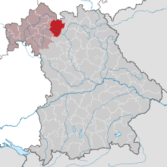
Haßberge
- district in Bavaria, Germany
The Haßberge district, located in the northern part of Bavaria, Germany, is known for its beautiful landscapes, rolling hills, dense forests, and quaint villages, making it an excellent destination for hiking enthusiasts. Here are some key points about hiking in the Haßberge district:...
- Country:

- Capital: Haßfurt
- Licence Plate Code: HAS
- Coordinates: 50° 4' 48" N, 10° 40' 12" E


- GPS tracks (wikiloc): [Link]
- AboveSeaLevel: 368 м m
- Area: 956.00 sq km
- Population: 80257
- Web site: [Link]


Rhön-Grabfeld
- district in Bavaria, Germany
Rhön-Grabfeld is a picturesque region located in Bavaria, Germany, renowned for its scenic landscapes, rolling hills, and rich natural beauty. It comprises part of the UNESCO Biosphere Reserve Rhön, which is characterized by its unique geology, biodiversity, and well-maintained hiking trails....
- Country:

- Capital: Bad Neustadt an der Saale
- Licence Plate Code: MET; KÖN; NES
- Coordinates: 50° 19' 48" N, 10° 15' 0" E


- GPS tracks (wikiloc): [Link]
- AboveSeaLevel: 320 м m
- Area: 1022.00 sq km
- Population: 77197
- Web site: [Link]
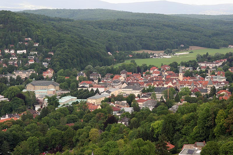

Bad Kissingen
- district in Bavaria, Germany
Bad Kissingen, located in Bavaria, Germany, is a beautiful spa town known for its healing mineral waters and lovely natural surroundings. The area's scenic landscapes make it an excellent destination for hiking enthusiasts. Here are some key points about hiking in Bad Kissingen:...
- Country:

- Capital: Bad Kissingen
- Licence Plate Code: HAB; BRK; KG
- Coordinates: 50° 15' 0" N, 10° 0' 0" E


- GPS tracks (wikiloc): [Link]
- AboveSeaLevel: 330 м m
- Area: 1137.00 sq km
- Population: 99022
- Web site: [Link]
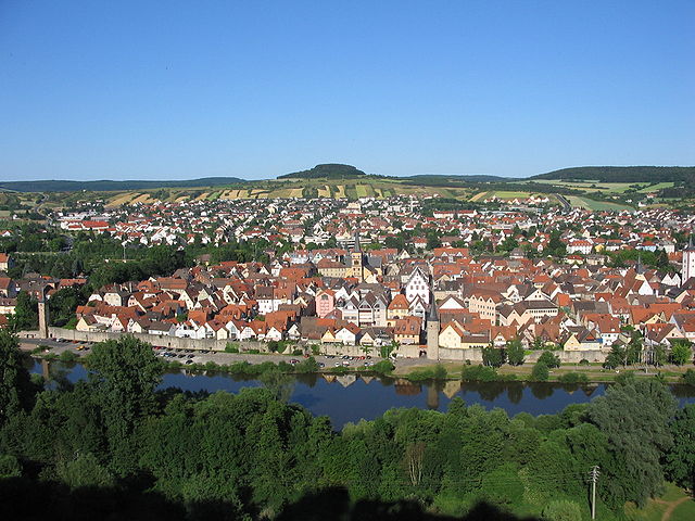

Main-Spessart
- district in Bavaria, Germany
Main-Spessart is a beautiful region located in Bavaria, Germany, known for its scenic landscapes, charming villages, and rich cultural heritage. It's a fantastic destination for hiking enthusiasts, offering a variety of trails that cater to different skill levels. Here’s what you can expect when hiking in Main-Spessart:...
- Country:

- Capital: Karlstadt am Main
- Licence Plate Code: MSP
- Coordinates: 49° 55' 12" N, 9° 45' 0" E


- GPS tracks (wikiloc): [Link]
- AboveSeaLevel: 313 м m
- Area: 1321.4186 sq km
- Population: 125915
- Web site: [Link]


Schweinfurt
- town in Bavaria, Germany
Schweinfurt, located in southern Germany, is not only known for its historical significance but also for its beautiful natural landscapes, making it a great destination for hiking enthusiasts. Here are some aspects to consider when hiking in this region:...
- Country:

- Postal Code: 97422; 97423; 97424; 97421
- Local Dialing Code: 09721
- Licence Plate Code: SW
- Coordinates: 50° 3' 0" N, 10° 14' 0" E


- GPS tracks (wikiloc): [Link]
- AboveSeaLevel: 226 м m
- Area: 35.71 sq km
- Population: 51969
- Web site: [Link]
